Mata, Rio Grande do Sul, Administrative municipality in Rio Grande do Sul, Brazil.
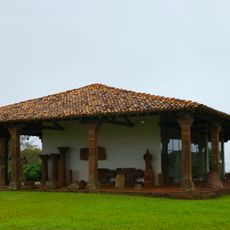
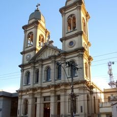
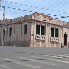
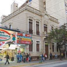
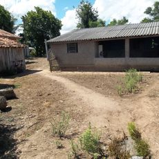
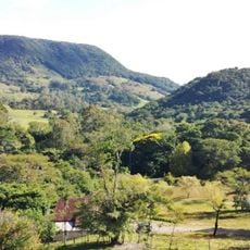
Mata is a municipality located in Rio Grande do Sul in southern Brazil, positioned in an area of moderate elevation. The town has a rural character with agricultural activities shaping the local landscape and daily life.
The settlement began in 1836 when the first residents arrived to establish a community in the region. These early foundations shaped the agricultural development that would characterize the area for generations.
The food here shows the influence of German and Italian settlers who brought their cooking traditions to the region. You can taste these roots in the way people prepare rice, potatoes, cassava, and grilled meats.
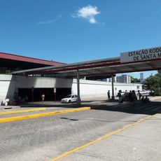
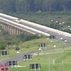
The town is best reached by car, as infrastructure follows typical rural patterns for the region. Visitors should expect basic accommodations and simple local services that the community offers.
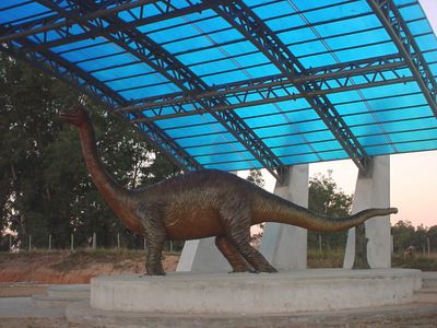
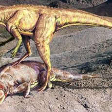
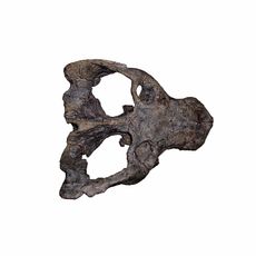
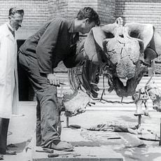
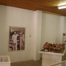
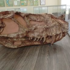
The area contains petrified wood remnants from ancient times that offer insights into the region's deep geological past. The Daniel Cargnin Museum displays these fossils and helps visitors understand the prehistoric heritage preserved here.
Location: Rio Grande do Sul
Elevation above the sea: 127 m
Shares border with: Jaguari, Jari, Rio Grande do Sul, São Pedro do Sul, São Vicente do Sul, Toropi
Website: http://mata.rs.gov.br
GPS coordinates: -29.56583,-54.46000
Latest update: December 10, 2025 15:54
São Miguel das Missões
113.6 km
Mission São João Batista
123.4 km
Mission São Lourenço Mártir
125.3 km
Sanga da Alemoa
68.4 km
Mission Museum
113.9 km
Catedral de Nossa Senhora da Conceição
64.5 km
Estádio Presidente Vargas
63.1 km
Paleontological Sites of Santa Maria
65.9 km
Estação Rodoviária de Santa Maria
66 km
Paleorrota
68.4 km
Paleontological Site Arroio Cancela
65.9 km
Basilica Shrine of Our Lady Mediatrix of All Graces
64.6 km
Erico Verissimo Museum
132 km
Ponte Marechal José de Abreu
87.3 km
Paleontological Site Chiniquá
10.5 km
Avenida Rio Branco
64.4 km
Theatro Treze de Maio
64.6 km
Museum Daniel Cargnin
0 m
Museu Gama D'Eça
64.6 km
Planetário da UFSM
73.9 km
Museum Vincente Pallotti
63 km
Paleontological Site Jazigo Cinco
68.5 km
Comunidade Arnesto Penna Carneiro
91.6 km
Museum Paleontologic and Archaeological Walter Ilha
18.7 km
Quarta Colônia State Park
116.6 km
Ponto da Memória Missioneira
113.6 km
Cemitério Israelita de Philippson
67.3 km
Headquarters building of the municipal council of Cruz Alta
131.9 kmVisited this place? Tap the stars to rate it and share your experience / photos with the community! Try now! You can cancel it anytime.
Discover hidden gems everywhere you go!
From secret cafés to breathtaking viewpoints, skip the crowded tourist spots and find places that match your style. Our app makes it easy with voice search, smart filtering, route optimization, and insider tips from travelers worldwide. Download now for the complete mobile experience.
A unique approach to discovering new places❞
— Le Figaro
All the places worth exploring❞
— France Info
A tailor-made excursion in just a few clicks❞
— 20 Minutes