Enable Location

We need your location to show you interesting places around you

Discover nearby places

Find interesting locations and hidden gems around you

Precise directions

Get accurate directions and distances to places

Your location is never shared with other users. It's only used when you tap the location button.

Q'asiri

Log in to your account

Start exploring — it's free

Trusted by 60,664 travelers worldwide

Continue with Google
Continue with Apple
or

We will send you a code to connect

By continuing, you accept our Terms and Conditions and our Privacy Policy

Check your inbox

We've sent a pincode in your inbox. Please enter the code below.

Q'asiri

Q'asiri, Mountain summit in Larecaja Province, Bolivia

Description

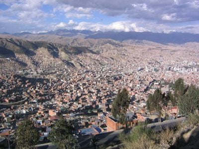
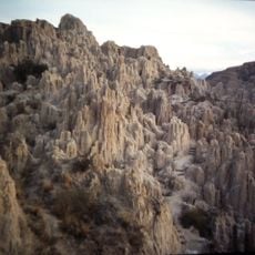
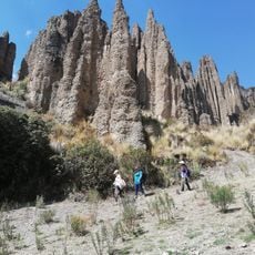
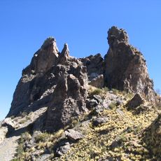
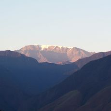
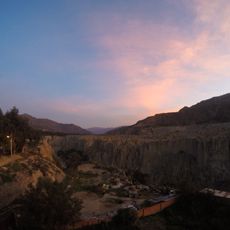
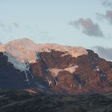
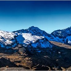
Q'asiri is a mountain summit in the Cordillera Real that rises to 5,828 meters (19,118 feet) and features steep slopes with prominent rocky formations throughout its profile. The mountain is shaped by two rivers that originate on its western side and flow toward San Francisco Lake, which drains the water resources from the surrounding slopes.

History

The first documented ascent took place in 1928 via the southwest ridge, marking the start of mountaineering exploration in this section of the Cordillera Real. This early expedition established a route that would influence future climbing attempts in the region.

Culture

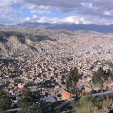
The name comes from the Aymara language and reflects how indigenous communities connect with the mountain landscapes of the Bolivian Andes. Local people use these mountains as landmarks and reference points in their daily life and traditional practices.

Practical

The mountain attracts experienced hikers and climbers who need to prepare for high-altitude conditions. The clearer weather and safer conditions occur during the drier months, making these periods more suitable for visiting.

Did you know?

The summit sits between Janq'u Uma and Qalsata peaks, forming a natural corridor that shapes local weather patterns and ecological zones. This position makes it a notable landmark in the landscape and influences how air and water move across the region.

GPS coordinates
-16.44446,-67.93759
Latest update
December 14, 2025 20:27

AroundUs brings together thousands of curated places, local tips, and hidden gems, enriched daily by 60,000 contributors worldwide. Discover all places nearby (Bolivia).

« Q'asiri - Mountain summit in Larecaja Province, Bolivia » is provided by Around Us (aroundus.com). Images and texts are derived from Wikimedia project under a Creative Commons license. You are allowed to copy, distribute, and modify copies of this page, under the conditions set by the license, as long as this note is clearly visible.

Discover hidden gems everywhere you go!

From secret cafés to breathtaking viewpoints, skip the crowded tourist spots and find places that match your style. Our app makes it easy with voice search, smart filtering, route optimization, and insider tips from travelers worldwide. Download now for the complete mobile experience.

Around Us App Screenshot

A unique approach to discovering new places

Le Figaro

All the places worth exploring

France Info

A tailor-made excursion in just a few clicks

20 Minutes

Around Us
Travel Guide & Maps
Download

Send to your phone

QR Code
1

Open the camera app on your mobile.

2

Point at the QR code with your camera. A notification will appear.

3

Tap the notification to open the link.