Espigão d'Oeste, Municipality in Rondônia, Brazil
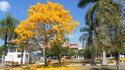
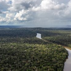
Espigão d'Oeste is a municipality in Rondônia, located in the northwestern region of Brazil. The town sits amid forested areas and functions as a regional center with basic infrastructure for daily life.
The municipality was founded during government development initiatives in northern Brazil at the end of the 20th century. This founding period shaped the settlement structure and economic direction of the region.
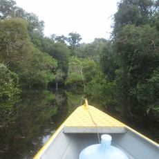
The Roosevelt Reservation, spanning 2.7 hectares in western Espigão d'Oeste, serves as home to 1,200 Cinta Larga Indigenous People, preserving their traditions.
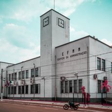
Visitors will find local schools serving as anchor points in daily community life. The basic infrastructure means relying on local resources and shops for everyday needs.
The Roosevelt area in the western region holds significant diamond deposits that have shaped the local economy. These natural resources play an important role in the community's business activities.
Location: Rondônia
Elevation above the sea: 270 m
Shares border with: Aripuanã
Website: https://espigaodooeste.ro.gov.br
GPS coordinates: -11.52472,-61.01278
Latest update: December 7, 2025 20:26
Madeira-Mamoré Railroad
441.4 km
Fort Prince of Beira
384.7 km
Noel Kempff Mercado National Park
301.7 km
Pacaás Novos National Park
266.9 km
Catarata Arco Iris
251.2 kmUrubichá
442.7 km
Juruena National Park
514.7 km
Serra Ricardo Franco State Park
349.5 km
Campos Amazônicos National Park
352.5 km
Cachoeira do Jatobá
391.1 kmRíos Blanco y Negro Wildlife Reserve
393.6 km
Mapinguari National Park
500.6 km
Bajo Paraguá Municipal Protected Area
339 km
Rio Cautário Federal Extractive Reserve
349.8 km
Aquariquara Extractive Reserve
228.3 km
Association of Machadinho Rubber Tappers
257.4 km
Lago do Cuniã Extractive Reserve
449.7 km
Federico Ahlfeld Falls
248.6 km
Ruins of the Church of the Holy Trinity
404.3 km
Rio Cautário State Extractive Reserve
362 km
Rio Ouro Preto Extractive Reserve
411.4 kmIsla Cumprida
228.5 km
Madeira-Mamoré Railroad, rail yard
441.6 km
Castanheira do Estádio Aluízio Pinheiro Ferreira
442.4 km
Capela de Santo Antônio de Pádua
441.1 km
Três Caixas d'Água
441.7 km
Indigenous Territory Tenharim do Igarapé Preto
343.3 km
Prédio da Administração Central da EFMM
441.5 kmVisited this place? Tap the stars to rate it and share your experience / photos with the community! Try now! You can cancel it anytime.
Discover hidden gems everywhere you go!
From secret cafés to breathtaking viewpoints, skip the crowded tourist spots and find places that match your style. Our app makes it easy with voice search, smart filtering, route optimization, and insider tips from travelers worldwide. Download now for the complete mobile experience.
A unique approach to discovering new places❞
— Le Figaro
All the places worth exploring❞
— France Info
A tailor-made excursion in just a few clicks❞
— 20 Minutes