Chest opened
+${chestReward.xp} XP
Explorer
NOUVEAU ×${chestReward.collectible.quantity}
tapez pour fermer
Chest locked

Open chests in the app

Around Us is built for your phone — chests unlock when you walk, explore and capture nearby places.

Enable Location

We need your location to show you interesting places around you

Discover nearby places

Find interesting locations and hidden gems around you

Precise directions

Get accurate directions and distances to places

Your location is never shared with other users. It's only used when you tap the location button.

Log in to your account

Start exploring — it's free

Trusted by 72,883 travelers worldwide

Continue with Google
Continue with Apple
or

We will send you a code to connect

By continuing, you accept our Terms and Conditions and our Privacy Policy

Check your inbox

We've sent a pincode in your inbox. Please enter the code below.

Serra do Cachimbo
Discussion Reviews Photo
10.8k Popularity

Serra do Cachimbo, Mountain ridge in southern Pará, Brazil.

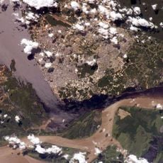
Serra do Cachimbo is a mountain ridge in southern Pará that rises between 250 and 740 meters (820 and 2,430 feet) above the surrounding landscape. The formation consists of continuous rocky masses separated by flat-bottomed valleys that shape the terrain of this remote area.

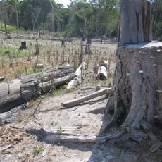
A military testing facility called Campo de Provas Brigadeiro Velloso was established within the ridge as part of Brazilian defense development. This installation brought significant infrastructure changes to an otherwise remote mountain region.

Indigenous communities maintain their traditional ways of life throughout the Serra do Cachimbo region, preserving their connection to the natural environment.

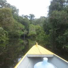
The BR-163 highway provides the main access route through this mountain region, though visitors should prepare for isolated conditions and sparse facilities. Bringing supplies and planning ahead is essential since services are limited in this remote area.

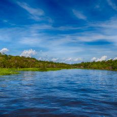
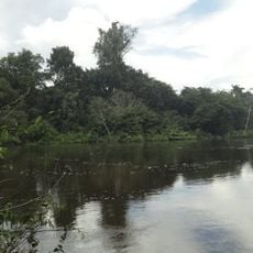
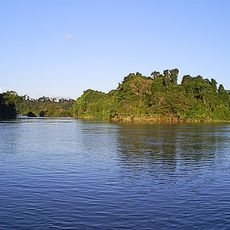
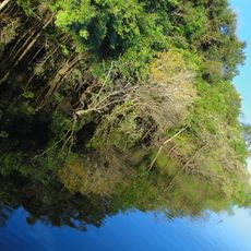
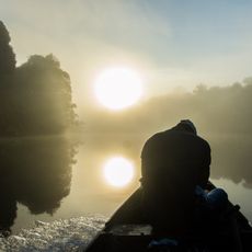
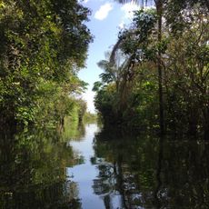
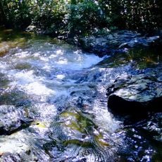
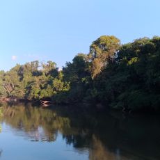
The ridge contains natural springs that form the source waters of several river systems, particularly the Cristalino and São Bento rivers. These waterways originate here before flowing across the landscape to join the larger Tapajós basin.

The community of curious travelers

AroundUs brings together thousands of curated places, local tips, and hidden gems, enriched daily by 60,000 contributors worldwide.

Start exploring
GPS coordinates
-7.52812,-57.23775
Latest update
December 10, 2025 15:52
Reviews
Share your experience

No review yet

Discussions
Start a discussion...

No discussion yet

« Serra do Cachimbo - Mountain ridge in southern Pará, Brazil » is provided by Around Us (aroundus.com). Images and texts are derived from Wikimedia project under a Creative Commons license. You are allowed to copy, distribute, and modify copies of this page, under the conditions set by the license, as long as this note is clearly visible.

Discover hidden gems everywhere you go!

From secret cafés to breathtaking viewpoints, skip the crowded tourist spots and find places that match your style. Our app makes it easy with voice search, smart filtering, route optimization, and insider tips from travelers worldwide. Download now for the complete mobile experience.

Around Us App Screenshot

A unique approach to discovering new places

Le Figaro

All the places worth exploring

France Info

A tailor-made excursion in just a few clicks

20 Minutes

Around Us
Travel Guide & Maps
Download

Send to your phone

QR Code
1

Open the camera app on your mobile.

2

Point at the QR code with your camera. A notification will appear.

3

Tap the notification to open the link.