Mutunópolis, Municipality in northern Goiás, Brazil.
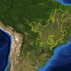
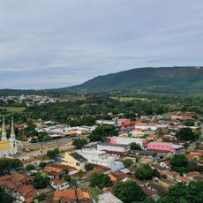
Mutunópolis is a municipality in northern Goiás that spans roughly 870 square kilometers and sits at about 410 meters in elevation. The settlement functions as an administrative center for the surrounding rural areas in Brazil's central-western region.
Three pioneers, including João Gonçalves Pacheco, founded the initial settlement in 1950 while searching for fertile agricultural land. The founding was part of a broader expansion wave across Goiás during the mid-20th century.
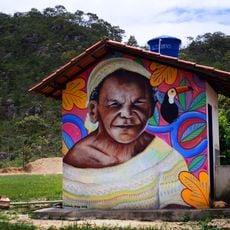
The name brings together a Tupi word for a local bird with the Greek word for city, reflecting the mixing of indigenous heritage and European influence found throughout the region. Walking through the town, you can sense this dual cultural foundation in how the community connects to its natural surroundings.
The town offers basic healthcare through a local hospital and several medical clinics for residents and visitors. Schools and other essential services are available, making it a functioning rural administrative hub.
Agriculture is the backbone of the local economy, with hundreds of farms cultivating rice, corn, manioc, bananas, and soybeans. This crop diversity allows the community to rely less on a single harvest and provides year-round work opportunities.
Location: Goiás
Elevation above the sea: 413 m
Shares border with: Santa Tereza de Goiás, Amaralina, Estrela do Norte, Mara Rosa, Porangatu
GPS coordinates: -13.73278,-49.27500
Latest update: December 12, 2025 12:01
Cerrado
174.5 km
Chapada dos Veadeiros National Park
178.1 km
Parish Church of Our Lady of the Rosary
238.4 km
Pirineus State Park
234.2 km
Historic center of Pirenópolis
238.4 km
Church of Our Lord of Bonfim
238.4 km
Church of Our Lady of Carmo
238 km
Bona Espero
184.5 km
Araguaia State Park
226.7 km
Parque Estadual da Serra de Jaraguá
230 km
Memorial Serra da Mesa
92.2 km
Casa de Câmara e Cadeia
238.1 km
Cataratas dos Couros
174.8 km
Capela Nossa Senhora da Penha de França
249.1 km
Cachoeira Santa Bárbara
194 km
Igreja de Nossa Senhora da Conceição
225.7 km
Igreja de Nossa Senhora do Rosário
225.9 km
Cachoeira de Santa Bárbara
194 km
Cachoeira das Araras
223.9 km
Cachoeira do Abade
238.2 km
Fazenda Gleba Vargem I Private Natural Heritage Reserve
234.7 km
Cachoeira do Abismo
161.6 km
Cachoeira do Segredo
165.4 km
Cachoeira das Sete Quedas
169.3 km
Cachoeira do Córrego Almécegas II
187.4 km
Quilombo Kalunga
198.8 km
Casa com Janelas de Rótulas e Forro Pintado, na Rua da Cadeia
119.1 km
Mirante da Janela
161.3 kmVisited this place? Tap the stars to rate it and share your experience / photos with the community! Try now! You can cancel it anytime.
Discover hidden gems everywhere you go!
From secret cafés to breathtaking viewpoints, skip the crowded tourist spots and find places that match your style. Our app makes it easy with voice search, smart filtering, route optimization, and insider tips from travelers worldwide. Download now for the complete mobile experience.
A unique approach to discovering new places❞
— Le Figaro
All the places worth exploring❞
— France Info
A tailor-made excursion in just a few clicks❞
— 20 Minutes