Enable Location

We need your location to show you interesting places around you

Discover nearby places

Find interesting locations and hidden gems around you

Precise directions

Get accurate directions and distances to places

Your location is never shared with other users. It's only used when you tap the location button.

Log in to your account

Join the adventure

Create your free account and start exploring (like 60k+ others)

We will send you a code to connect

or
Continue with Google
Continue with Apple
By continuing, you accept our Terms and Conditions and our Privacy Policy

Check your inbox

We've sent a pincode in your inbox. Please enter the code below.

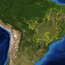
Arraias, Municipal administration center in Tocantins, Brazil

Description

Arraias is a municipal administration center in Tocantins, located in the highlands of northern Brazil. The town serves as the local hub for government services and administrative functions for the surrounding region.

History

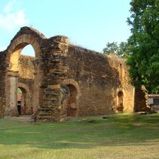
Arraias developed as a regional administration center over time, becoming a focal point for local governance in the region. Its growth is connected to the broader development of Tocantins as a state in the late 20th century.

Culture

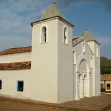
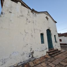
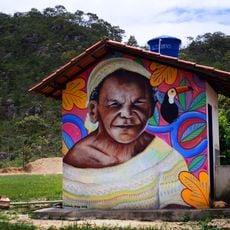
The Quilombola community of Kalunga do Mimoso shapes daily life and social bonds in the region, with their traditions visible in local schools and community activities. This heritage forms an important part of the municipality's identity.

Practical

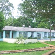
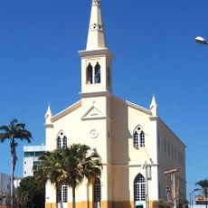
The town provides access to government and municipal services through both in-person offices and online channels for residents and visitors. Essential services and administrative facilities are accessible within the town center.

Did you know?

The municipality gained recognition among Brazilian towns for implementing transparent governance practices, setting an example for public administration. This distinction reflects a commitment to open communication between local government and residents.

Location
Elevation above the sea
682 m
Shares border with
Novo Alegre, Taguatinga, Combinado, Lavandeira, Aurora do Tocantins, Campos Belos, Cavalcante, Conceição do Tocantins, Monte Alegre de Goiás, Paranã, Ponte Alta do Bom Jesus, Taipas do Tocantins
GPS coordinates
-12.93083,-46.93778
Latest update
December 7, 2025 20:20

AroundUs brings together thousands of curated places, local tips, and hidden gems, enriched daily by 60,000 contributors worldwide. Discover all places nearby (Tocantins).

« Arraias - Municipal administration center in Tocantins, Brazil » is provided by Around Us (aroundus.com). Images and texts are derived from Wikimedia project under a Creative Commons license. You are allowed to copy, distribute, and modify copies of this page, under the conditions set by the license, as long as this note is clearly visible.

Discover hidden gems everywhere you go!

From secret cafés to breathtaking viewpoints, skip the crowded tourist spots and find places that match your style. Our app makes it easy with voice search, smart filtering, route optimization, and insider tips from travelers worldwide. Download now for the complete mobile experience.

Around Us App Screenshot

A unique approach to discovering new places

Le Figaro

All the places worth exploring

France Info

A tailor-made excursion in just a few clicks

20 Minutes

Around Us
Travel Guide & Maps
Download

Send to your phone

QR Code
1

Open the camera app on your mobile.

2

Point at the QR code with your camera. A notification will appear.

3

Tap the notification to open the link.