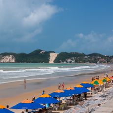
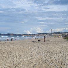
Barra de Cunhaú, Beach in Canguaretama, Brazil
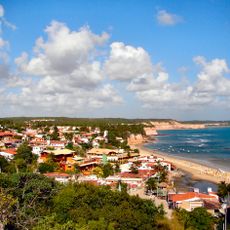
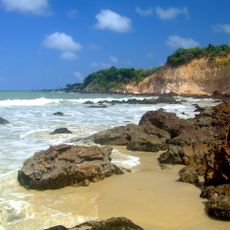
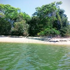
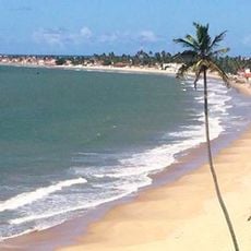
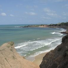
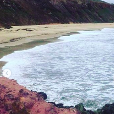
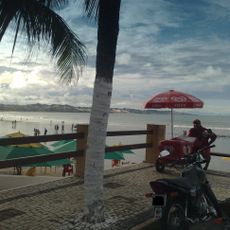
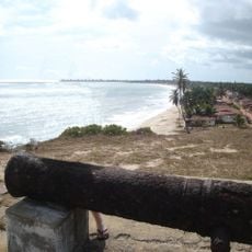
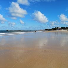
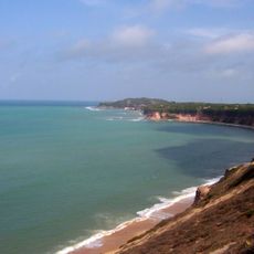
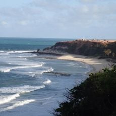
Barra de Cunhaú is a beach with white sand along Brazil's Atlantic coast, shaped by natural pools formed where coral grows beneath the surface. Coconut palms line the shore and create shade in several areas.
The name Cunhaú comes from the Tupi language, joining cunhã meaning woman with y meaning water. This connection to indigenous language reveals the area's deep roots in the region.
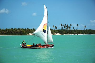
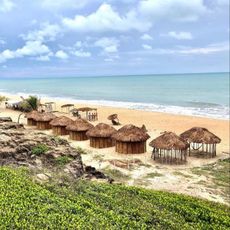
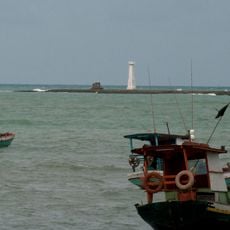
Local fishermen work the waters using methods passed down through generations, and their daily catch becomes the main ingredient in beachfront restaurants. This rhythm of fishing and eating shapes how the community moves through each day.
The beach sits about 85 kilometers from Natal and is reached via BR-101 highway and RN-269 road. Regular buses operate between the state capital and the area, making access straightforward.
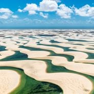
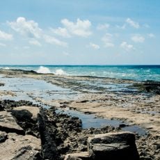
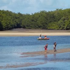
Two rivers, the Catú and Curimataú, meet the ocean at this location and create visible patterns in the water. The mixing of fresh and salt water produces natural formations that stand out to visitors.
Location: Rio Grande do Norte
Location: Canguaretama
GPS coordinates: -6.31041,-35.05538
Latest update: December 6, 2025 17:42
Brazil's Northeast region extends from the coast to the interior, connecting national parks, colonial towns and natural areas. The landscape shifts between coastal stretches, tablelands, river deltas and protected ecosystems. Geological formations, waterfalls and historic settlements mark the territory, which covers several Brazilian states. Places in this collection include the white dunes and lagoons of Lençóis Maranhenses National Park in Maranhão, the Delta do Parnaíba along the Piauí coast, and the cliffs of Morro Branco in Ceará. Jericoacoara National Park protects coastal habitats and formations such as Pedra Furada. Inland, Chapada Diamantina National Park and Chapada das Mesas National Park in Bahia and Maranhão feature tablelands, caves and waterfalls including Cachoeira do Buracão. Serra da Capivara National Park in Piauí preserves prehistoric rock paintings, while Vale do Catimbau National Park in Pernambuco is marked by rock formations. The coastal zone offers the Fernando de Noronha Archipelago off Pernambuco, marine parks at Areia Vermelha and Praia de Calhetas, and the canyons of the São Francisco River between Alagoas and Sergipe. Colonial centers such as Olinda and the historic center of João Pessoa preserve architecture from earlier centuries.
World's Largest Cashew Tree
38.3 km
Pipa Beach
9.3 km
Ponta Negra
49.5 km
Frasqueirão
48.9 km
Parque da Cidade Dom Nivaldo Monte
55.3 km
Praia de Cotovelo
46.5 km
Pórtico dos Reis Magos
52.6 km
Praia de Búzios
31.7 km
Praia de Camurupim
25.5 km
Mata da Estrela Private Natural Heritage Reserve
12.9 km
Barra do Rio Mamanguape Environmental Protection Area
53.7 km
Praia do Forte
41.9 km
Barra de Tabatinga
29.7 km
Tambá beach
39.7 km
Phare de Baía da Traição
42.9 km
Bacopari Lighthouse
10 km
Trincheiras beach
44.2 km
Jerimum beach
37.4 km
Pirangi beach
37.1 km
Área de Relevante Interesse Ecológica Manguezais da Foz do Rio Mamanguape
53.7 km
Fortim da Baía da Traição
41.8 km
Praia Pirangi do Norte
38.2 km
Ponta do Madeiro
12.5 km
Praia do Amor
8.5 km
Ruínas da Capela de Nossa Senhora das Candeias
16.7 km
Arco do Sol
51.4 km
Cinépolis Natal Shopping
55 km
Baobab in Nísia Floresta
29.6 kmReviews
Visited this place? Tap the stars to rate it and share your experience / photos with the community! Try now! You can cancel it anytime.
Discover hidden gems everywhere you go!
From secret cafés to breathtaking viewpoints, skip the crowded tourist spots and find places that match your style. Our app makes it easy with voice search, smart filtering, route optimization, and insider tips from travelers worldwide. Download now for the complete mobile experience.
A unique approach to discovering new places❞
— Le Figaro
All the places worth exploring❞
— France Info
A tailor-made excursion in just a few clicks❞
— 20 Minutes