Chest opened
+${chestReward.xp} XP
Explorer
NOUVEAU ×${chestReward.collectible.quantity}
tapez pour fermer
Chest locked

Open chests in the app

Around Us is built for your phone — chests unlock when you walk, explore and capture nearby places.

Enable Location

We need your location to show you interesting places around you

Discover nearby places

Find interesting locations and hidden gems around you

Precise directions

Get accurate directions and distances to places

Your location is never shared with other users. It's only used when you tap the location button.

Log in to your account

Start exploring — it's free

Trusted by 72,899 travelers worldwide

Continue with Google
Continue with Apple
or

We will send you a code to connect

By continuing, you accept our Terms and Conditions and our Privacy Policy

Check your inbox

We've sent a pincode in your inbox. Please enter the code below.

Kamonia
Discussion Reviews Photo
1.2k Popularity

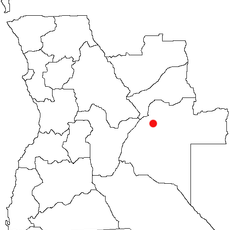
Kamonia, Mining district in Kasai Province, Democratic Republic of the Congo

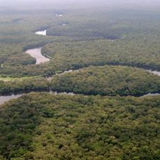
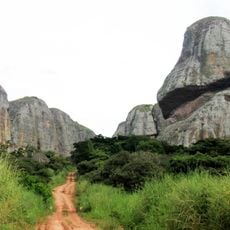
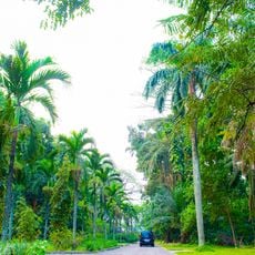
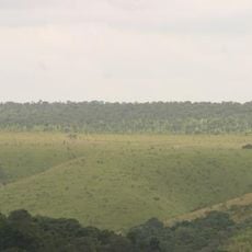
Kamonia is a mining district in Kasai Province located in the central part of the Democratic Republic of the Congo, where mineral deposits lie beneath tropical terrain. The territory is shaped by extraction activities and small-scale farming that sustain the local population.

The area was previously called Tshikapa Territory before administrative changes came in 2015 when Kasai-Occidental Province was divided. This reorganization placed the territory under new provincial administration and restructured how the region was governed.

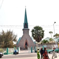
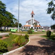
Different ethnic groups live side by side in this territory, maintaining their traditions through local markets where regional products and handmade goods are openly traded.

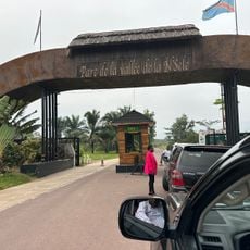
The area is reached through local roads that can be challenging depending on weather and season. Visitors should prepare for basic facilities and consider hiring local guides to navigate the territory effectively.

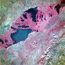
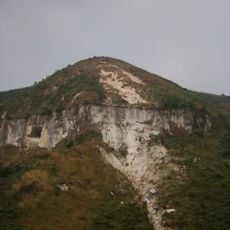
The geology of this territory contains specific mineral formations that have shaped how people make their living for generations. These natural deposits are why mining remains the primary income source for many families in the area.

The community of curious travelers

AroundUs brings together thousands of curated places, local tips, and hidden gems, enriched daily by 60,000 contributors worldwide.

Start exploring
Location
GPS coordinates
-6.88333,21.33333
Latest update
December 14, 2025 18:47
Around this place
Palace of the Nation
Congo, Democratic Republic of the

Palace of the Nation

729.5 km
Tour de l'Échangeur de Limete
Congo, Democratic Republic of the

Tour de l'Échangeur de Limete

719.7 km
Salonga National Park
Congo, Democratic Republic of the

Salonga National Park

574.2 km
Nsele Valley Park
Congo, Democratic Republic of the

Nsele Valley Park

696.1 km
National Museum of the Democratic Republic of Congo
Congo, Democratic Republic of the

National Museum of the Democratic Republic of Congo

726.1 km
Kalandula Falls
Angola

Kalandula Falls

636.5 km
Palais du Peuple
Congo, Democratic Republic of the

Palais du Peuple

725.9 km
Upemba National Park
Congo, Democratic Republic of the

Upemba National Park

625.6 km
Stade Municipal de Kintélé
Congo

Stade Municipal de Kintélé

731.8 km
Pedras Negras de Pungo Andongo
Angola

Pedras Negras de Pungo Andongo

704.8 km
Nabemba Tower
Congo

Nabemba Tower

730 km
Central Market, Kinshasa

Central Market, Kinshasa

725.9 km
Kisantu Botanical garden
Congo, Democratic Republic of the

Kisantu Botanical garden

719.9 km
Angola

Cangandala National Park

600.2 km
Basilique Sainte-Anne-du-Congo de Brazzaville
Congo

Basilique Sainte-Anne-du-Congo de Brazzaville

730.6 km
Upemba Depression
Congo, Democratic Republic of the

Upemba Depression

590.6 km
Mont Mangengenge
Congo, Democratic Republic of the

Mont Mangengenge

698.7 km
Case de Gaulle
Congo

Case de Gaulle

731.5 km
Kinshasa botanical garden
Congo, Democratic Republic of the

Kinshasa botanical garden

726.2 km
Stade 24 Novembre
Congo, Democratic Republic of the

Stade 24 Novembre

725.3 km
Sacred Heart Cathedral, Brazzaville
Congo

Sacred Heart Cathedral, Brazzaville

731.6 km
Our Lady of Seven Sorrows Cathedral, Kisantu
Congo, Democratic Republic of the

Our Lady of Seven Sorrows Cathedral, Kisantu

719.2 km
Domaine et réserve de Bombo-Lumene
Congo, Democratic Republic of the

Domaine et réserve de Bombo-Lumene

633.7 km
Lake Nzilo
Congo, Democratic Republic of the

Lake Nzilo

625.1 km
Karipande
Angola

Karipande

696.2 km
Stade des Jeunes
Congo, Democratic Republic of the

Stade des Jeunes

160 km
Our Lady of the Assumption Cathedral, Saurimo
Angola

Our Lady of the Assumption Cathedral, Saurimo

325.4 km
Statue de Pierre Savorgnan de Brazza
Congo

Statue de Pierre Savorgnan de Brazza

730.7 km
Show the full map
Reviews
Share your experience

No review yet

Discussions
Start a discussion...

No discussion yet

« Kamonia - Mining district in Kasai Province, Democratic Republic of the Congo » is provided by Around Us (aroundus.com). Images and texts are derived from Wikimedia project under a Creative Commons license. You are allowed to copy, distribute, and modify copies of this page, under the conditions set by the license, as long as this note is clearly visible.

Discover hidden gems everywhere you go!

From secret cafés to breathtaking viewpoints, skip the crowded tourist spots and find places that match your style. Our app makes it easy with voice search, smart filtering, route optimization, and insider tips from travelers worldwide. Download now for the complete mobile experience.

Around Us App Screenshot

A unique approach to discovering new places

Le Figaro

All the places worth exploring

France Info

A tailor-made excursion in just a few clicks

20 Minutes

Around Us
Travel Guide & Maps
Download

Send to your phone

QR Code
1

Open the camera app on your mobile.

2

Point at the QR code with your camera. A notification will appear.

3

Tap the notification to open the link.