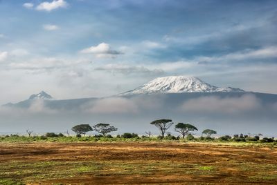
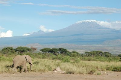
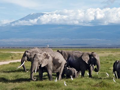
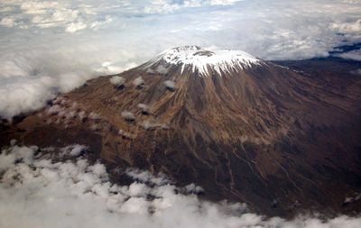
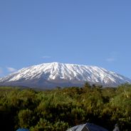
Mount Kilimanjaro, Dormant volcano in Kilimanjaro Region, Tanzania.
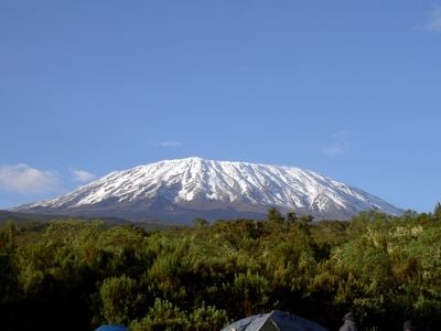
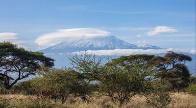
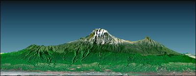
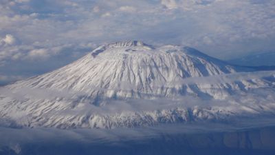
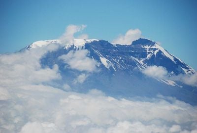
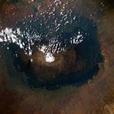
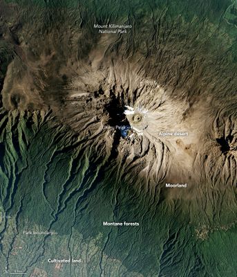
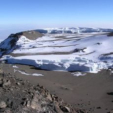
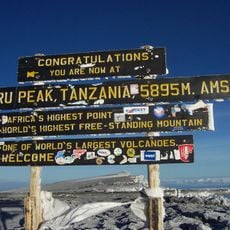
Mount Kilimanjaro is Africa's highest massif at 5,895 meters above sea level, formed by three volcanic cones called Kibo, Mawenzi, and Shira. The formation passes through different vegetation zones from rainforest through moorland to alpine desert, while the Kibo summit crater measures roughly two kilometers in diameter and the flanks stretch across a base approximately 60 kilometers wide.
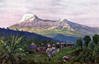
Volcanic activity formed the massif around 750,000 years ago, with Kibo taking its current shape approximately 360,000 years ago. German explorers Hans Meyer and Ludwig Purtscheller reached the summit on October 6, 1889, before the British colonial administration established the national park in 1973 and UNESCO granted World Heritage status in 1987.
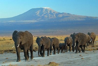
For the Chagga people, the mountain carries deep spiritual meaning while its fertile slopes have sustained coffee and banana farming for generations. Village communities draw on meltwater for irrigation and regard the summit zone as a sacred place that continues to shape their daily routines and sense of identity.
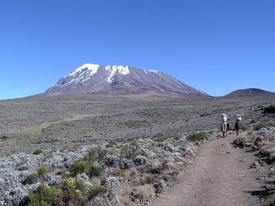
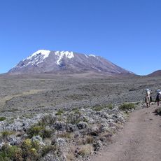
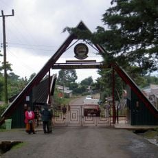
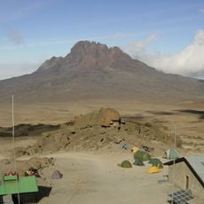
Climbers need permits, certified guides, and five to nine days for routes like Marangu or Machame through several climate zones. The dry seasons from January to March and June to October provide favorable conditions, while equipment should include sleeping bags rated to minus 20 degrees Celsius and altitude acclimatization medication, with starting points in Moshi and Arusha offering lodging from budget to luxury options.
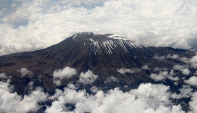
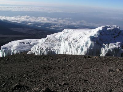
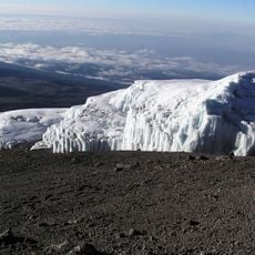
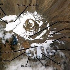
The summit zone holds shrinking ice fields that have declined 80 percent since 1912, sparking scientific debates about climate change impacts. Researchers track the retreat by comparing historical photographs with current images, while some scientists project complete glacier disappearance within coming decades, which would significantly affect local water supplies and ecosystem balance in surrounding lowlands.
Location: Kilimanjaro Region
Elevation above the sea: 5,895 m
Made from material: rhyolite
Part of: Great Rift Valley, Seven Summits, Volcanic Seven Summits, Highest mountain peaks of Africa, ultra-prominent peak, Seven Third Summits
GPS coordinates: -3.07641,37.35400
Latest update: December 2, 2025 20:55
From the highest peaks to coastal cliffs, this collection brings together geographically significant observation points across all continents. The locations offer views of mountain ranges, waterfalls, deserts, oceans, and notable architectural structures. The selection includes the Great Wall near Beijing, the Cliffs of Moher above the Atlantic, the Grand Canyon in Arizona, and Mount Everest on the Nepal-Tibet border. Among the waterfalls are Iguazú Falls between Brazil and Argentina, Victoria Falls between Zambia and Zimbabwe, and Niagara Falls between Canada and the United States. The Pyramids of Giza, the Alhambra in Granada, and the Taj Mahal in Agra showcase important architectural achievements from different eras. Natural formations such as Uluru in the Australian outback, Halong Bay in Vietnam, Banff National Park in the Canadian Rockies, and the Norwegian fjords demonstrate Earth's geological diversity. Additional locations include Santorini in the Aegean Sea, the Amazon rainforest, Horseshoe Bend on the Colorado River, Petra in Jordan, Mount Kilimanjaro in Tanzania, the Fitz Roy range in Patagonia, and Plitvice Lakes National Park in Croatia.
This collection brings together active volcanoes located on multiple continents, from Cotopaxi in the Ecuadorian Andes to Mount Fuji in Japan, including Vesuvius in Italy and Mauna Loa in Hawaii. Each site demonstrates different geological processes: stratovolcanoes like Mount Saint Helens and Etna produce explosive eruptions, while Hawaiian shield volcanoes generate flowing lava that can travel long distances. The selection also includes sites that have marked history through their destructive power, such as Krakatoa, whose 1883 eruption caused tens of thousands of casualties, or Vesuvius, which buried Pompeii and Herculaneum in AD 79. Other volcanoes like Iceland's Eyjafjallajökull have recently shown their ability to disrupt human activities globally. These locations offer insight into how volcanic activity shapes landscapes and influences nearby populations.
The Earth offers a wide range of geological shapes shaped over millions of years by weather and the movements of the land. In Northern Ireland, thousands of basalt columns stand along the coast, leftover from an ancient eruption. In Arizona, the Colorado River carved out a canyon more than 400 miles long. In Bolivia, a salt flat forms a giant mirror during the rainy season. You can also find white terraces formed by hot springs in Turkey, eroded sandstone arches in the American desert, or the largest coral reef in the world off Australia. Some formations show that volcanic activity still occurs, like in Yellowstone Park. Others are the result of tectonic plate collisions, such as the Himalayas where Mount Everest rises. These places tell the story of Earth's geology and are still changing under the influence of wind, water, and moving continents.
Tanzania provides photographers with an extraordinary range of subjects, from the Serengeti plains to Zanzibar's coastline and Mount Kilimanjaro, the highest peak in Africa at 19,341 feet (5,895 meters). The country contains major wildlife reserves including Tarangire, where elephant herds move between baobab trees, and the Ngorongoro Crater, which holds a dense concentration of large mammals within its 100-square-mile (260-square-kilometer) caldera. Coastal regions and offshore islands like Mafia and Pemba offer opportunities to photograph coral reefs, sea turtles, and traditional dhow boats. The Mahale Mountains support habituated chimpanzee groups, while Selous Game Reserve presents riverine landscapes and diverse animal populations. Stone Town's historic quarter features Arab, Persian, and Indian architecture spanning several centuries, including the House of Wonders and the narrow alleys of the former trading port. The less visited Katavi National Park delivers scenes of hundreds of hippos crowding shrinking pools during the dry season. Kondoa rock art sites preserve prehistoric paintings dating back as far as 30,000 years. The active volcano Ol Doinyo Lengai and alkaline Lake Natron with its flamingo flocks add geological interest. From the terraced hillsides of the Usambara Mountains to the wildflower meadows of Kitulo National Park, Tanzania covers nearly every photographic interest.
Mount Meru
68.2 km
Mount Kibo
1.4 km
Amboseli National Park
48.9 km
Kilimanjaro National Park
1.8 km
Arusha National Park
61 km
Tsavo West National Park
90.7 km
Furtwängler Glacier
661 m
Rebmann Glacier
1.1 km
Kikuletwa Hot Springs
44.7 km
Uhuru Peak
64 m
Mawenzi
11.5 km
Arusha Declaration Monument
80.9 km
Northern Ice Field
2.1 km
Arrow Glacier
1.5 km
Materuni Waterfalls
20 km
Nyumba ya Mungu Reservoir
72.8 km
Sheikh Amri Abeid Memorial Stadium
81.1 km
Ngurdoto Crater
53.1 km
Uhuru Peak
1.1 km
Ol Doinyo Orok
93.3 km
Balletto Glacier
1.1 km
Barranco Glacier
1.5 km
Drygalski Glacier
2.4 km
Credner Glacier
2.6 km
Great Penck Glacier
2.7 km
Little Penck Glacier
2.6 km
Barafu-Lager
3.8 km
New Safari Hotel
80.3 kmReviews
Visited this place? Tap the stars to rate it and share your experience / photos with the community! Try now! You can cancel it anytime.
Discover hidden gems everywhere you go!
From secret cafés to breathtaking viewpoints, skip the crowded tourist spots and find places that match your style. Our app makes it easy with voice search, smart filtering, route optimization, and insider tips from travelers worldwide. Download now for the complete mobile experience.
A unique approach to discovering new places❞
— Le Figaro
All the places worth exploring❞
— France Info
A tailor-made excursion in just a few clicks❞
— 20 Minutes