Gunung Kendang, Stratovolcano in West Java, Indonesia
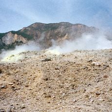
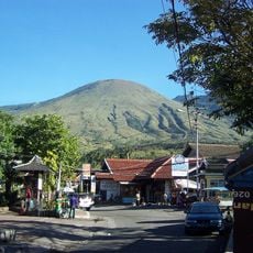
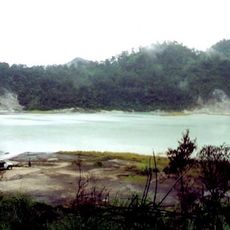
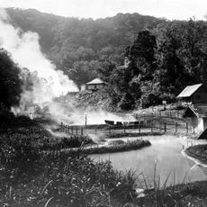
Gunung Kendang is a stratovolcano on the border between Kertasari Subdistrict, Bandung Regency, and Pasirwangi Subdistrict, Garut Regency, West Java. It holds four fumarole fields, among them Kawah Manuk, a broad crater 2.75 km wide. Sulfur sublimation, mud pots and hot springs occur on the mountain.
Mount Kendang is a stratovolcano on the border of Kertasari Subdistrict in Bandung Regency and Pasirwangi Subdistrict in Garut Regency, West Java. Its north-to-south ridge forms the natural divide between four major river basins: the Citarum and Cimanuk on either side, with the Cikandang and Cilaki basins further west. The eastern slopes feed the Cimanuk, whose main river reaches Java's north coast, while the Cikandang and Cilaki drain toward the south coast. The mountain marks the southeasternmost point of the Citarum basin.
The name Kendang refers to the kendang, the two-headed drum central to Sundanese gamelan and jaipongan ensembles. The mountain's ridge also marks the divide between the Citarum and Cimanuk river basins, and its eastern slopes form the headwaters of the Cimanuk, which flows to Java's north coast.
The mountain straddles the border of Bandung Regency (Kertasari Subdistrict) and Garut Regency (Pasirwangi Subdistrict), so approach routes differ by side. The north-to-south ridge separates the Citarum and Cimanuk watersheds, with the Cikandang and Cilaki basins on the western flank. Plan which slope you will enter from before setting out.
The ridge running north to south along Gunung Kendang forms the watershed boundary between four river basins: Citarum, Cimanuk, Cikandang and Cilaki. The mountain is the farthest southeastern point of the Citarum basin, while streams on its eastern slopes feed the Cimanuk, which drains to Java's north coast.
The community of curious travelers
AroundUs brings together thousands of curated places, local tips, and hidden gems, enriched daily by 93,276 contributors worldwide.