Enable Location

We need your location to show you interesting places around you

Discover nearby places

Find interesting locations and hidden gems around you

Precise directions

Get accurate directions and distances to places

Your location is never shared with other users. It's only used when you tap the location button.

Mount Butak

Log in to your account

Start exploring — it's free

Trusted by 62,215 travelers worldwide

Continue with Google
Continue with Apple
or

We will send you a code to connect

By continuing, you accept our Terms and Conditions and our Privacy Policy

Check your inbox

We've sent a pincode in your inbox. Please enter the code below.

Mount Butak

Mount Butak, Stratovolcano in Malang, Indonesia

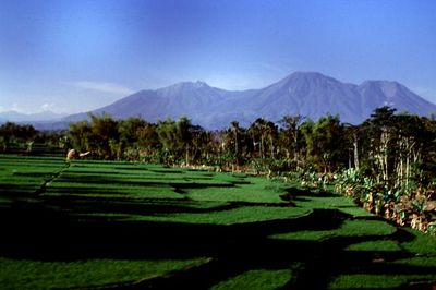
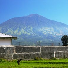
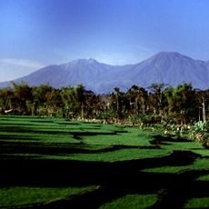
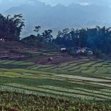
Mount Butak is a stratovolcano located at the border between Malang and Blitar regions in East Java, rising to about 2,868 meters above sea level. The slopes display typical volcanic features, and the summit offers expansive views across the surrounding landscape.

The mountain has never erupted throughout documented geological history, despite its classification as a stratovolcano. This dormant status makes it a relatively stable hiking area compared to other volcanic peaks in the region.

The name Butak comes from the dry savanna landscape that surrounds the peak during extended dry seasons in East Java. This type of terrain shapes how visitors experience the mountain and the views they encounter.

Two official hiking routes lead to the summit: the Panderman trail from Toyomerto village and the Sirah Kencong path, both with moderate difficulty. Hikers should prepare for changing conditions, especially during dry seasons when the landscape becomes parched.

From the Cemoro Kandang grassland near the summit, visitors can see four neighboring mountain peaks on clear days: Mount Semeru, Mount Arjuno, Mount Liman, and Mount Lawu. This view is a rare moment that rewards the effort of the climb.

The community of curious travelers

AroundUs brings together thousands of curated places, local tips, and hidden gems, enriched daily by 60,000 contributors worldwide.

Start exploring
Location
Elevation above the sea
2,868 m
GPS coordinates
-7.95535,112.46518
Latest update
December 7, 2025 19:25
« Mount Butak - Stratovolcano in Malang, Indonesia » is provided by Around Us (aroundus.com). Images and texts are derived from Wikimedia project under a Creative Commons license. You are allowed to copy, distribute, and modify copies of this page, under the conditions set by the license, as long as this note is clearly visible.

Discover hidden gems everywhere you go!

From secret cafés to breathtaking viewpoints, skip the crowded tourist spots and find places that match your style. Our app makes it easy with voice search, smart filtering, route optimization, and insider tips from travelers worldwide. Download now for the complete mobile experience.

Around Us App Screenshot

A unique approach to discovering new places

Le Figaro

All the places worth exploring

France Info

A tailor-made excursion in just a few clicks

20 Minutes

Around Us
Travel Guide & Maps
Download

Send to your phone

QR Code
1

Open the camera app on your mobile.

2

Point at the QR code with your camera. A notification will appear.

3

Tap the notification to open the link.