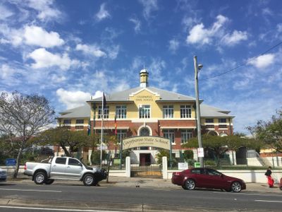
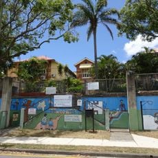
Coorparoo State School, State school in Coorparoo, Queensland.
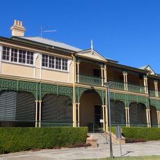
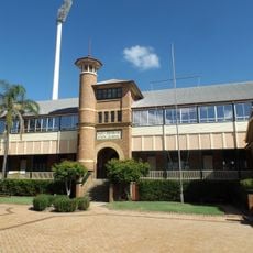
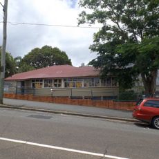
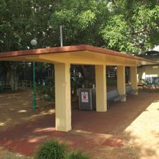
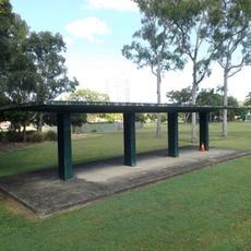
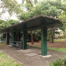
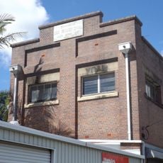
Coorparoo State School is a state school in Queensland featuring two large brick buildings constructed between 1928 and 1942. The grounds include open outdoor areas and a timber-framed structure from 1907 for recreational use.
Local landowner Samuel Stevens donated land in 1876 to establish the school, which opened with 37 students enrolled. The main brick buildings were later constructed during the 1920s and 1930s.
The name Coorparoo comes from the Aboriginal word Koolpuroom, which describes either a place of mosquitoes or the call of a dove. This naming reflects the area's indigenous heritage and the natural sounds that once defined the landscape.
The school is located on Old Cleveland Road with architectural features designed to maximize natural light and ventilation through thoughtful classroom layout. Visitors can walk around the grounds during available hours to view the historic structures from the outside.
During World War II, the school served as a first aid post and air raid precautions center for the local community. This role shows how school buildings became community resources in times of crisis.
Location: Queensland
Website: https://coorpaross.eq.edu.au
GPS coordinates: -27.49490,153.06050
Latest update: December 11, 2025 18:08
Langlands Park
1.1 km
Broadway Hotel
2.3 km
Eulalia, Norman Park
1.3 km
Queen Alexandra Home
122 m
East Brisbane State School
2.3 km
St Paul's Anglican Church, East Brisbane
1.8 km
Old Cleveland Road Tramway Tracks
2.5 km
Norman Hotel
2.5 km
Norman Park State School
2.3 km
Hanworth
2.1 km
Kitawah
1.8 km
Diamantina Health Care Museum
2.8 km
Triumph Cinema
1.5 km
Mowbraytown Presbyterian Church
2.2 km
Woolloongabba Post Office
2.8 km
Hester Villa
2.3 km
Mowbray Park War Memorial
2.4 km
Taylor-Heaslop Building
2.5 km
Coorparoo School of Arts and RSL Memorial Hall
102 m
Woolloongabba Police Station
2.6 km
Coorparoo Substation No. 210
1 km
Coorparoo Fire Station
196 m
Eskgrove
2.3 km
La Trobe, East Brisbane
2.3 km
Stones Corner Air Raid Shelter
1.7 km
Raymond Park (East) Air Raid Shelter
2.5 km
Woolloongabba Air Raid Shelter
1.7 km
Brisbane City Council Tramway Substation No 9
2.3 kmVisited this place? Tap the stars to rate it and share your experience / photos with the community! Try now! You can cancel it anytime.
Discover hidden gems everywhere you go!
From secret cafés to breathtaking viewpoints, skip the crowded tourist spots and find places that match your style. Our app makes it easy with voice search, smart filtering, route optimization, and insider tips from travelers worldwide. Download now for the complete mobile experience.
A unique approach to discovering new places❞
— Le Figaro
All the places worth exploring❞
— France Info
A tailor-made excursion in just a few clicks❞
— 20 Minutes