Tantalus, Extinct cinder cone in the Koʻolau Range, Oʻahu, Hawaii, United States
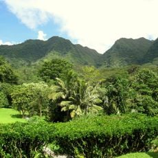
Tantalus is a summit on Oahu featuring a crater at its peak and natural slopes covered with eucalyptus and guava trees. The mountain provides expansive views across the island and surrounding waters from its highest point.
The U.S. Army built a fire-control station on Tantalus as part of its coastal artillery defense system, paired with the station at Diamond Head to direct the coast artillery batteries at Fort DeRussy and Fort Ruger. On March 4, 1942, the southern slope was bombed during Operation K, Japan's second, unsuccessful attack on Oʻahu.
Punahou School students in the 19th century named the peak after Tantalus, the Greek figure punished in Hades by food and water receding from his reach, because the summit seemed to recede as they climbed. The same students named Olympus, Round Top and Sugarloaf. The Hawaiian name is Puʻu ʻŌhiʻa.
The summit is reached by the 6-mile Tantalus Loop, a narrow, winding road shared with cyclists and skateboarders. The top lies within Puu Ualakaa State Park, which has a lookout, restrooms and picnic shelter. On Friday nights the Waikiki fireworks can be seen from the overlook.
The Tantalus Time Trial, run since 1974 from the base to the top of the loop, is the longest continuously running cycling race in Hawaiʻi. The same 6-mile Tantalus Loop began as a wagon trail in the late 1800s, when a two-room, corrugated-roofed Half-Way House managed by forester David Haugh served trekkers.
The community of curious travelers
AroundUs brings together thousands of curated places, local tips, and hidden gems, enriched daily by 92,591 contributors worldwide.