Enable Location

We need your location to show you interesting places around you

Discover nearby places

Find interesting locations and hidden gems around you

Precise directions

Get accurate directions and distances to places

Your location is never shared with other users. It's only used when you tap the location button.

Encino

Log in to your account

Start exploring — it's free

Trusted by 61,981 travelers worldwide

Continue with Google
Continue with Apple
or

We will send you a code to connect

By continuing, you accept our Terms and Conditions and our Privacy Policy

Check your inbox

We've sent a pincode in your inbox. Please enter the code below.

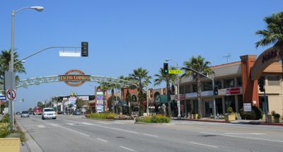
Encino, Residential neighborhood in San Fernando Valley, Los Angeles, United States.

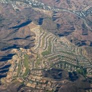
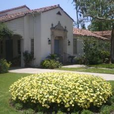
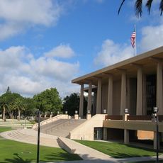
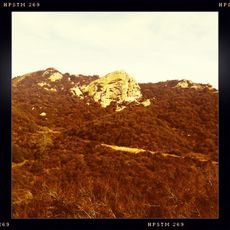
Encino is a residential neighborhood in the San Fernando Valley of Los Angeles, sitting on the northern slope of the Santa Monica Mountains. The area covers several miles with many single-family homes among mature trees and planted front yards.

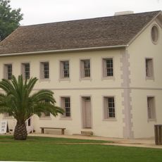
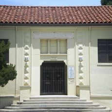
The area began as Rancho Los Encinos in 1845, first serving as agricultural land under Mexican administration. After incorporation into Los Angeles, the neighborhood developed through residential construction projects in the years following World War II.

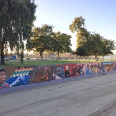
The name means "the oaks" in Spanish, referring to the many old trees throughout the area. Residents appreciate the quiet residential setting with wide streets and large plots as a retreat from the busy city center.

The neighborhood sits about 20 miles (32 kilometers) northwest of downtown Los Angeles and is best reached by car. Wide main streets like Ventura Boulevard cross through with many shops and restaurants along the route.

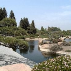
A natural spring pond within Los Encinos State Historic Park has supplied water continuously since the first settlement days. The spring originally provided fresh water for the Tongva population and later Spanish settlers for farming and daily use.

The community of curious travelers

AroundUs brings together thousands of curated places, local tips, and hidden gems, enriched daily by 60,000 contributors worldwide.

Start exploring
Location
Inception
1845
Shares border with
Tarzana, Sherman Oaks
Address
Encino, Los Angeles, CA, USA
GPS coordinates
34.15913,-118.50162
Latest update
February 5, 2026 10:59
Star neighborhoods in California: celebrity houses, actor residences, and Hollywood villas

Southern California has long drawn the attention of movie, music, and entertainment stars. Since the early days of Hollywood, these personalities have picked certain neighborhoods to settle in, creating living areas known around the world. These places tell the story of the American star system and...

Around this place
Mulholland Drive
United States of America

Mulholland Drive

3.3 km
Getty Center
United States of America

Getty Center

9.4 km
J. Paul Getty Museum
United States of America

J. Paul Getty Museum

9.5 km
Chartwell Mansion
United States of America

Chartwell Mansion

9.7 km
Harold Lloyd Estate
United States of America

Harold Lloyd Estate

10.5 km
Sheats Goldstein Residence
United States of America

Sheats Goldstein Residence

9.5 km
Murphy Ranch
United States of America

Murphy Ranch

9.8 km
Sepulveda Dam
United States of America

Sepulveda Dam

2.8 km
Radford Studio Center
United States of America

Radford Studio Center

10.3 km
United States of America

Franklin Canyon Park

10.3 km
Grace Community Church
United States of America

Grace Community Church

10.1 km
George Sturges House
United States of America

George Sturges House

10.4 km
The Great Wall of Los Angeles
United States of America

The Great Wall of Los Angeles

8.3 km
Bel-Air Country Club
United States of America

Bel-Air Country Club

10.2 km
Beverly Hills Women's Club
United States of America

Beverly Hills Women's Club

10.5 km
Bel Air Presbyterian Church
United States of America

Bel Air Presbyterian Church

3.5 km
The Japanese Garden
United States of America

The Japanese Garden

3.3 km
Los Encinos State Historic Park
United States of America

Los Encinos State Historic Park

240 m
Matadome
United States of America

Matadome

9.5 km
United States of America

Van Nuys City Hall

5.8 km
Valley Beth Shalom
United States of America

Valley Beth Shalom

2.3 km
California State University Northridge Botanic Garden
United States of America

California State University Northridge Botanic Garden

9.2 km
Cathedral of St. Mary Byzantine Catholic Church
United States of America

Cathedral of St. Mary Byzantine Catholic Church

3.3 km
Old Trapper's Lodge
United States of America

Old Trapper's Lodge

8.1 km
Saint Saviour's Chapel
United States of America

Saint Saviour's Chapel

8.6 km
Van Nuys Branch
United States of America

Van Nuys Branch

5.6 km
Eagle Rock
United States of America

Eagle Rock

8.6 km
Valley Relics Museum
United States of America

Valley Relics Museum

6.1 km
Show the full map
« Encino - Residential neighborhood in San Fernando Valley, Los Angeles, United States » is provided by Around Us (aroundus.com). Images and texts are derived from Wikimedia project under a Creative Commons license. You are allowed to copy, distribute, and modify copies of this page, under the conditions set by the license, as long as this note is clearly visible.

Discover hidden gems everywhere you go!

From secret cafés to breathtaking viewpoints, skip the crowded tourist spots and find places that match your style. Our app makes it easy with voice search, smart filtering, route optimization, and insider tips from travelers worldwide. Download now for the complete mobile experience.

Around Us App Screenshot

A unique approach to discovering new places

Le Figaro

All the places worth exploring

France Info

A tailor-made excursion in just a few clicks

20 Minutes

Around Us
Travel Guide & Maps
Download

Send to your phone

QR Code
1

Open the camera app on your mobile.

2

Point at the QR code with your camera. A notification will appear.

3

Tap the notification to open the link.