Enable Location

We need your location to show you interesting places around you

Discover nearby places

Find interesting locations and hidden gems around you

Precise directions

Get accurate directions and distances to places

Your location is never shared with other users. It's only used when you tap the location button.

Sepulveda Dam

Log in to your account

Start exploring — it's free

Trusted by 61,987 travelers worldwide

Continue with Google
Continue with Apple
or

We will send you a code to connect

By continuing, you accept our Terms and Conditions and our Privacy Policy

Check your inbox

We've sent a pincode in your inbox. Please enter the code below.

Sepulveda Dam

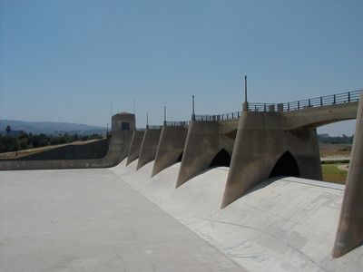
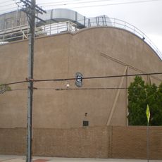
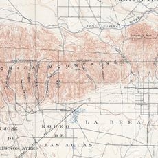
Sepulveda Dam, Flood control dam in Los Angeles County, United States.

The Sepulveda Dam is a flood control structure in Los Angeles County that impounds water from the Los Angeles River and protects surrounding neighborhoods from flooding. The dam itself extends across a width of roughly 4500 feet (1370 meters) and forms a large retention basin that collects water during the rainy season and releases it slowly afterward.

The US Army Corps of Engineers built the structure starting in 1941 as a response to the severe floods of 1938 that killed more than 100 people. Construction continued during World War II despite scarce resources and marked a turning point in flood protection for the region.

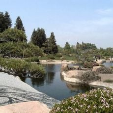
The name Sepulveda recalls an early Spanish settler family who lived in the region during the eighteenth century. Today local residents use the basin behind the dam for jogging, cycling, and team sports, valuing the grounds as a green space in a densely built area.

The grounds sit along Burbank Boulevard in Encino and offer daytime access to walking and cycling paths around the basin. Visitors find parking near the sports fields and should note that trails in the basin can be muddy after heavy rain.

The facility will host archery and BMX cycling competitions during the 2028 Summer Olympics. The basin also serves regularly as a filming location for action scenes because it is easily accessible and stays nearly dry during dry months.

The community of curious travelers

AroundUs brings together thousands of curated places, local tips, and hidden gems, enriched daily by 60,000 contributors worldwide.

Start exploring
Official opening
1941
GPS coordinates
34.16650,-118.47300
Latest update
December 20, 2025 12:09
Around this place
Mulholland Drive
United States of America

Mulholland Drive

4.2 km
Getty Center
United States of America

Getty Center

9.9 km
Chartwell Mansion
United States of America

Chartwell Mansion

9.3 km
Pickfair
United States of America

Pickfair

9.8 km
Harold Lloyd Estate
United States of America

Harold Lloyd Estate

9.7 km
Sheats Goldstein Residence
United States of America

Sheats Goldstein Residence

8.8 km
Radford Studio Center
United States of America

Radford Studio Center

7.9 km
United States of America

Franklin Canyon Park

9 km
Grace Community Church
United States of America

Grace Community Church

7.7 km
The Great Wall of Los Angeles
United States of America

The Great Wall of Los Angeles

5.6 km
Coldwater Canyon
United States of America

Coldwater Canyon

9.1 km
Beverly Hills Women's Club
United States of America

Beverly Hills Women's Club

9.8 km
Bel Air Presbyterian Church
United States of America

Bel Air Presbyterian Church

4.1 km
The Japanese Garden
United States of America

The Japanese Garden

2.1 km
17 Hertz Studio
United States of America

17 Hertz Studio

8.9 km
Bailey House – Case Study House
United States of America

Bailey House – Case Study House

9.3 km
Los Encinos State Historic Park
United States of America

Los Encinos State Historic Park

2.5 km
Matadome
United States of America

Matadome

9.7 km
United States of America

Van Nuys City Hall

3.1 km
Valley Beth Shalom
United States of America

Valley Beth Shalom

1.3 km
California State University Northridge Botanic Garden
United States of America

California State University Northridge Botanic Garden

9.5 km
Cathedral of St. Mary Byzantine Catholic Church
United States of America

Cathedral of St. Mary Byzantine Catholic Church

564 m
North Hollywood Amelia Earhart Regional Library
United States of America

North Hollywood Amelia Earhart Regional Library

8.6 km
Saint Saviour's Chapel
United States of America

Saint Saviour's Chapel

6.4 km
Van Nuys Branch
United States of America

Van Nuys Branch

3 km
Valley Relics Museum
United States of America

Valley Relics Museum

5.8 km
El Portal Theatre
United States of America

El Portal Theatre

8.9 km
Playtime Co.
United States of America

Playtime Co.

3.1 km
Show the full map
« Sepulveda Dam - Flood control dam in Los Angeles County, United States » is provided by Around Us (aroundus.com). Images and texts are derived from Wikimedia project under a Creative Commons license. You are allowed to copy, distribute, and modify copies of this page, under the conditions set by the license, as long as this note is clearly visible.

Discover hidden gems everywhere you go!

From secret cafés to breathtaking viewpoints, skip the crowded tourist spots and find places that match your style. Our app makes it easy with voice search, smart filtering, route optimization, and insider tips from travelers worldwide. Download now for the complete mobile experience.

Around Us App Screenshot

A unique approach to discovering new places

Le Figaro

All the places worth exploring

France Info

A tailor-made excursion in just a few clicks

20 Minutes

Around Us
Travel Guide & Maps
Download

Send to your phone

QR Code
1

Open the camera app on your mobile.

2

Point at the QR code with your camera. A notification will appear.

3

Tap the notification to open the link.