Chest opened
+${chestReward.xp} XP
Explorer
NOUVEAU ×${chestReward.collectible.quantity}
tapez pour fermer
Chest locked

Open chests in the app

Around Us is built for your phone — chests unlock when you walk, explore and capture nearby places.

Enable Location

We need your location to show you interesting places around you

Discover nearby places

Find interesting locations and hidden gems around you

Precise directions

Get accurate directions and distances to places

Your location is never shared with other users. It's only used when you tap the location button.

Lincoln Heights

Log in to your account

Start exploring — it's free

Trusted by 72,890 travelers worldwide

Continue with Google
Continue with Apple
or

We will send you a code to connect

By continuing, you accept our Terms and Conditions and our Privacy Policy

Check your inbox

We've sent a pincode in your inbox. Please enter the code below.

Discussion Reviews 1 Photos
36.8k Popularity

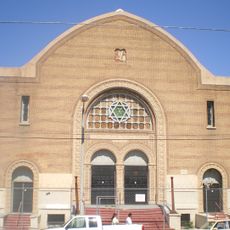
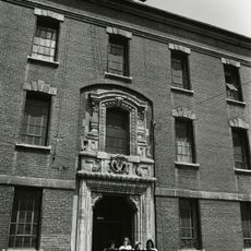
Lincoln Heights, Historic neighborhood in East Los Angeles, US.

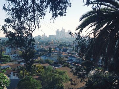
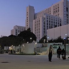
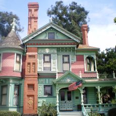
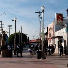
Lincoln Heights is a neighborhood in East Los Angeles with Victorian-era buildings and traditional shopping districts, particularly along North Broadway near the Los Angeles River. The area combines older residential blocks with historic commercial streets that serve as gathering points for the community.

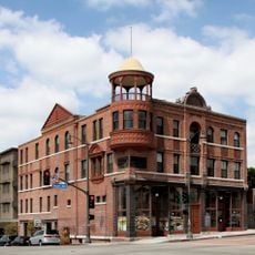
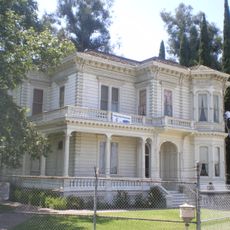
The area began as a large ranch purchased in the 1860s and gradually transformed into Los Angeles's first suburban neighborhood. The district evolved from its agricultural origins to become an established residential and commercial area with its own identity.

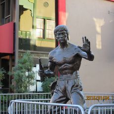
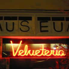
The neighborhood has deep roots in the Mexican-American community, visible through colorful murals that cover walls and tell local stories. Daily life here reflects traditions seen in family-owned shops and restaurants along the main streets.

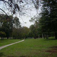
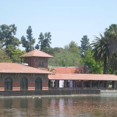
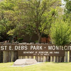
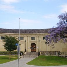
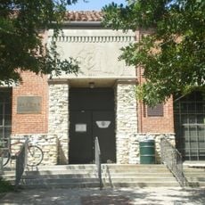
The neighborhood is easy to explore on foot, with main streets and shops concentrated around North Broadway. The Lincoln Heights Branch Library and Lincoln Park serve as useful reference points and offer good places to stop while walking around.

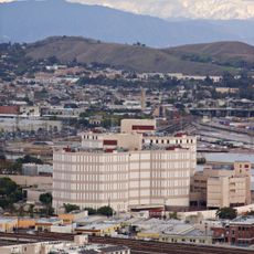
San Antonio Winery was started in 1917 and remains the oldest active business in the area, still making wine within the city limits. The winery shows how this neighborhood has housed both industry and homes side by side for more than a century.

The community of curious travelers

AroundUs brings together thousands of curated places, local tips, and hidden gems, enriched daily by 60,000 contributors worldwide.

Start exploring
Location
Shares border with
El Sereno
GPS coordinates
34.07360,-118.20963
Latest update
December 17, 2025 10:40
Around this place
Twin Towers Correctional Facility
United States of America

Twin Towers Correctional Facility

2.6 km
Chavez Ravine
United States of America

Chavez Ravine

2.7 km
Los Angeles County+USC Medical Center
United States of America

Los Angeles County+USC Medical Center

1.6 km
Dodger Dog
United States of America

Dodger Dog

2.7 km
Los Angeles State Historic Park
United States of America

Los Angeles State Historic Park

2.1 km
Heritage Square Museum
United States of America

Heritage Square Museum

1.6 km
Lummis House
United States of America

Lummis House

2.2 km
Lincoln Park
United States of America

Lincoln Park

1.1 km
Hale House
United States of America

Hale House

1.6 km
Statue of Bruce Lee
United States of America

Statue of Bruce Lee

2.7 km
Mariachi Plaza
United States of America

Mariachi Plaza

3 km
Southwest Museum of the American Indian
United States of America

Southwest Museum of the American Indian

3 km
William Mead Homes
United States of America

William Mead Homes

2.2 km
Breed Street Shul
United States of America

Breed Street Shul

3 km
Ernest E. Debs Regional Park
United States of America

Ernest E. Debs Regional Park

2.9 km
MTA Building
United States of America

MTA Building

2.9 km
Terminal Annex
United States of America

Terminal Annex

2.8 km
Woman's Building
United States of America

Woman's Building

1.6 km
Velveteria
United States of America

Velveteria

3.1 km
Arroyo Seco bicycle path
United States of America

Arroyo Seco bicycle path

3.1 km
Boyle Hotel – Cummings Block
United States of America

Boyle Hotel – Cummings Block

3.1 km
Ernest and Florence Bent Halstead House and Grounds
United States of America

Ernest and Florence Bent Halstead House and Grounds

2.4 km
Richard Henry Dana Branch
United States of America

Richard Henry Dana Branch

2.2 km
Ziegler Estate
United States of America

Ziegler Estate

2.8 km
Lincoln Heights Branch
United States of America

Lincoln Heights Branch

498 m
Malabar Branch
United States of America

Malabar Branch

2.8 km
Mount Pleasant House
United States of America

Mount Pleasant House

1.6 km
Cypress Park Branch
United States of America

Cypress Park Branch

3 km
Show the full map
Reviews
Share your experience

No review yet

Discussions
Start a discussion...

No discussion yet

« Lincoln Heights - Historic neighborhood in East Los Angeles, US » is provided by Around Us (aroundus.com). Images and texts are derived from Wikimedia project under a Creative Commons license. You are allowed to copy, distribute, and modify copies of this page, under the conditions set by the license, as long as this note is clearly visible.

Discover hidden gems everywhere you go!

From secret cafés to breathtaking viewpoints, skip the crowded tourist spots and find places that match your style. Our app makes it easy with voice search, smart filtering, route optimization, and insider tips from travelers worldwide. Download now for the complete mobile experience.

Around Us App Screenshot

A unique approach to discovering new places

Le Figaro

All the places worth exploring

France Info

A tailor-made excursion in just a few clicks

20 Minutes

Around Us
Travel Guide & Maps
Download

Send to your phone

QR Code
1

Open the camera app on your mobile.

2

Point at the QR code with your camera. A notification will appear.

3

Tap the notification to open the link.