Enable Location

We need your location to show you interesting places around you

Discover nearby places

Find interesting locations and hidden gems around you

Precise directions

Get accurate directions and distances to places

Your location is never shared with other users. It's only used when you tap the location button.

Victoria Avenue

Log in to your account

Start exploring — it's free

Trusted by 62,454 travelers worldwide

Continue with Google
Continue with Apple
or

We will send you a code to connect

By continuing, you accept our Terms and Conditions and our Privacy Policy

Check your inbox

We've sent a pincode in your inbox. Please enter the code below.

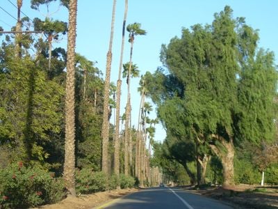
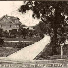
Victoria Avenue, street in Riverside, California, United States of America

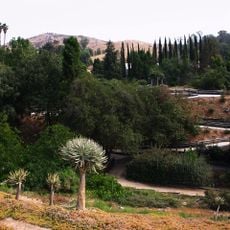
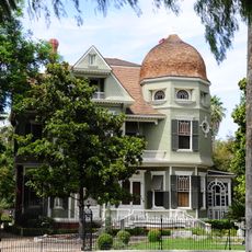
Victoria Avenue is a tree-lined street in Riverside that runs through a landscaped greenbelt filled with various plant species. Historic homes border the avenue, which was designed to connect residential areas with downtown and showcase the natural character of the region.

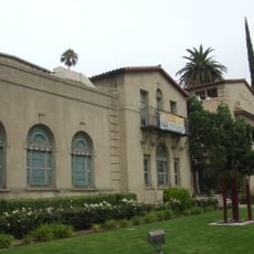
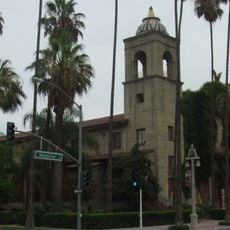
Victoria Avenue was built in 1892 by architect Franz Philip Hosp to connect Arlington Heights with downtown Riverside. It was added to the National Register of Historic Places on October 26, 2000, marking its importance in the city's development during the growth era.

Victoria Avenue was named to reflect the prosperity and ambitions of early residents who shaped the neighborhood. Walking along it today, you notice how the tree-lined street and historic homes remain central to how locals view their community's identity.

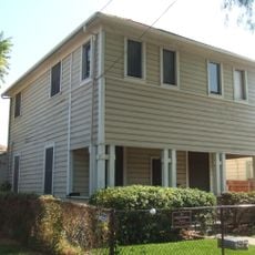
Victoria Avenue is easy to reach and offers a quiet route for walking or driving through landscaped areas with ample greenery. The street is well-maintained and best enjoyed at a relaxed pace to notice the historic homes and planted sections.

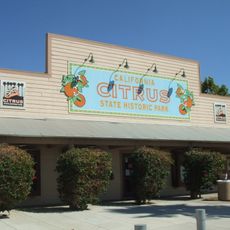
Victoria Avenue was originally surrounded by orange groves, some of which still remain visible today and link the street to Riverside's agricultural past. This connection to the citrus industry makes the street a living record of the region's economic history.

The community of curious travelers

AroundUs brings together thousands of curated places, local tips, and hidden gems, enriched daily by 60,000 contributors worldwide.

Start exploring
Location
GPS coordinates
33.92583,-117.39917
Latest update
February 9, 2026 08:23
Around this place
Riverside International Raceway
United States of America

Riverside International Raceway

11.8 km
Mission Inn
United States of America

Mission Inn

6.8 km
Mount Rubidoux
United States of America

Mount Rubidoux

6.5 km
Lake Mathews
United States of America

Lake Mathews

10.1 km
United States of America

Jurupa Oak

12 km
March Field Air Museum
United States of America

March Field Air Museum

13.1 km
California Citrus State Historic Park
United States of America

California Citrus State Historic Park

3.8 km
Riverside Fox Theater
United States of America

Riverside Fox Theater

6.8 km
Harada House
United States of America

Harada House

7.1 km
University of California, Riverside Citrus Variety Collection
United States of America

University of California, Riverside Citrus Variety Collection

8.4 km
Riverside International Automotive Museum
United States of America

Riverside International Automotive Museum

10.4 km
Riverside Art Museum
United States of America

Riverside Art Museum

6.8 km
Riverside Municipal Auditorium
United States of America

Riverside Municipal Auditorium

6.8 km
University of California, Riverside Botanic Gardens
United States of America

University of California, Riverside Botanic Gardens

8.9 km
Jensen Alvarado Ranch
United States of America

Jensen Alvarado Ranch

7.6 km
Slover Mountain
United States of America

Slover Mountain

16.4 km
Heritage House
United States of America

Heritage House

2.4 km
UCR Soccer Stadium
United States of America

UCR Soccer Stadium

8.6 km
Grand Boulevard
United States of America

Grand Boulevard

16.4 km
Entomology Research Museum
United States of America

Entomology Research Museum

8.4 km
Museum of Riverside
United States of America

Museum of Riverside

6.7 km
First Congregational Church of Riverside
United States of America

First Congregational Church of Riverside

6.7 km
Mount Jurupa
United States of America

Mount Jurupa

12.5 km
Colton Carnegie Library
United States of America

Colton Carnegie Library

17.4 km
United States of America

Estelle Mountain

17.7 km
Fort Benson
United States of America

Fort Benson

18.3 km
Woman's Improvement Club Clubhouse
United States of America

Woman's Improvement Club Clubhouse

16.6 km
Národní památník Prisoner of War/Missing in Action
United States of America

Národní památník Prisoner of War/Missing in Action

12.8 km
Show the full map
« Victoria Avenue - street in Riverside, California, United States of America » is provided by Around Us (aroundus.com). Images and texts are derived from Wikimedia project under a Creative Commons license. You are allowed to copy, distribute, and modify copies of this page, under the conditions set by the license, as long as this note is clearly visible.

Discover hidden gems everywhere you go!

From secret cafés to breathtaking viewpoints, skip the crowded tourist spots and find places that match your style. Our app makes it easy with voice search, smart filtering, route optimization, and insider tips from travelers worldwide. Download now for the complete mobile experience.

Around Us App Screenshot

A unique approach to discovering new places

Le Figaro

All the places worth exploring

France Info

A tailor-made excursion in just a few clicks

20 Minutes

Around Us
Travel Guide & Maps
Download

Send to your phone

QR Code
1

Open the camera app on your mobile.

2

Point at the QR code with your camera. A notification will appear.

3

Tap the notification to open the link.