Chest opened
+${chestReward.xp} XP
Explorer
NOUVEAU ×${chestReward.collectible.quantity}
tapez pour fermer
Chest locked

Open chests in the app

Around Us is built for your phone — chests unlock when you walk, explore and capture nearby places.

Enable Location

We need your location to show you interesting places around you

Discover nearby places

Find interesting locations and hidden gems around you

Precise directions

Get accurate directions and distances to places

Your location is never shared with other users. It's only used when you tap the location button.

Cleveland National Forest

Log in to your account

Start exploring — it's free

Trusted by 72,999 travelers worldwide

Continue with Google
Continue with Apple
or

We will send you a code to connect

By continuing, you accept our Terms and Conditions and our Privacy Policy

Check your inbox

We've sent a pincode in your inbox. Please enter the code below.

Discussion Reviews 3 Photos
33k Popularity

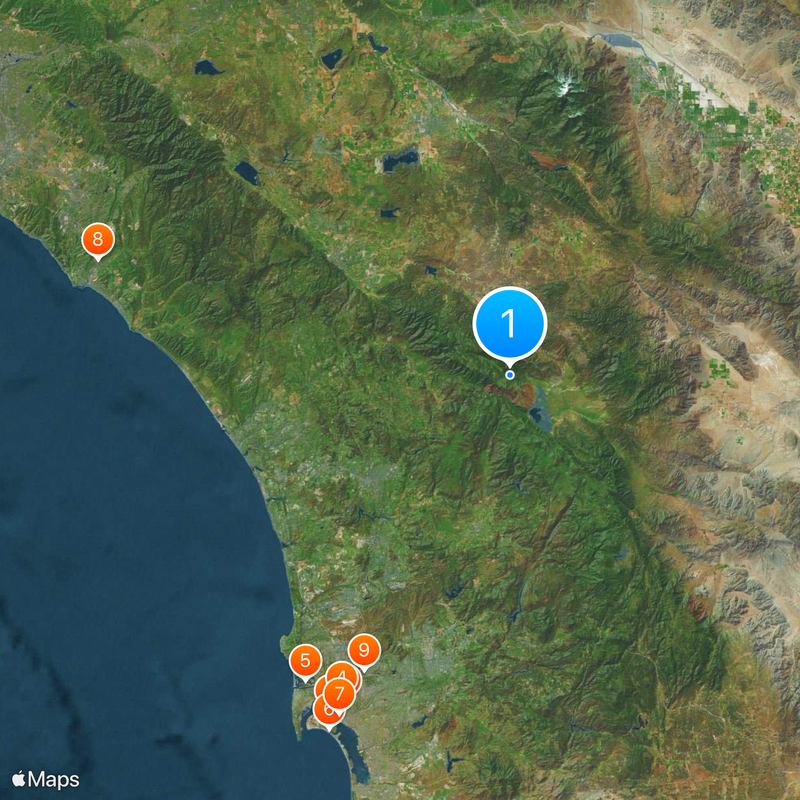
Cleveland National Forest, National forest in San Diego County, United States.

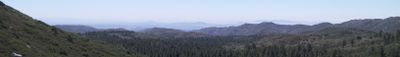
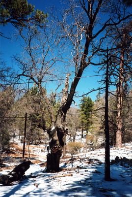
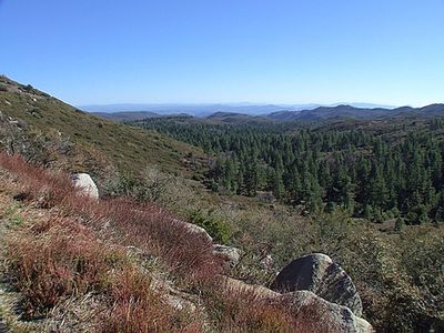
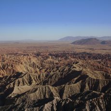
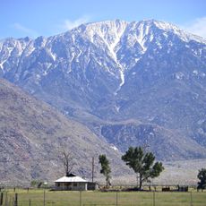
Cleveland National Forest is a protected area in San Diego County covering around 460,000 acres of mountainous terrain with chaparral canyons, desert areas, meadows, oak woodlands, and conifer forests. The land spans three ranger districts with varied ecosystems that shift across short distances.

The forest was established on July 1, 1908 by President Theodore Roosevelt, merging two earlier protected reserves into one. This combination created a larger, connected protected area for conservation purposes.

The Kumeyaay, Payómkawichum, Cahuilla, and Cupeño peoples originally lived on this land, leaving behind pathways that form much of today's trail network. Their long presence shaped how the terrain is traveled and understood by visitors today.

Visitors need a National Forest Adventure Pass for parking in designated areas, available at local merchants or visitor centers. Planning ahead to obtain this pass ensures smooth access to trailheads and recreation areas throughout the forest.

The forest contains four designated wilderness areas—Agua Tibia, Hauser, Pine Creek, and San Mateo Canyon—that protect undeveloped landscapes across all three ranger districts. These wilderness zones remain roadless and retain primitive conditions that set them apart from other parts of the forest.

The community of curious travelers

AroundUs brings together thousands of curated places, local tips, and hidden gems, enriched daily by 60,000 contributors worldwide.

Start exploring
Location
Inception
July 1, 1908
Operator
United States Forest Service
GPS coordinates
33.30000,-116.80000
Latest update
December 19, 2025 23:59
Around this place
USS Midway
United States of America

USS Midway

74.1 km
Balboa Park
United States of America

Balboa Park

71 km
San Diego Zoo
United States of America

San Diego Zoo

70.8 km
SeaWorld San Diego
United States of America

SeaWorld San Diego

71.6 km
Hotel del Coronado
United States of America

Hotel del Coronado

77.4 km
Petco Park
United States of America

Petco Park

73.9 km
Mission San Juan Capistrano
United States of America

Mission San Juan Capistrano

83.3 km
Mission San Diego de Alcalá
United States of America

Mission San Diego de Alcalá

64.1 km
Black's Beach
United States of America

Black's Beach

62 km
San Diego Wild Animal Park
United States of America

San Diego Wild Animal Park

29.1 km
Anza-Borrego Desert State Park
United States of America

Anza-Borrego Desert State Park

37.6 km
Torrey Pines Golf Course
United States of America

Torrey Pines Golf Course

60.5 km
Whaley House
United States of America

Whaley House

71.2 km
San Diego–Coronado Bridge
United States of America

San Diego–Coronado Bridge

76 km
Palm Springs Aerial Tramway
United States of America

Palm Springs Aerial Tramway

62.2 km
Saddleback Church
United States of America

Saddleback Church

88.4 km
Legoland California
United States of America

Legoland California

51.4 km
Kaufmann Desert House
United States of America

Kaufmann Desert House

64.9 km
San Jacinto Peak
United States of America

San Jacinto Peak

58.4 km
Marine Corps Recruit Depot San Diego
United States of America

Marine Corps Recruit Depot San Diego

72.3 km
Palomar Mountain Observatory
United States of America

Palomar Mountain Observatory

8.7 km
Mission San Luis Rey de Francia
United States of America

Mission San Luis Rey de Francia

49 km
Star of India
United States of America

Star of India

73.3 km
La Casa Pacifica
United States of America

La Casa Pacifica

74.8 km
La Jolla Cove
United States of America

La Jolla Cove

66.7 km
San Diego Stadium
United States of America

San Diego Stadium

64.8 km
Old Town San Diego State Historic Park
United States of America

Old Town San Diego State Historic Park

71.1 km
Forever Marilyn
United States of America

Forever Marilyn

62.9 km
Show the full map
Reviews
Share your experience

No review yet

Discussions
Start a discussion...

No discussion yet

« Cleveland National Forest - National forest in San Diego County, United States » is provided by Around Us (aroundus.com). Images and texts are derived from Wikimedia project under a Creative Commons license. You are allowed to copy, distribute, and modify copies of this page, under the conditions set by the license, as long as this note is clearly visible.

Discover hidden gems everywhere you go!

From secret cafés to breathtaking viewpoints, skip the crowded tourist spots and find places that match your style. Our app makes it easy with voice search, smart filtering, route optimization, and insider tips from travelers worldwide. Download now for the complete mobile experience.

Around Us App Screenshot

A unique approach to discovering new places

Le Figaro

All the places worth exploring

France Info

A tailor-made excursion in just a few clicks

20 Minutes

Around Us
Travel Guide & Maps
Download

Send to your phone

QR Code
1

Open the camera app on your mobile.

2

Point at the QR code with your camera. A notification will appear.

3

Tap the notification to open the link.