Toro Peak

Log in to your account

AroundUs is a community-driven map of interesting places, built by curious explorers like you. It grows with every review, story, and photo you share.
Connect to save your favorite spots, contribute locations, and create personalized routes.
By continuing, you accept our Terms and Conditions and our Privacy Policy
Add to collection
Map
Suggest a change
Share

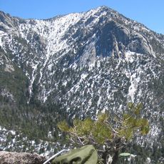
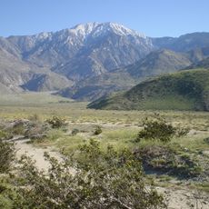
Toro Peak, Summit in Santa Rosa Mountains, California, United States
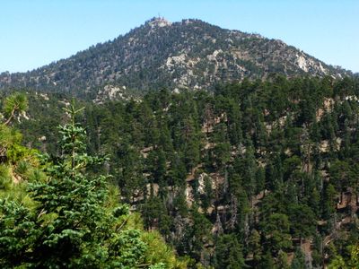
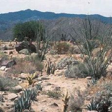
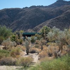
Toro Peak rises to an elevation of 8,716 feet with a prominent outline visible from Palm Springs and the surrounding Riverside County valleys.

The mountain's summit has been under the protection of the Santa Rosa Indian Reservation, marked by a United States Geological Survey marker since its establishment.

The peak represents a natural boundary within the San Bernardino National Forest, connecting multiple recreational paths used by mountaineers throughout different seasons.
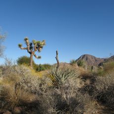
Access requires a 13-mile drive on dirt roads starting from California State Route 74, followed by a 500-foot hike from the restricted gate.

The mountain supports an uncommon combination of Incense Cedar, White Fir, Jeffrey Pine, and Limber Pine trees, defying typical California elevation patterns.

Location: California

GPS coordinates: 33.52336,-116.42557

Latest update: March 17, 2025 20:08

Photos
Around this place
Show the full map
Humana Challenge
United States of America

Humana Challenge

20.5 km
Sunnylands
United States of America

Sunnylands

28.3 km
Lake Hemet
United States of America

Lake Hemet

29.6 km
Living Desert Zoo and Gardens
United States of America

Living Desert Zoo and Gardens

20.4 km
Tahquitz Peak
United States of America

Tahquitz Peak

34.8 km
Santa Rosa and San Jacinto Mountains National Monument
United States of America

Santa Rosa and San Jacinto Mountains National Monument

18.2 km
Tahquitz Canyon
United States of America

Tahquitz Canyon

11.2 km
Spotlight 29 Casino
United States of America

Spotlight 29 Casino

30.7 km
La Quinta Resort and Club
United States of America

La Quinta Resort and Club

21.7 km
Galleta Meadows Estate
United States of America

Galleta Meadows Estate

26.6 km
Coachella Valley National Wildlife Refuge
United States of America

Coachella Valley National Wildlife Refuge

32.2 km
Shields Date Gardens
United States of America

Shields Date Gardens

25.2 km
Tahquitz Falls
United States of America

Tahquitz Falls

33.7 km
Santa Rosa Wilderness
United States of America

Santa Rosa Wilderness

10.7 km
Moorten Botanical Garden and Cactarium
United States of America

Moorten Botanical Garden and Cactarium

32.8 km
Cornelia White House
United States of America

Cornelia White House

35 km
Yokoji Zen Mountain Center
United States of America

Yokoji Zen Mountain Center

29.1 km
Koerner House
United States of America

Koerner House

33 km
Kenaston House
United States of America

Kenaston House

26.3 km
Coachella Valley Savings No. 2
United States of America

Coachella Valley Savings No. 2

34.5 km
Martinez Canyon Rockhouse
United States of America

Martinez Canyon Rockhouse

9.4 km
Sunnylands Center & Gardens
United States of America

Sunnylands Center & Gardens

28.6 km
Palm Springs Unified School District Educational Administrative Center
United States of America

Palm Springs Unified School District Educational Administrative Center

34 km
College of the Desert Arboretum
United States of America

College of the Desert Arboretum

23.6 km
Museum of Ancient Wonders
United States of America

Museum of Ancient Wonders

28.6 km
Jack Nicklaus Resort Golf Course
United States of America

Jack Nicklaus Resort Golf Course

20.8 km
Classic Club
United States of America

Classic Club

30.1 km
Santa Rosa & San Jacinto Mountains National Monument Visitor Center
United States of America

Santa Rosa & San Jacinto Mountains National Monument Visitor Center

16.6 km
Show the full map
Reviews

Visited this place? Tap the stars to rate it and share your experience / photos with the community! Try now! You can cancel it anytime.

« Toro Peak - Summit in Santa Rosa Mountains, California, United States » is provided by Around Us (aroundus.com). Images and texts are derived from Wikimedia project under a Creative Commons license. You are allowed to copy, distribute, and modify copies of this page, under the conditions set by the license, as long as this note is clearly visible.

Discover hidden gems everywhere you go!

From secret cafés to breathtaking viewpoints, skip the crowded tourist spots and find places that match your style. Our app makes it easy with voice search, smart filtering, route optimization, and insider tips from travelers worldwide. Download now for the complete mobile experience.

Around Us App Screenshot

A unique approach to discovering new places

Le Figaro

All the places worth exploring

France Info

A tailor-made excursion in just a few clicks

20 Minutes