Sugarloaf Mountain, Desert summit in Maricopa County, Arizona.
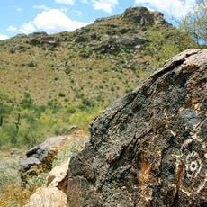
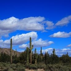
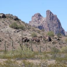
Sugarloaf Mountain is a cone-shaped summit rising from the desert plains of Maricopa County. The slopes connect directly to the surrounding arid terrain, where shrubby plants grow sparsely across the ground.
Sugarloaf Mountain is the highest point of the Hummingbird Springs Wilderness, a low, arid basin in northwest Maricopa County about 65 miles west of Phoenix. The wilderness lies just north of the Big Horn Mountains Wilderness, the two separated only by a jeep trail leading to Hummingbird Springs. Its washes drain southwest into Tiger Wash, a tributary of Centennial Wash and the Gila River.
The peak marks the highest point of the Hummingbird Springs Wilderness, a low, arid range in northwest Maricopa County. The wilderness lies just north of the Big Horn Mountains Wilderness, and the two are separated only by a jeep trail leading to Hummingbird Springs.
Bring plenty of water and plan to hike early in the morning to avoid intense heat. The months from October through April offer the most comfortable conditions for outdoor exploration.
Sugarloaf Mountain is the tallest peak in the Hummingbird Springs Wilderness, a low, arid range in northwest Maricopa County about 65 miles west of Phoenix. The wilderness lies just north of the Big Horn Mountains Wilderness, separated only by a jeep trail leading to Hummingbird Springs.
The community of curious travelers
AroundUs brings together thousands of curated places, local tips, and hidden gems, enriched daily by 94,029 contributors worldwide.