Enable Location

We need your location to show you interesting places around you

Discover nearby places

Find interesting locations and hidden gems around you

Precise directions

Get accurate directions and distances to places

Your location is never shared with other users. It's only used when you tap the location button.

Log in to your account

Start exploring — it's free

Trusted by 62,061 travelers worldwide

Continue with Google
Continue with Apple
or

We will send you a code to connect

By continuing, you accept our Terms and Conditions and our Privacy Policy

Check your inbox

We've sent a pincode in your inbox. Please enter the code below.

Presidio–Ojinaga International Rail Bridge

Presidio–Ojinaga International Rail Bridge, Railway bridge at Mexico-United States border, Texas and Chihuahua.

The Presidio-Ojinaga International Rail Bridge is a steel and concrete structure crossing the Rio Grande to link Presidio, Texas with Ojinaga, Chihuahua. A single-track railway line runs across this crossing to move trains between the two border towns.

An original wooden bridge from the early 1900s was destroyed in 2008, prompting a complete reconstruction that started in 2018. The new structure was built with modern engineering techniques and improved safety standards for cross-border operations.

The bridge represents one of only five international rail crossings in Texas, facilitating transportation connections between the United States and Mexico.

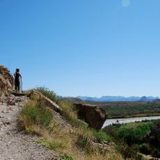
Visitors can view the bridge from either side of the border, with the best views available from the riverbank areas of the border towns. The border inspection facilities are specialized for rail traffic and may be busy during peak inspection times.

During reconstruction, engineers raised the track height to accommodate new flood protection levees that partially covered sections of the previous bridge. This adaptation illustrates how infrastructure must adjust to changing environmental conditions and protective measures.

The community of curious travelers

AroundUs brings together thousands of curated places, local tips, and hidden gems, enriched daily by 60,000 contributors worldwide.

Start exploring
Location
Location
Part of
Mexico–United States border
GPS coordinates
29.56173,-104.39511
Latest update
December 13, 2025 12:41
Around this place
Cibolo Creek Ranch
United States of America

Cibolo Creek Ranch

33.9 km
Chinati Foundation
United States of America

Chinati Foundation

89.5 km
Cañón de Santa Elena Flora and Fauna Protection Area
Mexico

Cañón de Santa Elena Flora and Fauna Protection Area

71.6 km
Big Bend Ranch State Park
United States of America

Big Bend Ranch State Park

23.6 km
Aguja Formation
Mexico

Aguja Formation

91.5 km
Javelina Formation
United States of America

Javelina Formation

100.8 km
El Paisano Hotel
United States of America

El Paisano Hotel

91 km
Fort Leaton State Historic Site
United States of America

Fort Leaton State Historic Site

6.8 km
Luna Jacal
United States of America

Luna Jacal

92 km
Presidio County Courthouse
United States of America

Presidio County Courthouse

91.1 km
Rancho Estelle
United States of America

Rancho Estelle

91.6 km
Peguis Canyon
Mexico

Peguis Canyon

36.3 km
Santa Elena Canyon
Mexico

Santa Elena Canyon

87.8 km
Sotol Vista Overlook
United States of America

Sotol Vista Overlook

106.1 km
Santa Elena Canyon Trail
United States of America

Santa Elena Canyon Trail

87.8 km
Central Marfa Historic District
United States of America

Central Marfa Historic District

90.9 km
Museum of Electronic Wonders @ FOOD SHARK with Snack Bar & Casita Bar
United States of America

Museum of Electronic Wonders @ FOOD SHARK with Snack Bar & Casita Bar

90.1 km
Castolon Historic District
United States of America

Castolon Historic District

97.8 km
Fort Leaton State Historic Site
United States of America

Fort Leaton State Historic Site

6.8 km
Marfa Lights Viewing Area
United States of America

Marfa Lights Viewing Area

93.5 km
Castolon Ranger Station
United States of America

Castolon Ranger Station

97.8 km
Sacred Heart Catholic Mission Church
United States of America

Sacred Heart Catholic Mission Church

29.7 km
Homer Wilson Ranch Overlook
United States of America

Homer Wilson Ranch Overlook

106.7 km
Alvino House
United States of America

Alvino House

97.7 km
Castolon Store
United States of America

Castolon Store

97.9 km
Maverick Entrance Sign
United States of America

Maverick Entrance Sign

90.8 km
Fortin de la Cienega
United States of America

Fortin de la Cienega

33.7 km
Recreation Building
United States of America

Recreation Building

97.9 km
Show the full map
« Presidio–Ojinaga International Rail Bridge - Railway bridge at Mexico-United States border, Texas and Chihuahua » is provided by Around Us (aroundus.com). Images and texts are derived from Wikimedia project under a Creative Commons license. You are allowed to copy, distribute, and modify copies of this page, under the conditions set by the license, as long as this note is clearly visible.

Discover hidden gems everywhere you go!

From secret cafés to breathtaking viewpoints, skip the crowded tourist spots and find places that match your style. Our app makes it easy with voice search, smart filtering, route optimization, and insider tips from travelers worldwide. Download now for the complete mobile experience.

Around Us App Screenshot

A unique approach to discovering new places

Le Figaro

All the places worth exploring

France Info

A tailor-made excursion in just a few clicks

20 Minutes

Around Us
Travel Guide & Maps
Download

Send to your phone

QR Code
1

Open the camera app on your mobile.

2

Point at the QR code with your camera. A notification will appear.

3

Tap the notification to open the link.