Chest opened
+${chestReward.xp} XP
Explorer
NOUVEAU ×${chestReward.collectible.quantity}
tapez pour fermer
Chest locked

Open chests in the app

Around Us is built for your phone — chests unlock when you walk, explore and capture nearby places.

Enable Location

We need your location to show you interesting places around you

Discover nearby places

Find interesting locations and hidden gems around you

Precise directions

Get accurate directions and distances to places

Your location is never shared with other users. It's only used when you tap the location button.

Huachuca Mountains

Log in to your account

Start exploring — it's free

Trusted by 72,890 travelers worldwide

Continue with Google
Continue with Apple
or

We will send you a code to connect

By continuing, you accept our Terms and Conditions and our Privacy Policy

Check your inbox

We've sent a pincode in your inbox. Please enter the code below.

Huachuca Mountains
Discussion Reviews 1 Photos
11.1k Popularity

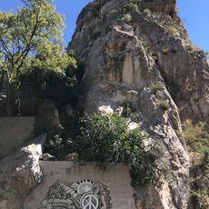
Huachuca Mountains, Mountain range in Cochise County, Arizona, US.

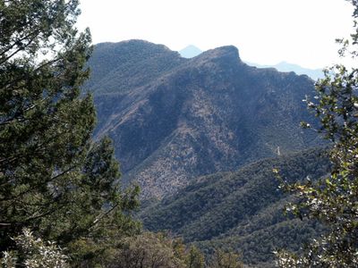
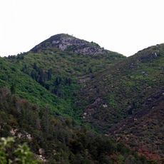
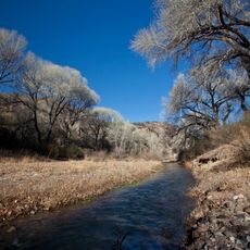
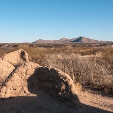
The Huachuca Mountains form a mountain range in Cochise County that rises from lower elevations to Miller Peak at the summit. Multiple canyons cut through the range, creating distinct valleys and ridges that shape the terrain.

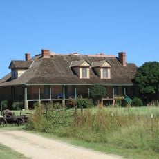
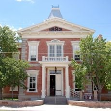
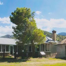
Fort Huachuca was established at the mountain base in 1877 and served as a military installation for intelligence and communications units during World War II. The fort became a key strategic location for military operations in the region.

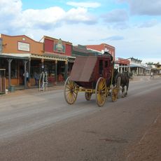
The mountain range takes its name from a former Pima village, reflecting the indigenous presence of Native American tribes in southeastern Arizona. The place name itself shows how the landscape remains connected to the people who have lived here.

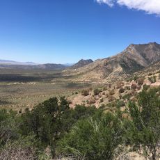
The range features numerous hiking paths at different difficulty levels, with access points available through the neighboring Coronado National Forest. Visitors should note that the elevation changes significantly affect weather and trail conditions.

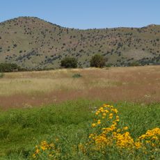
The elevation differences create multiple climate zones that support a range of plant species not typically found together in this region. Hikers can move through distinct landscapes within a short distance, experiencing significant temperature changes as they gain altitude.

The community of curious travelers

AroundUs brings together thousands of curated places, local tips, and hidden gems, enriched daily by 60,000 contributors worldwide.

Start exploring
Location
GPS coordinates
31.40000,-110.30000
Latest update
December 8, 2025 13:42
Around this place
Bird Cage Theatre
United States of America

Bird Cage Theatre

41.3 km
Coronado National Memorial
United States of America

Coronado National Memorial

6.3 km
San Rafael Ranch
United States of America

San Rafael Ranch

30.2 km
Miller Peak
United States of America

Miller Peak

1 km
Schieffelin Hall
United States of America

Schieffelin Hall

41.4 km
Tombstone Courthouse
United States of America

Tombstone Courthouse

41.1 km
Murray Springs Clovis Site
United States of America

Murray Springs Clovis Site

22.2 km
San Pedro Riparian National Conservation Area
United States of America

San Pedro Riparian National Conservation Area

25.9 km
Tombstone Historic District
United States of America

Tombstone Historic District

41.2 km
Presidio Santa Cruz de Terrenate
United States of America

Presidio Santa Cruz de Terrenate

40.1 km
Brown Canyon Ranch
United States of America

Brown Canyon Ranch

8.2 km
Bisbee Historic District
United States of America

Bisbee Historic District

37 km
The Little Outfit Schoolhouse
United States of America

The Little Outfit Schoolhouse

28.1 km
Hereford Arizona Observatory
United States of America

Hereford Arizona Observatory

8.3 km
Canelo Hills Cienega Reserve
United States of America

Canelo Hills Cienega Reserve

28 km
Phelps Dodge General Office Building
United States of America

Phelps Dodge General Office Building

36.9 km
St. Patrick's Roman Catholic Church
United States of America

St. Patrick's Roman Catholic Church

36.3 km
Canelo School
United States of America

Canelo School

25.5 km
Canelo Ranger Station
United States of America

Canelo Ranger Station

26.6 km
Cady Hall
United States of America

Cady Hall

45.7 km
James Finley House
United States of America

James Finley House

39.2 km
Coronado cave
United States of America

Coronado cave

6.6 km
Plaza Juárez
Mexico

Plaza Juárez

46.3 km
Bisbee Residential Historic District
United States of America

Bisbee Residential Historic District

36.1 km
Bisbee Woman's Club Clubhouse
United States of America

Bisbee Woman's Club Clubhouse

36.7 km
Cananea city hall
Mexico

Cananea city hall

46.4 km
Kinjockity Ranch
United States of America

Kinjockity Ranch

7.6 km
Castle Rock
United States of America

Castle Rock

36.6 km
Show the full map
Reviews
Share your experience

No review yet

Discussions
Start a discussion...

No discussion yet

« Huachuca Mountains - Mountain range in Cochise County, Arizona, US » is provided by Around Us (aroundus.com). Images and texts are derived from Wikimedia project under a Creative Commons license. You are allowed to copy, distribute, and modify copies of this page, under the conditions set by the license, as long as this note is clearly visible.

Discover hidden gems everywhere you go!

From secret cafés to breathtaking viewpoints, skip the crowded tourist spots and find places that match your style. Our app makes it easy with voice search, smart filtering, route optimization, and insider tips from travelers worldwide. Download now for the complete mobile experience.

Around Us App Screenshot

A unique approach to discovering new places

Le Figaro

All the places worth exploring

France Info

A tailor-made excursion in just a few clicks

20 Minutes

Around Us
Travel Guide & Maps
Download

Send to your phone

QR Code
1

Open the camera app on your mobile.

2

Point at the QR code with your camera. A notification will appear.

3

Tap the notification to open the link.