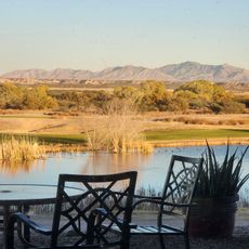
Rincon Mountains, Mountain range in southeastern Arizona, United States.
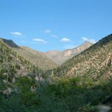
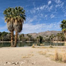
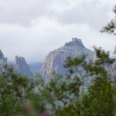
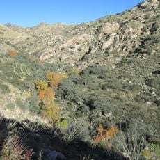
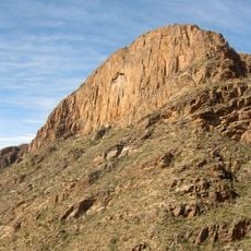
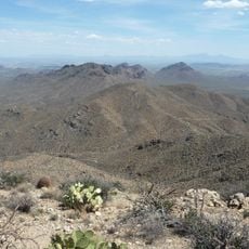
The Rincon Mountains form a rugged range in southeastern Arizona stretching from southwest to northeast and reaching their highest point above 8,600 feet. The massif features steep slopes, deep canyons, and diverse terrain that changes with elevation.
These mountains formed roughly 50 million years ago through volcanic activity and tectonic faulting. Since then, erosion from water and weather has continuously sculpted the canyons and slopes we see today.
Indigenous groups such as the Mogollon and Sobaipuri lived in and around these mountains for thousands of years, adapting their communities to the rugged terrain. Today, archaeological traces remain scattered across the slopes, telling stories of the people who called this place home.
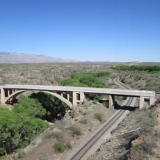
Multiple trails of varying difficulty offer access to explore this range, with entry points scattered around the perimeter. Bring plenty of water and be ready for elevation changes and temperature shifts as you climb.
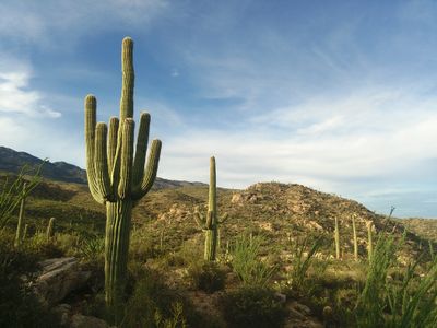
The range contains distinct ecological zones that shift dramatically with elevation, from desert plants like saguaro cacti at lower heights to pine and fir forests higher up. This transition between different ecosystems occurs over a surprisingly short distance.
Location: Arizona
GPS coordinates: 32.17000,-110.51000
Latest update: December 6, 2025 16:03
Arizona contains geological formations spanning millions of years alongside evidence of Spanish colonial settlement and prehistoric cultures. The landscape includes sandstone canyons such as Antelope Canyon X and Canyon de Chelly National Monument, extensive desert areas with saguaro and organ pipe...
309th Aerospace Maintenance and Regeneration Group
30.6 km
Pima Air & Space Museum
33.6 km
Sabino Canyon
33.2 km
Colossal Cave
16.3 kmBear Canyon
30.7 km
Catalina Station
34.6 km
Agua Caliente Regional Park
24.4 km
Thimble Peak
31.1 km
Ciénega Bridge
21.1 km
Molino Canyon
25 km
Pusch Ridge Wilderness Area
38.3 km
The Mini Time Machine Museum
37.8 km
Lowell Ranger Station
33 kmMae West Peaks
37.4 km
Manning Cabin
5.9 km
Benson Railroad Historic District
30.2 km
Apache Powder Historic Residential District
30.1 km
Programa de las Leguminosas del Desierto
4.8 km
Saguaro Wilderness
18.3 km
San Pedro Golf Course
30 km
The Historic Aviation Bone Yard
30.8 km
Rincon Mountain Visitor Center
21.4 km
Saint Joseph church in Tucson
34.7 km
Saint Cyril of Alexandria church in Tucson
36.8 km
Aerospace Maintenance and Regeneration Center
30.6 km
San Pedro chapel capillita in Tucson
36.4 km
San Pedro River Railroad Bridge
31.6 km
Marsh Station Bridge
21.1 kmVisited this place? Tap the stars to rate it and share your experience / photos with the community! Try now! You can cancel it anytime.
Discover hidden gems everywhere you go!
From secret cafés to breathtaking viewpoints, skip the crowded tourist spots and find places that match your style. Our app makes it easy with voice search, smart filtering, route optimization, and insider tips from travelers worldwide. Download now for the complete mobile experience.
A unique approach to discovering new places❞
— Le Figaro
All the places worth exploring❞
— France Info
A tailor-made excursion in just a few clicks❞
— 20 Minutes