Chest opened
+${chestReward.xp} XP
Explorer
NOUVEAU ×${chestReward.collectible.quantity}
tapez pour fermer
Chest locked

Open chests in the app

Around Us is built for your phone — chests unlock when you walk, explore and capture nearby places.

Enable Location

We need your location to show you interesting places around you

Discover nearby places

Find interesting locations and hidden gems around you

Precise directions

Get accurate directions and distances to places

Your location is never shared with other users. It's only used when you tap the location button.

Apache-Sitgreaves National Forests

Log in to your account

Start exploring — it's free

Trusted by 72,880 travelers worldwide

Continue with Google
Continue with Apple
or

We will send you a code to connect

By continuing, you accept our Terms and Conditions and our Privacy Policy

Check your inbox

We've sent a pincode in your inbox. Please enter the code below.

Apache-Sitgreaves National Forests
Discussion Reviews 1 Photos
12.9k Popularity

Apache-Sitgreaves National Forests, National forest in eastern Arizona and western New Mexico, United States.

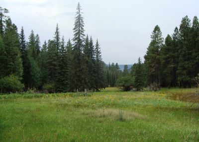
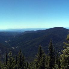
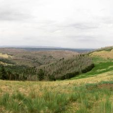
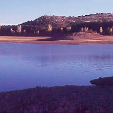
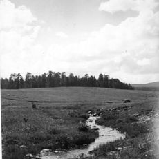
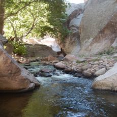
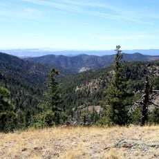
Apache-Sitgreaves National Forests span eastern Arizona and western New Mexico, combining two major forest areas with mountains, dense woodlands, lakes, and streams. The terrain shifts from high peaks to river valleys with varied plant and animal habitats throughout.

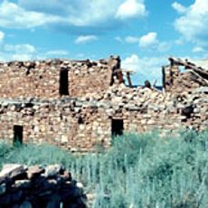
The forests are named after the Apache peoples and Charles S. Sitgreaves, an explorer who surveyed the region during the 1850s. This pairing reflects the intertwined history of indigenous presence and American exploration of these mountain lands.

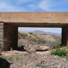
This forest holds deep roots in Apache and other Native American traditions, with tribal communities maintaining ceremonial ties and cultural practices across these lands.

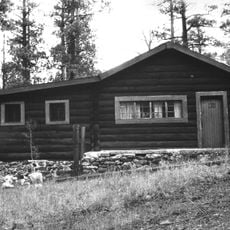
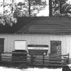
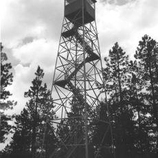
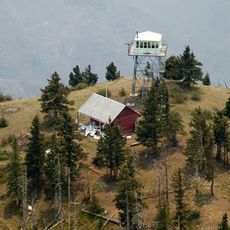
Visitors find accessible campgrounds, hiking trails, and multiple cold-water lakes connected by well-maintained roads across the forest. The region is best explored gradually, taking time to venture into different valleys and high country areas.

The forest contains four designated wilderness areas that protect habitats for over 400 wildlife species, from mountain lions to black bears. These protected zones offer rare refuge for landscapes touched minimally by human activity.

The community of curious travelers

AroundUs brings together thousands of curated places, local tips, and hidden gems, enriched daily by 60,000 contributors worldwide.

Start exploring
Location
Location
GPS coordinates
33.63720,-109.28800
Latest update
December 7, 2025 20:43
Around this place
Morenci Mine
United States of America

Morenci Mine

61.3 km
Mount Baldy
United States of America

Mount Baldy

39.3 km
Mogollon
United States of America

Mogollon

53.1 km
Round Valley Ensphere
United States of America

Round Valley Ensphere

53.8 km
Kinishba Ruins
United States of America

Kinishba Ruins

73.7 km
Escudilla Mountain
United States of America

Escudilla Mountain

38.6 km
Lyman Reservoir
United States of America

Lyman Reservoir

80.6 km
Apache National Forest
United States of America

Apache National Forest

19.8 km
Casa Malpaís
United States of America

Casa Malpaís

57.1 km
Gila Box Riparian National Conservation Area
United States of America

Gila Box Riparian National Conservation Area

81.7 km
Alpine Elementary School
United States of America

Alpine Elementary School

25 km
Park Avenue Bridge
United States of America

Park Avenue Bridge

64.7 km
Lake Mountain Lookout Complex
United States of America

Lake Mountain Lookout Complex

73.1 km
Butterfly Lodge
United States of America

Butterfly Lodge

45 km
Whitewater Creek
United States of America

Whitewater Creek

51.8 km
Eagar Townsite Historic District
United States of America

Eagar Townsite Historic District

52.4 km
Corduroy Creek Bridge
United States of America

Corduroy Creek Bridge

95.5 km
Clifton Townsite Historic District
United States of America

Clifton Townsite Historic District

64.8 km
Eagar School
United States of America

Eagar School

52.4 km
Los Burros Ranger Station
United States of America

Los Burros Ranger Station

71.3 km
PS Knoll Lookout Complex
United States of America

PS Knoll Lookout Complex

16.6 km
Gila River Bridge
United States of America

Gila River Bridge

74.8 km
Mogollon Baldy Lookout Cabin
United States of America

Mogollon Baldy Lookout Cabin

76.2 km
Black Gap Bridge
United States of America

Black Gap Bridge

76.9 km
Gallo Mountains
United States of America

Gallo Mountains

79.7 km
Cosmic Campground
United States of America

Cosmic Campground

38.1 km
Chase Creek Railroad Bridge
United States of America

Chase Creek Railroad Bridge

64.6 km
Mogollon Baldy Lookout
United States of America

Mogollon Baldy Lookout

76.2 km
Show the full map
Reviews
Share your experience

No review yet

Discussions
Start a discussion...

No discussion yet

« Apache-Sitgreaves National Forests - National forest in eastern Arizona and western New Mexico, United States » is provided by Around Us (aroundus.com). Images and texts are derived from Wikimedia project under a Creative Commons license. You are allowed to copy, distribute, and modify copies of this page, under the conditions set by the license, as long as this note is clearly visible.

Discover hidden gems everywhere you go!

From secret cafés to breathtaking viewpoints, skip the crowded tourist spots and find places that match your style. Our app makes it easy with voice search, smart filtering, route optimization, and insider tips from travelers worldwide. Download now for the complete mobile experience.

Around Us App Screenshot

A unique approach to discovering new places

Le Figaro

All the places worth exploring

France Info

A tailor-made excursion in just a few clicks

20 Minutes

Around Us
Travel Guide & Maps
Download

Send to your phone

QR Code
1

Open the camera app on your mobile.

2

Point at the QR code with your camera. A notification will appear.

3

Tap the notification to open the link.