Enable Location

We need your location to show you interesting places around you

Discover nearby places

Find interesting locations and hidden gems around you

Precise directions

Get accurate directions and distances to places

Your location is never shared with other users. It's only used when you tap the location button.

Risaralda Department

Log in to your account

Start exploring — it's free

Trusted by 61,991 travelers worldwide

Continue with Google
Continue with Apple
or

We will send you a code to connect

By continuing, you accept our Terms and Conditions and our Privacy Policy

Check your inbox

We've sent a pincode in your inbox. Please enter the code below.

Risaralda Department, Administrative department in western central Colombia

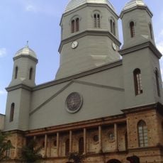
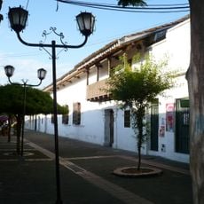
Risaralda is an administrative division in western central Colombia that stretches along the Andean cordillera and covers several climate zones. The capital Pereira sits in a fertile valley, while smaller communities are scattered among forested slopes and coffee plantations.

This administrative division was created on July 1, 1966, when the area separated from the larger Caldas Department and formed its own political unit. The border followed geographical features and economic connections that had developed since colonial times.

The name comes from the Risaralda River that flows through this mountain landscape and now marks the western border of the administrative area. In the higher-altitude towns, residents often speak with a soft accent typical of the coffee-growing region, which differs slightly from the Spanish spoken along the coast.

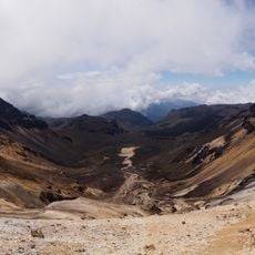
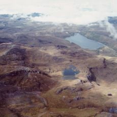
Main roads connect the capital with the mountains to the east and lead toward the Pacific coast to the west, with winding mountain stretches requiring several hours of travel time. Elevations range from warm valleys to cooler mountain areas, so pack clothing for different temperatures.

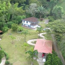
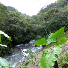
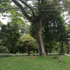
Two nature reserves at higher elevations preserve cloud forests where rare bird species like the Andean cock-of-the-rock live and are often spotted by hikers. The volcanic soil composition allows coffee cultivation with a pronounced flavor profile valued by roasters worldwide.

The community of curious travelers

AroundUs brings together thousands of curated places, local tips, and hidden gems, enriched daily by 60,000 contributors worldwide.

Start exploring
Location
Inception
July 1, 1966
Capital city
Pereira
Elevation above the sea
1,516 m
Reference
RIS
Shares border with
Antioquia, Caldas Department, Tolima Department, Quindío Department, Valle del Cauca Department, Chocó Department
GPS coordinates
5.01667,-75.91667
Latest update
December 12, 2025 22:59
« Risaralda Department - Administrative department in western central Colombia » is provided by Around Us (aroundus.com). Images and texts are derived from Wikimedia project under a Creative Commons license. You are allowed to copy, distribute, and modify copies of this page, under the conditions set by the license, as long as this note is clearly visible.

Discover hidden gems everywhere you go!

From secret cafés to breathtaking viewpoints, skip the crowded tourist spots and find places that match your style. Our app makes it easy with voice search, smart filtering, route optimization, and insider tips from travelers worldwide. Download now for the complete mobile experience.

Around Us App Screenshot

A unique approach to discovering new places

Le Figaro

All the places worth exploring

France Info

A tailor-made excursion in just a few clicks

20 Minutes

Around Us
Travel Guide & Maps
Download

Send to your phone

QR Code
1

Open the camera app on your mobile.

2

Point at the QR code with your camera. A notification will appear.

3

Tap the notification to open the link.