Cerro Bravo, Stratovolcano in Tolima, Colombia
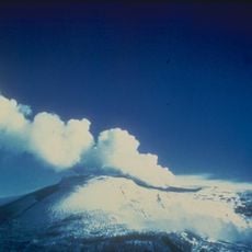
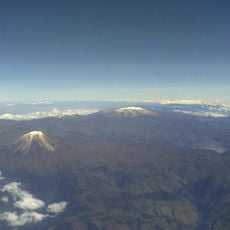
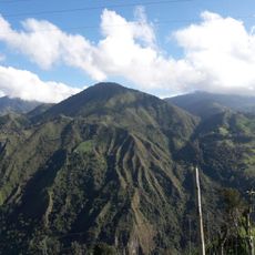
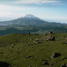
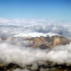
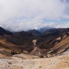
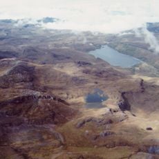
Cerro Bravo is a stratovolcano in Tolima that rises to approximately 4,000 meters elevation with two connected calderas at its summit. The slopes display exposed dacite rock formations that reveal the mountain's volcanic composition.
The volcano began forming approximately 50,000 years ago, with the current structure shaped by multiple eruption cycles over the past 14,000 years. These repeated volcanic events gradually built up the mountain over time.
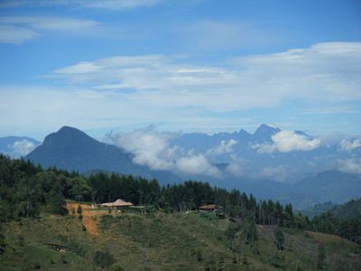
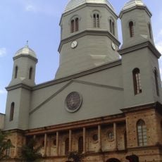
Communities living nearby have adapted to the volcanic terrain and incorporate the mountain into their daily routines and land use. The presence shapes local agriculture and how people interact with the surrounding landscape.
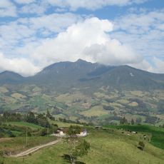
You can reach the mountain via the paved road connecting Manizales and Bogotá, with multiple routes leading up to the central dome. Conditions change with elevation, so be ready for varying weather as you climb.
The volcano produces thick, slow-moving lava that forms domes capable of blocking its own vents. When these blockages eventually fail or break down, they can trigger eruptions or collapses, making it a kind of natural geological laboratory.
Elevation above the sea: 3,985 m
Made from material: dacite
GPS coordinates: 5.08958,-75.29122
Latest update: December 10, 2025 16:26
Nevado del Ruiz
23.3 km
Coffee Cultural Landscape of Colombia
60.7 km
Los Nevados National Natural Park
33.3 km
Volcán Cerro Machín
68.4 km
Nevado del Tolima
48.1 km
Santa Isabel
32.7 km
Catedral Basílica Metropolitana Nuestra Señora del Rosario
25.2 km
César Gaviria Trujillo Viaduct
53.2 km
Paisaje Cultural Cafetero
59.1 km
Catedral de Nuestra Señora de la Pobreza
54.3 km
Nevado del Quindío
43.6 km
Otún Quimbaya Fauna and Flora Sanctuary
51.8 km
Páramo de Sonsón
70 km
Catedral de Ibagué
72 km
Torre de Herveo
22 km
Quimbaya Museum
70.1 km
Our Lady of Chiquinquirá Cathedral, Sonsón
69.1 km
Basílica Menor de San Antonio de Padua de Manzanares
23.8 km
Museo Casa de los Abuelos
69.3 km
Santuario de Nuestra Señora de Valvanera
69.2 km
Centro Cultural Metropolitano de Convenciones de Armenia
71.1 km
Plaza de Ruíz y Zapata
69 km
Sonsón town hall
69 km
Parque Consotá
65.9 km
Itare Theater
69 km
Teatro Municipal (Sonsón)
69 km
Museo del Disco y la Música
57.4 km
Museo Fiestas Del Maíz
69.2 kmVisited this place? Tap the stars to rate it and share your experience / photos with the community! Try now! You can cancel it anytime.
Discover hidden gems everywhere you go!
From secret cafés to breathtaking viewpoints, skip the crowded tourist spots and find places that match your style. Our app makes it easy with voice search, smart filtering, route optimization, and insider tips from travelers worldwide. Download now for the complete mobile experience.
A unique approach to discovering new places❞
— Le Figaro
All the places worth exploring❞
— France Info
A tailor-made excursion in just a few clicks❞
— 20 Minutes