Enable Location

We need your location to show you interesting places around you

Discover nearby places

Find interesting locations and hidden gems around you

Precise directions

Get accurate directions and distances to places

Your location is never shared with other users. It's only used when you tap the location button.

Volcán Cerro Machín

Log in to your account

Start exploring — it's free

Trusted by 61,990 travelers worldwide

Continue with Google
Continue with Apple
or

We will send you a code to connect

By continuing, you accept our Terms and Conditions and our Privacy Policy

Check your inbox

We've sent a pincode in your inbox. Please enter the code below.

Volcán Cerro Machín

Volcán Cerro Machín, Stratovolcano in Tolima Department, Colombia.

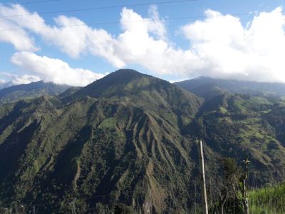
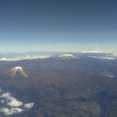
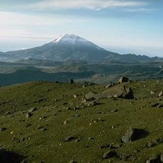
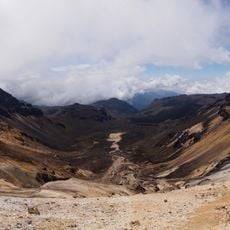
Cerro Machín is a stratovolcano on the eastern flank of the Central Cordillera that rises to 2,650 meters and holds a crater measuring 2.4 kilometers across. Inside this crater sit three dacite domes that shape the volcanic landscape.

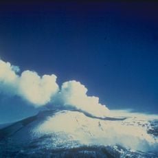
Scientists have recorded six major explosive eruptions over the past 5,000 years, with the most recent taking place roughly 900 years ago. These eruptions left ash deposits now scattered across much of the surrounding region.

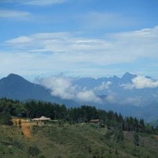
The volcano area holds agricultural significance for local communities who maintain farms and livestock operations on its fertile slopes.

Access requires a 4x4 vehicle to handle the unpaved road from Ibagué that climbs steeply through narrow mountain paths. The drive can take several hours depending on weather, so plan to leave early in the morning.

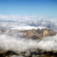
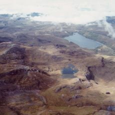
An active hydrothermal system generates fumaroles and thermal springs across the volcano, while ongoing microseismic activity signals underground magma movement. Measurements have also detected elevated radon concentrations around the crater area.

The community of curious travelers

AroundUs brings together thousands of curated places, local tips, and hidden gems, enriched daily by 60,000 contributors worldwide.

Start exploring
Elevation above the sea
2,650 m
Made from material
dacite
GPS coordinates
4.48333,-75.39167
Latest update
December 20, 2025 01:31
« Volcán Cerro Machín - Stratovolcano in Tolima Department, Colombia » is provided by Around Us (aroundus.com). Images and texts are derived from Wikimedia project under a Creative Commons license. You are allowed to copy, distribute, and modify copies of this page, under the conditions set by the license, as long as this note is clearly visible.

Discover hidden gems everywhere you go!

From secret cafés to breathtaking viewpoints, skip the crowded tourist spots and find places that match your style. Our app makes it easy with voice search, smart filtering, route optimization, and insider tips from travelers worldwide. Download now for the complete mobile experience.

Around Us App Screenshot

A unique approach to discovering new places

Le Figaro

All the places worth exploring

France Info

A tailor-made excursion in just a few clicks

20 Minutes

Around Us
Travel Guide & Maps
Download

Send to your phone

QR Code
1

Open the camera app on your mobile.

2

Point at the QR code with your camera. A notification will appear.

3

Tap the notification to open the link.