Villanueva, Administrative municipality in Casanare Department, Colombia.
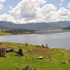
Villanueva is a municipality in Casanare Department situated at roughly 265 meters elevation. It spreads across about 800 square kilometers in the tropical region of the department.
The municipality was founded in 1962, marking the start of organized local government in this region. This establishment brought initial infrastructure projects and better connections to neighboring areas.
The Festival Nacional de Colonias in August showcases regional dishes and art from people who came from different parts of Colombia. This event brings visitors together to experience the cultural diversity that shaped the community.
The municipality is accessible through road networks connecting to neighboring towns, with the nearest airport about 90 kilometers away in Villavicencio. Visitors should prepare for tropical weather and arrange local transportation in advance.
Agriculture here focuses heavily on African palm cultivation, a crop introduced in 1978. These plantations have fundamentally reshaped the local economy and continue to define the landscape.
Location: Casanare Department
Inception: 1962
Elevation above the sea: 265 m
Website: http://villanueva-casanare.gov.co
GPS coordinates: 4.60874,-72.92879
Latest update: December 7, 2025 10:06
Puente de Boyacá
109 km
Chingaza National Natural Park
85.8 km
Estadio Bello Horizonte - Rey Pelé
92.8 km
Playa Blanca
100.6 km
Represa del Sisga
101.8 km
Hunzahúa Well
113.8 km
Guavio Reservoir
65.2 km
Embalse de Chivor
58.3 km
Bioparque Los Ocarros
89 km
Cathedral Basilica of St. James the Apostle, Tunja
113.6 km
Plaza de Bolívar
113.5 km
La pila del mono
113.8 km
Our Lady of Mount Carmel Cathedral, Villavicencio
93.8 km
Páramo de Guacheneque
91.2 km
Paredón de los Mártires
113.1 km
Cojines del Zaque
113.8 km
Monumento a la Raza Indígena
113.8 km
Santiago de las Atalayas Stadium
100.6 km
Plaza Real de Tunja
113.8 km
La Esmeralda Dam
52.2 km
Bosque de la República
113.8 km
Palacio de la Torre
113.8 km
Columna a los mártires
113.8 km
Natural Reserve "Old Pueblito"
107.6 km
Lac del Guavio
65.7 km
Tominé Reservoir
108.1 km
Lac del Sisga
101.8 km
Cascada La Chorrera
114.5 kmVisited this place? Tap the stars to rate it and share your experience / photos with the community! Try now! You can cancel it anytime.
Discover hidden gems everywhere you go!
From secret cafés to breathtaking viewpoints, skip the crowded tourist spots and find places that match your style. Our app makes it easy with voice search, smart filtering, route optimization, and insider tips from travelers worldwide. Download now for the complete mobile experience.
A unique approach to discovering new places❞
— Le Figaro
All the places worth exploring❞
— France Info
A tailor-made excursion in just a few clicks❞
— 20 Minutes