Barva Canton

Log in to your account

AroundUs is a community-driven map of interesting places, built by curious explorers like you. It grows with every review, story, and photo you share.
Connect to save your favorite spots, contribute locations, and create personalized routes.
Continue with Google
Continue with Apple
Continue with X
Continue with Facebook
Continue with email
By continuing, you accept our Terms and Conditions and our Privacy Policy
Create an account
Add to collection
Map
Suggest a change
Share

Barva Canton, Administrative canton in Heredia Province, Costa Rica

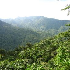
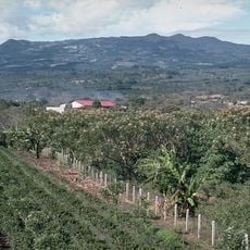
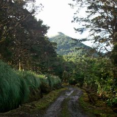
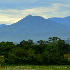
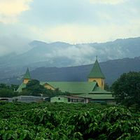
Barva Canton is an administrative region in Heredia Province that extends across mountainous terrain from urban settlements to the slopes of Barva Volcano. It comprises six districts connected by National Routes 113 and 114, creating a patchwork of communities spread across different elevations.

The name comes from Cacique Barvac, a regional ruler in 1569 who left his mark on the territory. The area was officially designated as a canton on December 7, 1848, establishing its status as an independent administrative unit.

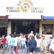
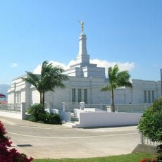
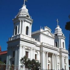
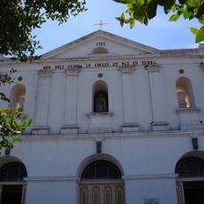
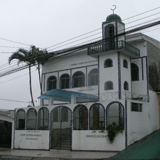
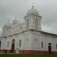
The Parish of Saint Bartholomew sits at the heart of town and serves as a gathering place for the community. People meet here for annual celebrations on August 24 and on weekends to shop at traditional stores and markets in the central district.

Access is via National Route 113 from the eastern side or Route 114 from other directions, with both roads serving different districts. The higher elevation communities require more travel time, so planning your route ahead is helpful.

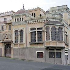
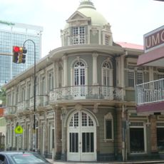
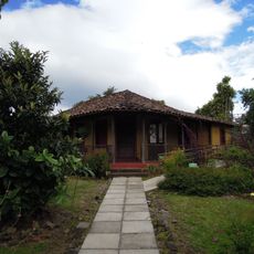
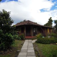
The area is known for coffee plantations and dairy farming on the volcanic slopes, which define much of its rural character. Colonial adobe buildings still stand in the central district, giving the main town its historical look.

Location: Heredia Province

Capital city: Barva

Elevation above the sea: 1,895 m

Area: 56.01

Shares border with: San Rafael Canton, Heredia Canton, Flores Canton, Santa Bárbara Canton

Website: https://munibarva.go.cr

GPS coordinates: 10.07638,-84.11554

Latest update: December 7, 2025 20:47

Photos
Reviews

Visited this place? Tap the stars to rate it and share your experience / photos with the community! Try now! You can cancel it anytime.

« Barva Canton - Administrative canton in Heredia Province, Costa Rica » is provided by Around Us (aroundus.com). Images and texts are derived from Wikimedia project under a Creative Commons license. You are allowed to copy, distribute, and modify copies of this page, under the conditions set by the license, as long as this note is clearly visible.

Discover hidden gems everywhere you go!

From secret cafés to breathtaking viewpoints, skip the crowded tourist spots and find places that match your style. Our app makes it easy with voice search, smart filtering, route optimization, and insider tips from travelers worldwide. Download now for the complete mobile experience.

Around Us App Screenshot

A unique approach to discovering new places

Le Figaro

All the places worth exploring

France Info

A tailor-made excursion in just a few clicks

20 Minutes