San Carlos Canton, Administrative canton in Alajuela Province, Costa Rica
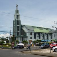
San Carlos Canton is an administrative district in Alajuela Province that spreads across a wide area from the San Carlos Plain extending northward to the Nicaraguan border. The canton is subdivided into thirteen districts with Ciudad Quesada serving as its main center.
The territory was formally created through Decree Number 17 on September 26, 1911, as part of Costa Rica's territorial reorganization. This administrative division helped improve governance of the country's northern regions.
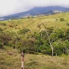
The region centers on dairy farming and milk production, which shapes daily life and local traditions throughout the territory. Farms and processing facilities are visible everywhere, reflecting this economic focus.
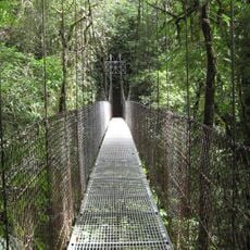
The main town of Ciudad Quesada is connected to other settlements via National Routes 4 and 35, making travel throughout the area straightforward. These road connections allow visitors to move between the different districts with relative ease.
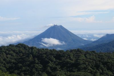
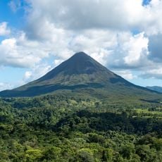
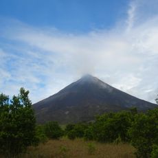
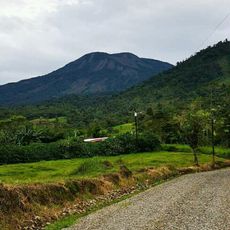
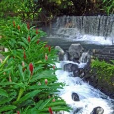
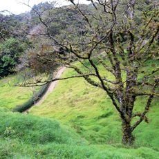
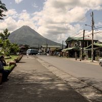
The territory contains Arenal Volcano, one of the country's most active volcanoes, and numerous natural hot springs scattered throughout the landscape. These geothermal waters provide warm natural pools in a mountainous setting.
Location: Alajuela Province
Capital city: Quesada
Elevation above the sea: 98 m
Shares border with: San Ramón Canton, Tilarán Canton, Guatuso Canton, Los Chiles Canton, Sarapiquí Canton, Grecia Canton, Sarchí Canton, Zarcero Canton
Website: https://munisc.go.cr
GPS coordinates: 10.61722,-84.51472
Latest update: December 20, 2025 01:36
Arenal Volcano
26.9 km
Monteverde Cloud Forest Reserve
46 km
Arenal Volcano National Park
26.8 km
Chato Volcan
27.2 km
Caño Negro Wildlife Refuge
39.7 km
La Fortuna Waterfall
26.4 km
Platanar
39.1 km
Arenal Hanging Bridges
27.1 kmJuan Castro Blanco National Park
42.1 km
Volcán Congo
51.2 km
Tabacón Hot Springs
26.9 km
Selvatura Park
43.1 kmVolcán Porvenir
42 km
Monteverde Theme Park
47.9 km
Curi Cancha Wildlife Refuge
46.8 kmArenal Huetar Norte Conservation Area
21 kmEl Viejo Volcano
44.3 kmBorder Corridor Wildlife Refuge
38.6 kmCerro Congo
51.2 km
Agua y Paz Biosphere Reserve
29.7 km
Butterfly Conservatory
33.8 kmBosque Alegre Wildlife Refuge
47.7 kmArenal Volcano Emergency Forest Reserve
26 kmLacustrino de Tamborcito Wetlands
39.7 km
Monteverde Orchid Garden
47.5 kmCerro Campana
42.9 kmCerro Bolívar
46.9 kmScenic viewpoint
33.8 kmVisited this place? Tap the stars to rate it and share your experience / photos with the community! Try now! You can cancel it anytime.
Discover hidden gems everywhere you go!
From secret cafés to breathtaking viewpoints, skip the crowded tourist spots and find places that match your style. Our app makes it easy with voice search, smart filtering, route optimization, and insider tips from travelers worldwide. Download now for the complete mobile experience.
A unique approach to discovering new places❞
— Le Figaro
All the places worth exploring❞
— France Info
A tailor-made excursion in just a few clicks❞
— 20 Minutes