Enable Location

We need your location to show you interesting places around you

Discover nearby places

Find interesting locations and hidden gems around you

Precise directions

Get accurate directions and distances to places

Your location is never shared with other users. It's only used when you tap the location button.

Sierra de Ajusco-Chichinauhtzin

Log in to your account

Start exploring — it's free

Trusted by 61,558 travelers worldwide

Continue with Google
Continue with Apple
or

We will send you a code to connect

By continuing, you accept our Terms and Conditions and our Privacy Policy

Check your inbox

We've sent a pincode in your inbox. Please enter the code below.

Sierra de Ajusco-Chichinauhtzin

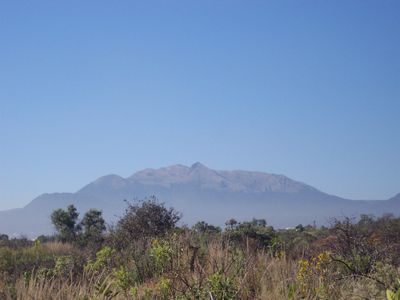
Sierra de Ajusco-Chichinauhtzin, Mountain range between Mexico City and Morelos, Mexico

Description

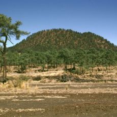
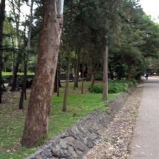
The Sierra de Ajusco-Chichinauhtzin is a mountain range in southern Mexico City and Morelos containing dozens of volcanic cones and several prominent peaks. The landscape spans roughly 100 square kilometers and is made of lava, ash, and other volcanic materials.

History

The mountain range formed roughly two million years ago through intense volcanic activity that transformed the ancient lake basin of Mexico into the current landscape. This geological transformation shaped the land where the Aztec civilization later developed.

Culture

The mountain range held sacred meaning for the Aztecs as a connection to their deities of mountains and water. Today, local communities use the paths and forest areas for traditional celebrations that reflect their relationship with the land.

Practical

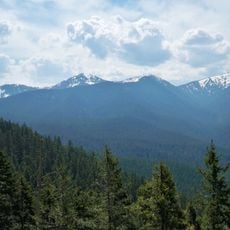
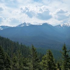
The range has multiple hiking trails and viewpoints accessible from different entry points. Higher areas are noticeably cooler and can be foggy, especially in early mornings or during rain.

Did you know?

The range functions as a vital biological corridor hosting a wealth of forest types and animals adapted differently across elevations, from lower to higher zones. Many of these species occur only in this region and are found nowhere else in the world.

Location
Location
Made from material
igneous rock
GPS coordinates
19.20000,-99.25000
Latest update
December 10, 2025 16:20

AroundUs brings together thousands of curated places, local tips, and hidden gems, enriched daily by 60,000 contributors worldwide. Discover all places nearby (Morelos).

« Sierra de Ajusco-Chichinauhtzin - Mountain range between Mexico City and Morelos, Mexico » is provided by Around Us (aroundus.com). Images and texts are derived from Wikimedia project under a Creative Commons license. You are allowed to copy, distribute, and modify copies of this page, under the conditions set by the license, as long as this note is clearly visible.

Discover hidden gems everywhere you go!

From secret cafés to breathtaking viewpoints, skip the crowded tourist spots and find places that match your style. Our app makes it easy with voice search, smart filtering, route optimization, and insider tips from travelers worldwide. Download now for the complete mobile experience.

Around Us App Screenshot

A unique approach to discovering new places

Le Figaro

All the places worth exploring

France Info

A tailor-made excursion in just a few clicks

20 Minutes

Around Us
Travel Guide & Maps
Download

Send to your phone

QR Code
1

Open the camera app on your mobile.

2

Point at the QR code with your camera. A notification will appear.

3

Tap the notification to open the link.