Enable Location

We need your location to show you interesting places around you

Discover nearby places

Find interesting locations and hidden gems around you

Precise directions

Get accurate directions and distances to places

Your location is never shared with other users. It's only used when you tap the location button.

Cumbres del Ajusco National Park

Log in to your account

Start exploring — it's free

Trusted by 62,107 travelers worldwide

Continue with Google
Continue with Apple
or

We will send you a code to connect

By continuing, you accept our Terms and Conditions and our Privacy Policy

Check your inbox

We've sent a pincode in your inbox. Please enter the code below.

Cumbres del Ajusco National Park

Cumbres del Ajusco National Park, National park in southern Mexico City, Mexico

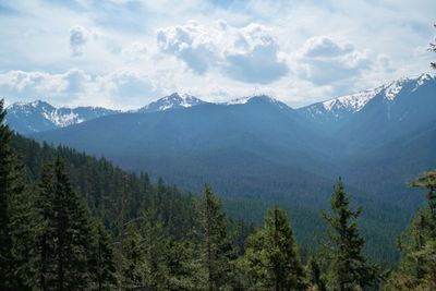
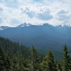
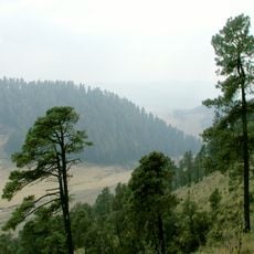
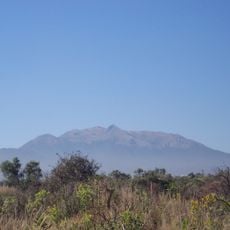
Cumbres del Ajusco is a protected area covering 920 hectares of pine forests and volcanic rock formations in the southern edge of Mexico City. The highest point in the park, Pico del Águila, reaches 3,930 meters and offers views across the valley and surrounding volcanoes on clear days.

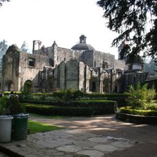
The Mexican government declared this mountain region a national park on September 23, 1936, to protect water sources and forests serving the capital. In the decades that followed, access roads and shelters were built to serve hikers and climbers arriving from the growing city below.

The name Ajusco comes from the Náhuatl word "Axochco", meaning "place where water springs up", referring to the many streams that begin here. Visitors walking the trails today will notice small shrines and memorial stones that locals have placed over generations in clearings along the routes.

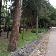
Trails wind through dense pine forests and across open slopes, so sturdy footwear and warm clothing are advisable because of the altitude. Fog can roll in quickly and reduce visibility, so it helps to stay on marked routes and return before dark.

During winter months, snowfall occasionally covers the forest here, making it one of the few places in the capital where visitors can see snow-covered pines. Some residents from nearby neighborhoods arrive with sleds and build snowmen in the clearings near the parking areas when conditions allow.

The community of curious travelers

AroundUs brings together thousands of curated places, local tips, and hidden gems, enriched daily by 60,000 contributors worldwide.

Start exploring
Location
Inception
September 23, 1936
GPS coordinates
19.21512,-99.25639
Latest update
December 5, 2025 22:30
« Cumbres del Ajusco National Park - National park in southern Mexico City, Mexico » is provided by Around Us (aroundus.com). Images and texts are derived from Wikimedia project under a Creative Commons license. You are allowed to copy, distribute, and modify copies of this page, under the conditions set by the license, as long as this note is clearly visible.

Discover hidden gems everywhere you go!

From secret cafés to breathtaking viewpoints, skip the crowded tourist spots and find places that match your style. Our app makes it easy with voice search, smart filtering, route optimization, and insider tips from travelers worldwide. Download now for the complete mobile experience.

Around Us App Screenshot

A unique approach to discovering new places

Le Figaro

All the places worth exploring

France Info

A tailor-made excursion in just a few clicks

20 Minutes

Around Us
Travel Guide & Maps
Download

Send to your phone

QR Code
1

Open the camera app on your mobile.

2

Point at the QR code with your camera. A notification will appear.

3

Tap the notification to open the link.