Valle de Juárez, Municipality in Jalisco, Mexico.
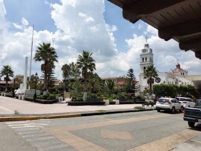
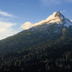
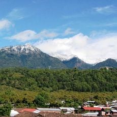
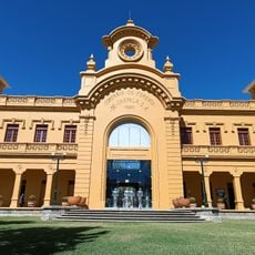
Valle de Juárez is a municipality in Jalisco in central-western Mexico situated at approximately 2000 meters elevation with agricultural lands and residential areas. The administrative center serves around 6,000 residents with electricity, water, and drainage services.
The region was originally inhabited by the Tarasco people under the name Tequesquite before becoming a municipality in 1895. The name changed in 1911 from Valle de Mazamitla to its current form.
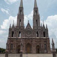
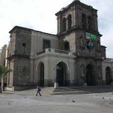
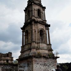
Annual celebrations honoring San Pascual Bailón draw the community together at the main plaza and parish church. These traditions reflect how local identity continues through recurring festivities shared with visitors.
The high elevation can affect visitors, so it's wise to arrive early and stay hydrated during your visit. The dry season offers better road conditions for accessing the area comfortably.
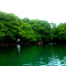
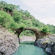
Natural springs at El Sirino and Agua Caliente feed local water supplies and shape the semi-dry climate of the area. These water sources have been part of the landscape since pre-colonial times.
Location: Jalisco
Capital city: Valle de Juárez (Mexico)
Elevation above the sea: 2,044 m
Address: 49540 Valle de Juárez, Jalisco, Mexico
Website: http://valledejuarezjalisco.gob.mx
GPS coordinates: 19.81611,-102.98333
Latest update: December 10, 2025 16:24
Parícutin
84.7 km
Cathedral of Our Lady of Guadalupe
75.9 km
Lago de Camécuaro National Park
81.5 kmEl Opeño
72 km
Nevado de Colima National Park
71 km
Pico de Tancítaro
82.6 km
Presidente InterContinental Hotel
75.9 km
Lake Cajititlan, Jalisco
76.4 km
Edificio Reforma 222 Torre 1
75.8 km
Torre MAPFRE
75.9 km
Hyatt Regency Mexico City
75.9 km
Immaculate Conception Cathedral, Zamora de Hidalgo
75.4 km
Torre Lomas
75.9 km
St. Joseph Cathedral, Ciudad Guzmán
51.8 km
Torre Mural
75.9 km
Reforma 115
75.9 km
Panorama Santa Fe
75.9 km
H2o Santa Fe building
75.9 kmTrióvalo Bernardo Obregón
76.2 km
Edificio Punta Poniente
75.9 km
Paragon Santa Fe
75.9 km
Edificio Reforma 90
75.9 km
Punta del Parque Torres A y B
75.9 km
Centro Cultural González Gallo
57 km
Chapala
57.6 km
Antigua Estación de Ferrocarril Tlajomulco
86.7 km
Puente del Diablo, Buenavista
75.8 km
Church of San Juan Parangaricutiro
83.3 kmVisited this place? Tap the stars to rate it and share your experience / photos with the community! Try now! You can cancel it anytime.
Discover hidden gems everywhere you go!
From secret cafés to breathtaking viewpoints, skip the crowded tourist spots and find places that match your style. Our app makes it easy with voice search, smart filtering, route optimization, and insider tips from travelers worldwide. Download now for the complete mobile experience.
A unique approach to discovering new places❞
— Le Figaro
All the places worth exploring❞
— France Info
A tailor-made excursion in just a few clicks❞
— 20 Minutes