Industrial Canal

Log in to your account

AroundUs is a community-driven map of interesting places, built by curious explorers like you. It grows with every review, story, and photo you share.
Connect to save your favorite spots, contribute locations, and create personalized routes.
Continue with Google
Continue with Apple
Continue with X
Continue with Facebook
Continue with email
By continuing, you accept our Terms and Conditions and our Privacy Policy
Create an account

Industrial Canal

Add to collection
Map
Suggest a change
Share

Industrial Canal, Navigation canal in Lower 9th Ward, New Orleans, US

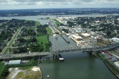
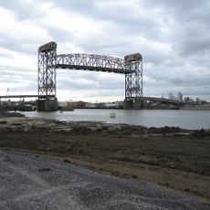
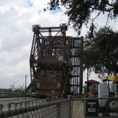
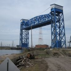
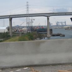
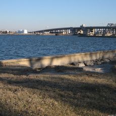
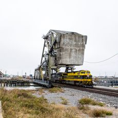
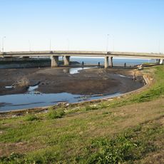
The Industrial Canal runs from Lake Pontchartrain to the Mississippi River and connects two major water routes. The waterway operates through a system of bridges and a navigation lock that manages ship traffic.

The canal was built after World War I to create a new connection between the lake and river. Work began in 1918 as maritime traffic patterns shifted with new trade routes.

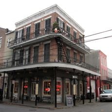
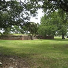
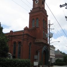
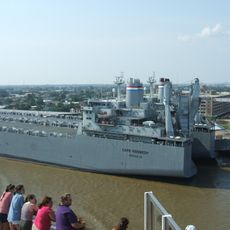
The canal separates the Lower 9th Ward from surrounding neighborhoods and created communities deeply tied to shipping and maritime work. You can see this connection to working life in the old warehouses and boat houses that line the water.

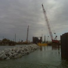
The canal is deep enough for large cargo ships that pass regularly and are visible at work. You can walk along the banks to watch activity on the water or take photos from the bridges that cross it.

A network of wells runs along the canal to manage underground water pressure and protect the banks. These wells work particularly hard during floods and help prevent damage to structures surrounding the waterway.

Location: New Orleans

GPS coordinates: 30.01234,-90.02829

Latest update: December 7, 2025 19:23

Photos
Around this place
Frenchmen Street
United States of America

Frenchmen Street

3.6 km
United States of America

7th Ward of New Orleans

4.9 km
United States of America

Pontchartrain Beach

3.9 km
Danziger Bridge
United States of America

Danziger Bridge

462 m
Pan American Stadium
United States of America

Pan American Stadium

6.1 km
Claiborne Avenue Bridge
United States of America

Claiborne Avenue Bridge

4.8 km
Spanish Fort
United States of America

Spanish Fort

5.4 km
I-10 High Rise Bridge
United States of America

I-10 High Rise Bridge

870 m
Seabrook Floodgate
United States of America

Seabrook Floodgate

2.2 km
St. Roch Market
United States of America

St. Roch Market

5.3 km
St. Claude Avenue Bridge
United States of America

St. Claude Avenue Bridge

5.4 km
Florida Avenue Bridge
United States of America

Florida Avenue Bridge

3.5 km
Almonaster Avenue Bridge
United States of America

Almonaster Avenue Bridge

903 m
Seabrook Bridge
United States of America

Seabrook Bridge

2.2 km
St. Vincent De Paul Roman Catholic Church
United States of America

St. Vincent De Paul Roman Catholic Church

5.6 km
St. Frances Cabrini Church
United States of America

St. Frances Cabrini Church

4.6 km
U.S. Army Supply Base New Orleans
United States of America

U.S. Army Supply Base New Orleans

5.7 km
Seabrook Railroad Bridge
United States of America

Seabrook Railroad Bridge

2.2 km
Jamnola
United States of America

Jamnola

5.7 km
Lombard Plantation
United States of America

Lombard Plantation

5.8 km
StudioBE
United States of America

StudioBE

5.7 km
Degas House, New Orleans
United States of America

Degas House, New Orleans

6.2 km
Lower Ninth Ward Living Museum
United States of America

Lower Ninth Ward Living Museum

5.9 km
Free People of Color Museum
United States of America

Free People of Color Museum

6.3 km
House of Dance & Feathers
United States of America

House of Dance & Feathers

5.9 km
Milneberg Lighthouse
United States of America

Milneberg Lighthouse

3.9 km
Lakeshore Drive Bayou St. John Bridge
United States of America

Lakeshore Drive Bayou St. John Bridge

5.4 km
Saint Roch Chapel
United States of America

Saint Roch Chapel

4.7 km
Show the full map
Reviews

Visited this place? Tap the stars to rate it and share your experience / photos with the community! Try now! You can cancel it anytime.

« Industrial Canal - Navigation canal in Lower 9th Ward, New Orleans, US » is provided by Around Us (aroundus.com). Images and texts are derived from Wikimedia project under a Creative Commons license. You are allowed to copy, distribute, and modify copies of this page, under the conditions set by the license, as long as this note is clearly visible.

Discover hidden gems everywhere you go!

From secret cafés to breathtaking viewpoints, skip the crowded tourist spots and find places that match your style. Our app makes it easy with voice search, smart filtering, route optimization, and insider tips from travelers worldwide. Download now for the complete mobile experience.

Around Us App Screenshot

A unique approach to discovering new places

Le Figaro

All the places worth exploring

France Info

A tailor-made excursion in just a few clicks

20 Minutes