Enable Location

We need your location to show you interesting places around you

Discover nearby places

Find interesting locations and hidden gems around you

Precise directions

Get accurate directions and distances to places

Your location is never shared with other users. It's only used when you tap the location button.

Log in to your account

Start exploring — it's free

Trusted by 61,820 travelers worldwide

Continue with Google
Continue with Apple
or

We will send you a code to connect

By continuing, you accept our Terms and Conditions and our Privacy Policy

Check your inbox

We've sent a pincode in your inbox. Please enter the code below.

Peason Ridge Wildlife Management Area

Peason Ridge Wildlife Management Area, Wildlife management area near Leesville, Louisiana, US.

Description

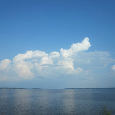
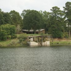
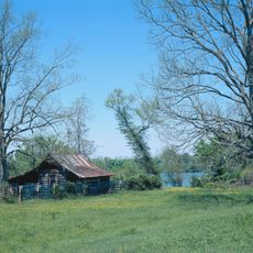
Peason Ridge Wildlife Management Area is a protected land near Leesville spanning 74,309 acres across three parishes with rolling terrain and diverse forest types. The landscape features longleaf pine forests interspersed with creek valleys that shape the region's hydrology and ecology.

History

The land is jointly managed by the Department of Defense and the U.S. Forest Service, serving dual purposes of military training and conservation. This shared stewardship has shaped how the area functions as a protected landscape.

Culture

The area supports traditional hunting practices where visitors can pursue deer, squirrel, rabbit, quail, woodcock, dove, and turkey during designated seasons. These regulated activities reflect long-standing local practices in the region.

Practical

Visitors need a self-clearing permit to access the area, and hunting activities may be cancelled without notice due to ongoing military operations. Check current conditions before visiting to understand access restrictions and what activities are available.

Did you know?

The area is home to Red-cockaded woodpecker populations that nest in mature pine trees throughout the diverse forest landscape. These rare birds are a critical focus for conservation efforts on the protected land.

GPS coordinates
31.37639,-93.25139
Latest update
December 14, 2025 14:43

AroundUs brings together thousands of curated places, local tips, and hidden gems, enriched daily by 60,000 contributors worldwide. Discover all places nearby (United States of America).

Around this place
Toledo Bend Reservoir
United States of America

Toledo Bend Reservoir

36.5 km
Melrose Plantation
United States of America

Melrose Plantation

36.7 km
Magnolia Plantation
United States of America

Magnolia Plantation

35.3 km
Los Adaes
United States of America

Los Adaes

37.2 km
Hodges Gardens State Park
United States of America

Hodges Gardens State Park

16.5 km
Cane River Creole National Historical Park
United States of America

Cane River Creole National Historical Park

39.9 km
Magnolia Mound Plantation House
United States of America

Magnolia Mound Plantation House

45.4 km
Oaklawn Plantation
United States of America

Oaklawn Plantation

39.8 km
Fort Jesup
United States of America

Fort Jesup

29.8 km
Oakland Plantation
United States of America

Oakland Plantation

39.8 km
South Toledo Bend State Park
United States of America

South Toledo Bend State Park

35.6 km
Harry Turpin Stadium
United States of America

Harry Turpin Stadium

43.8 km
Fort St. Jean Baptiste State Historic Site
United States of America

Fort St. Jean Baptiste State Historic Site

44.6 km
Kate Chopin House
United States of America

Kate Chopin House

36.6 km
Cherokee Plantation
United States of America

Cherokee Plantation

40.5 km
Burr's Ferry Bridge
United States of America

Burr's Ferry Bridge

43.3 km
Rebel State Historic Site
United States of America

Rebel State Historic Site

44.4 km
Natchitoches Historic District
United States of America

Natchitoches Historic District

44.7 km
Narcisse Prudhomme Plantation
United States of America

Narcisse Prudhomme Plantation

39.9 km
Badin-Roque House
United States of America

Badin-Roque House

36.4 km
First United Methodist Church
United States of America

First United Methodist Church

25.9 km
Robeline Methodist Church
United States of America

Robeline Methodist Church

35.3 km
Vernon Parish Courthouse
United States of America

Vernon Parish Courthouse

26.1 km
City Hotel
United States of America

City Hotel

42.6 km
Old Courthouse Museum
United States of America

Old Courthouse Museum

45.6 km
Jones House
United States of America

Jones House

35.9 km
Edmond Ellison Smart House
United States of America

Edmond Ellison Smart House

26.1 km
Sabine Theatre
United States of America

Sabine Theatre

30.8 km
Show the full map
« Peason Ridge Wildlife Management Area - Wildlife management area near Leesville, Louisiana, US » is provided by Around Us (aroundus.com). Images and texts are derived from Wikimedia project under a Creative Commons license. You are allowed to copy, distribute, and modify copies of this page, under the conditions set by the license, as long as this note is clearly visible.

Discover hidden gems everywhere you go!

From secret cafés to breathtaking viewpoints, skip the crowded tourist spots and find places that match your style. Our app makes it easy with voice search, smart filtering, route optimization, and insider tips from travelers worldwide. Download now for the complete mobile experience.

Around Us App Screenshot

A unique approach to discovering new places

Le Figaro

All the places worth exploring

France Info

A tailor-made excursion in just a few clicks

20 Minutes

Around Us
Travel Guide & Maps
Download

Send to your phone

QR Code
1

Open the camera app on your mobile.

2

Point at the QR code with your camera. A notification will appear.

3

Tap the notification to open the link.