Enable Location

We need your location to show you interesting places around you

Discover nearby places

Find interesting locations and hidden gems around you

Precise directions

Get accurate directions and distances to places

Your location is never shared with other users. It's only used when you tap the location button.

St. John the Baptist Parish

Log in to your account

Start exploring — it's free

Trusted by 61,817 travelers worldwide

Continue with Google
Continue with Apple
or

We will send you a code to connect

By continuing, you accept our Terms and Conditions and our Privacy Policy

Check your inbox

We've sent a pincode in your inbox. Please enter the code below.

St. John the Baptist Parish, Parish administrative division near New Orleans, United States.

Description

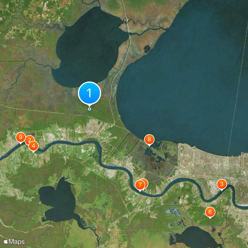
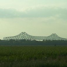
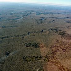
St. John the Baptist Parish is an administrative area that stretches along the Mississippi River, encompassing farmland and wetland areas in southeastern Louisiana. The landscape features broad riverbanks with scattered agricultural fields, wooded sections, and historic buildings spread throughout the region.

History

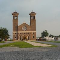
The area was the site of the German Coast Uprising in 1811, one of the largest organized rebellions by enslaved people in American history. The region was originally founded by German Catholic settlers in the 1720s who established themselves along the riverbank.

Culture

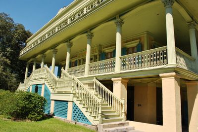
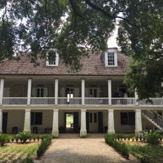
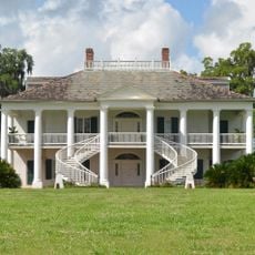
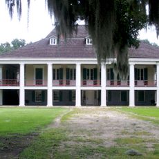
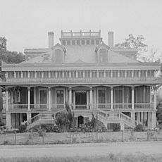
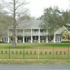
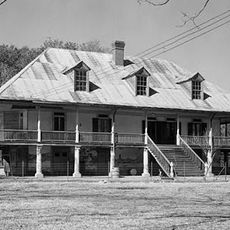
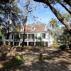
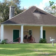
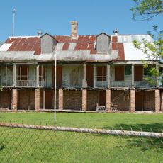
The parish contains several plantation sites from the 19th century that operate as historic destinations today, showing visitors how people lived in that era. Walking through these properties, you can see original buildings and grounds that reflect the region's past.

Practical

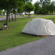
The area covers a large expanse, so having a car is helpful to explore the different sections and historic sites throughout the territory. Most plantations and points of interest are located near the main highway, making it easier to plan your visits.

Did you know?

The property layouts come from an early settlement pattern where plots were tightly connected to the river for easy transport of crops. This distinctive pattern from the original German settlers remains visible in how the land is organized today.

Location
Inception
1807
Capital city
Edgard
Shares border with
Tangipahoa Parish, St. Charles Parish, Lafourche Parish, Ascension Parish, St. James Parish, Livingston Parish, Jefferson Parish
GPS coordinates
30.12000,-90.50000
Latest update
December 20, 2025 14:23

AroundUs brings together thousands of curated places, local tips, and hidden gems, enriched daily by 60,000 contributors worldwide. Discover all places nearby (Louisiana).

Around this place
Whitney Plantation Historic District
United States of America

Whitney Plantation Historic District

17.1 km
Huey P. Long Bridge
United States of America

Huey P. Long Bridge

37.4 km
Evergreen Plantation
United States of America

Evergreen Plantation

17 km
Destrehan Plantation
United States of America

Destrehan Plantation

23.4 km
NOLA Motorsports Park
United States of America

NOLA Motorsports Park

39.3 km
Hale Boggs Memorial Bridge
United States of America

Hale Boggs Memorial Bridge

23.2 km
United States of America

I-10 Bonnet Carré Spillway Bridge

16.9 km
Gramercy Bridge
United States of America

Gramercy Bridge

18.6 km
Bayou Segnette State Park
United States of America

Bayou Segnette State Park

41.1 km
United States of America

TPC of Louisiana

38.4 km
San Francisco Plantation House
United States of America

San Francisco Plantation House

12.9 km
Ormond Plantation House
United States of America

Ormond Plantation House

21.4 km
Cajun Pride Swamp Tours
United States of America

Cajun Pride Swamp Tours

6.7 km
Homeplace Plantation House
United States of America

Homeplace Plantation House

18.8 km
Congregation Beth Israel
United States of America

Congregation Beth Israel

33.3 km
Magnolia Lane Plantation
United States of America

Magnolia Lane Plantation

37.5 km
Camp Parapet
United States of America

Camp Parapet

37.6 km
United States of America

1811 Kid Ory Historic House

6.8 km
LaBranche Plantation Dependency
United States of America

LaBranche Plantation Dependency

25.9 km
United States of America

Three Lakeway Center

35.1 km
Pass Manchac Light
United States of America

Pass Manchac Light

27.6 km
United States of America

LaBranche Wetlands Bridge

23.7 km
Segnette Field
United States of America

Segnette Field

40.3 km
Godchaux–Reserve Plantation
United States of America

Godchaux–Reserve Plantation

9.5 km
United States of America

CNR Bonnet Carré Spillway-McComb Bridge

12.7 km
United States of America

Jefferson Performing Arts Center

32.7 km
Maurepas Swamp Wildlife Management Area
United States of America

Maurepas Swamp Wildlife Management Area

3.3 km
United States of America

U.S. 61 Bonnet Carré Spillway Bridge

12.9 km
Show the full map
Administrative divisions
« St. John the Baptist Parish - Parish administrative division near New Orleans, United States » is provided by Around Us (aroundus.com). Images and texts are derived from Wikimedia project under a Creative Commons license. You are allowed to copy, distribute, and modify copies of this page, under the conditions set by the license, as long as this note is clearly visible.

Discover hidden gems everywhere you go!

From secret cafés to breathtaking viewpoints, skip the crowded tourist spots and find places that match your style. Our app makes it easy with voice search, smart filtering, route optimization, and insider tips from travelers worldwide. Download now for the complete mobile experience.

Around Us App Screenshot

A unique approach to discovering new places

Le Figaro

All the places worth exploring

France Info

A tailor-made excursion in just a few clicks

20 Minutes

Around Us
Travel Guide & Maps
Download

Send to your phone

QR Code
1

Open the camera app on your mobile.

2

Point at the QR code with your camera. A notification will appear.

3

Tap the notification to open the link.