Enable Location

We need your location to show you interesting places around you

Discover nearby places

Find interesting locations and hidden gems around you

Precise directions

Get accurate directions and distances to places

Your location is never shared with other users. It's only used when you tap the location button.

Log in to your account

Start exploring — it's free

Trusted by 61,815 travelers worldwide

Continue with Google
Continue with Apple
or

We will send you a code to connect

By continuing, you accept our Terms and Conditions and our Privacy Policy

Check your inbox

We've sent a pincode in your inbox. Please enter the code below.

Bayou Sauvage National Wildlife Refuge

Bayou Sauvage National Wildlife Refuge, National Wildlife Refuge in Eastern New Orleans, Louisiana

Description

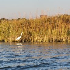
Bayou Sauvage National Wildlife Refuge is a protected area east of New Orleans with freshwater marshes, brackish lagoons, and forest stands along a natural bayou. The land offers hiking trails, fishing spots, and paddling routes where you can watch alligators, waterfowl, and hundreds of bird species.

History

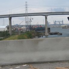
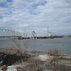
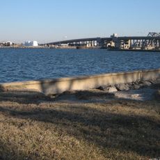
The land was originally planned for a large residential development called Pontchartrain, with three interstate interchanges already built before it became a refuge in 1990. This conversion saved the landscape from urban sprawl and turned it into an important protected area.

Culture

The name comes from Bayou Sauvage waterway, which served as a main travel route into New Orleans during early settlement times. The wetlands remain central to how people understand the natural character of this region.

Practical

The best way to explore the area is on foot using the hiking trails or by water with a canoe, especially during cooler months when wildlife is more active. Visitors should bring sturdy shoes and insect protection, as the land is wet and marshy.

Did you know?

The refuge hosts tens of thousands of migrating birds during spring and fall peak seasons as they travel between North and South America. This gathering makes it one of the most important stopover points for traveling species in the region.

Location
Inception
1990
GPS coordinates
30.08330,-89.85000
Latest update
December 8, 2025 20:02

AroundUs brings together thousands of curated places, local tips, and hidden gems, enriched daily by 60,000 contributors worldwide. Discover all places nearby (Louisiana).

Around this place
Six Flags New Orleans
United States of America

Six Flags New Orleans

8.9 km
I-10 Twin Span Bridge
United States of America

I-10 Twin Span Bridge

11.3 km
Fort Macomb
United States of America

Fort Macomb

4.9 km
Industrial Canal
United States of America

Industrial Canal

18.9 km
Fort Pike
United States of America

Fort Pike

14.3 km
The Jester
United States of America

The Jester

8.9 km
Mega Zeph
United States of America

Mega Zeph

9.1 km
Danziger Bridge
United States of America

Danziger Bridge

19 km
Lincoln Beach amusement park
United States of America

Lincoln Beach amusement park

10 km
Maestri Bridge
United States of America

Maestri Bridge

11.6 km
Zydeco Scream
United States of America

Zydeco Scream

9 km
I-10 High Rise Bridge
United States of America

I-10 High Rise Bridge

19.1 km
Fort Pike Bridge
United States of America

Fort Pike Bridge

14.9 km
Muskrat Scrambler
United States of America

Muskrat Scrambler

9 km
Florida Avenue Bridge
United States of America

Florida Avenue Bridge

20.1 km
Almonaster Avenue Bridge
United States of America

Almonaster Avenue Bridge

19.1 km
Chef Menteur Bridge
United States of America

Chef Menteur Bridge

4.7 km
Seabrook Bridge
United States of America

Seabrook Bridge

18.7 km
Seabrook Railroad Bridge
United States of America

Seabrook Railroad Bridge

18.7 km
Bayou Sauvage National Wildlife Refuge
United States of America

Bayou Sauvage National Wildlife Refuge

300 m
West Rigolets Light
United States of America

West Rigolets Light

14.6 km
CSX Chef Menteur Pass Bridge
United States of America

CSX Chef Menteur Pass Bridge

5.2 km
Green Bridge
United States of America

Green Bridge

12.2 km
Friscoville Street Historic District
United States of America

Friscoville Street Historic District

20.8 km
Lower Ninth Ward Living Museum
United States of America

Lower Ninth Ward Living Museum

20.8 km
Versailles Arms
United States of America

Versailles Arms

7.4 km
House of Dance & Feathers
United States of America

House of Dance & Feathers

20.5 km
Thánh đường Các thánh tử đạo Việt Nam
United States of America

Thánh đường Các thánh tử đạo Việt Nam

7.8 km
Show the full map
« Bayou Sauvage National Wildlife Refuge - National Wildlife Refuge in Eastern New Orleans, Louisiana » is provided by Around Us (aroundus.com). Images and texts are derived from Wikimedia project under a Creative Commons license. You are allowed to copy, distribute, and modify copies of this page, under the conditions set by the license, as long as this note is clearly visible.

Discover hidden gems everywhere you go!

From secret cafés to breathtaking viewpoints, skip the crowded tourist spots and find places that match your style. Our app makes it easy with voice search, smart filtering, route optimization, and insider tips from travelers worldwide. Download now for the complete mobile experience.

Around Us App Screenshot

A unique approach to discovering new places

Le Figaro

All the places worth exploring

France Info

A tailor-made excursion in just a few clicks

20 Minutes

Around Us
Travel Guide & Maps
Download

Send to your phone

QR Code
1

Open the camera app on your mobile.

2

Point at the QR code with your camera. A notification will appear.

3

Tap the notification to open the link.