Enable Location

We need your location to show you interesting places around you

Discover nearby places

Find interesting locations and hidden gems around you

Precise directions

Get accurate directions and distances to places

Your location is never shared with other users. It's only used when you tap the location button.

Sharkey County

Log in to your account

Start exploring — it's free

Trusted by 62,442 travelers worldwide

Continue with Google
Continue with Apple
or

We will send you a code to connect

By continuing, you accept our Terms and Conditions and our Privacy Policy

Check your inbox

We've sent a pincode in your inbox. Please enter the code below.

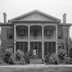
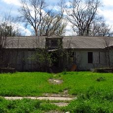
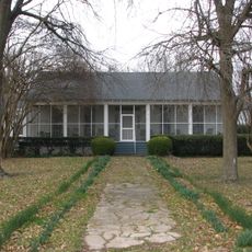
Sharkey County, Agricultural county in Mississippi Delta, United States.

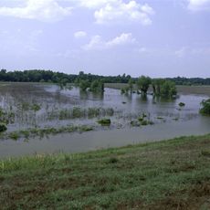
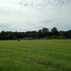
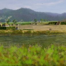
Sharkey County is an administrative division in the Mississippi Delta region covering fertile farmland where corn, soybeans, rice, and cotton are grown on a large scale. The landscape consists primarily of open fields and agricultural operations that define the character of the area.

The county was established in 1876 and named after William L. Sharkey, who served as provisional governor of Mississippi during the Reconstruction period following the Civil War. This naming reflects the county's connection to a transformative era in American history.

The annual Great Delta Bear Affair festival in October celebrates a local hunting story tied to President Theodore Roosevelt's 1902 expedition in the area. This community gathering connects residents to a surprising piece of American popular culture history.

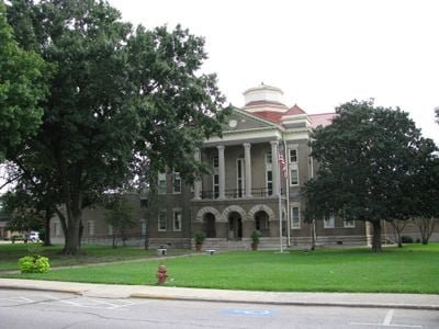
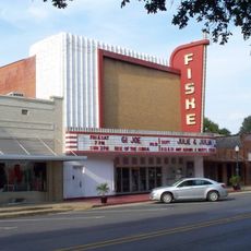
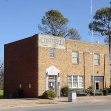
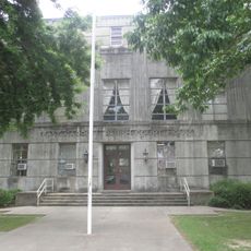
Visitors can find county services centered in Rolling Fork, the main administrative hub of the area. The region is best explored by car due to the dispersed nature of settlements across the flat Delta landscape.

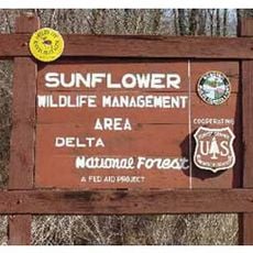
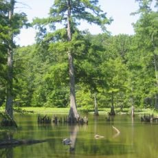
The Delta National Forest within the county features man-made reservoirs designed specifically for waterfowl habitat and recreation opportunities. The Blue Lake Recreational Area stands out as a natural retreat in an otherwise agricultural landscape.

The community of curious travelers

AroundUs brings together thousands of curated places, local tips, and hidden gems, enriched daily by 60,000 contributors worldwide.

Start exploring
GPS coordinates
32.87426,-90.84783
Latest update
December 8, 2025 13:41
Around this place
USS Cairo
United States of America

USS Cairo

55.5 km
Greenville Bridge
United States of America

Greenville Bridge

54.1 km
Lakeport Plantation
United States of America

Lakeport Plantation

51.3 km
Benjamin G. Humphreys Bridge
United States of America

Benjamin G. Humphreys Bridge

55 km
Holly Bluff Site
United States of America

Holly Bluff Site

16.8 km
Mount Holly
United States of America

Mount Holly

30.2 km
Jaketown Site
United States of America

Jaketown Site

52.6 km
Belmont Plantation
United States of America

Belmont Plantation

47.2 km
Delta National Forest
United States of America

Delta National Forest

22.4 km
Panther Swamp National Wildlife Refuge
United States of America

Panther Swamp National Wildlife Refuge

27.5 km
United States of America

5th United States Colored Heavy Artillery Regiment

53.8 km
Leroy Percy State Park
United States of America

Leroy Percy State Park

32.8 km
Afro-American Sons and Daughters Hospital
United States of America

Afro-American Sons and Daughters Hospital

41.8 km
Junius R. Ward House
United States of America

Junius R. Ward House

31.6 km
Michigan Memorial
United States of America

Michigan Memorial

57.9 km
Fiske Theatre
United States of America

Fiske Theatre

50.5 km
Woodburn Bridge
United States of America

Woodburn Bridge

58.6 km
First Baptist Church
United States of America

First Baptist Church

46.1 km
Louisiana State Cotton Museum
United States of America

Louisiana State Cotton Museum

34.4 km
Ricks Memorial Library
United States of America

Ricks Memorial Library

40.9 km
Big Black River Battlefield
United States of America

Big Black River Battlefield

58.4 km
American Legion Post No. 127 Building
United States of America

American Legion Post No. 127 Building

46.9 km
Eudora City Hall
United States of America

Eudora City Hall

46.7 km
Augustus J. Oakes House
United States of America

Augustus J. Oakes House

40.7 km
Dr. A.G. Anderson House
United States of America

Dr. A.G. Anderson House

46.6 km
Lake Providence Commercial Historic District
United States of America

Lake Providence Commercial Historic District

31.1 km
Kings Crossing Site
United States of America

Kings Crossing Site

54 km
New Crescent Theatre
United States of America

New Crescent Theatre

48.7 km
Show the full map
« Sharkey County - Agricultural county in Mississippi Delta, United States » is provided by Around Us (aroundus.com). Images and texts are derived from Wikimedia project under a Creative Commons license. You are allowed to copy, distribute, and modify copies of this page, under the conditions set by the license, as long as this note is clearly visible.

Discover hidden gems everywhere you go!

From secret cafés to breathtaking viewpoints, skip the crowded tourist spots and find places that match your style. Our app makes it easy with voice search, smart filtering, route optimization, and insider tips from travelers worldwide. Download now for the complete mobile experience.

Around Us App Screenshot

A unique approach to discovering new places

Le Figaro

All the places worth exploring

France Info

A tailor-made excursion in just a few clicks

20 Minutes

Around Us
Travel Guide & Maps
Download

Send to your phone

QR Code
1

Open the camera app on your mobile.

2

Point at the QR code with your camera. A notification will appear.

3

Tap the notification to open the link.