
Ondorea, village in Ende, East Nusa Tenggara Province, Indonesia
Location: Nangapanda
Location: East Nusa Tenggara
Elevation above the sea: 307 m
GPS coordinates: -8.76250,121.44417
Latest update: June 11, 2025 07:38

Komodo National Park
205.9 km
Keli Mutubuurai
40.6 km
Liang Bua
111.2 km
Taka Bone Rate National Park
233.7 km
Kelimutu National Park
44.1 km
Lewotolo
233.4 km
Rokatenda
57.5 km
Mount Egon
111.2 km
Keli Ebulobo
28.4 km
Pink Beach
212.5 km
Batu Tara
258.8 km
Inierie
55.8 km
Laiwangi Wanggameti National Park
200.6 km
Manupeu Tanah Daru National Park
221.6 km
Lewotobi
147.8 km
Iliboleng
204.4 km
Iya
25.8 km
Iliwerung
235.7 km
Poco Ranaka
101.5 km
Wolo Inelika
51.7 km
Koka
63.2 km
Ilimuda
138.7 km
Cathedral of the Holy Spirit, Weetebula
254.8 km
Cepi Watu Beach
94.8 km
Fort Solor
168.4 km
Parunu Beach
194.6 km
Pantai Otan
264.5 km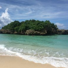
Pantai Marosi
259.1 kmReviews
Visited this place? Tap the stars to rate it and share your experience / photos with the community! Try now! You can cancel it anytime.
Discover hidden gems everywhere you go!
From secret cafés to breathtaking viewpoints, skip the crowded tourist spots and find places that match your style. Our app makes it easy with voice search, smart filtering, route optimization, and insider tips from travelers worldwide. Download now for the complete mobile experience.

A unique approach to discovering new places❞
— Le Figaro
All the places worth exploring❞
— France Info
A tailor-made excursion in just a few clicks❞
— 20 Minutes