·

Enable Location

We need your location to show you interesting places around you

Discover nearby places

Find interesting locations and hidden gems around you

Precise directions

Get accurate directions and distances to places

Your location is never shared with other users. It's only used when you tap the location button.

Hawaii Route 560

Log in to your account

Start exploring — it's free

Trusted by 62,649 travelers worldwide

Continue with Google
Continue with Apple
or

We will send you a code to connect

By continuing, you accept our Terms and Conditions and our Privacy Policy

Check your inbox

We've sent a pincode in your inbox. Please enter the code below.

Hawaii Route 560, state highway in Kauai County, Hawaii, United States that is listed on the National Register of Historic Places

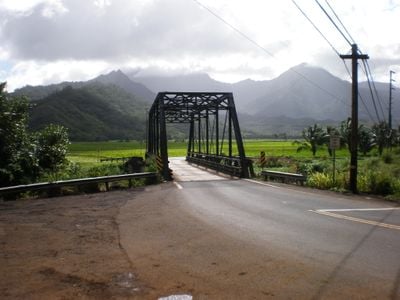
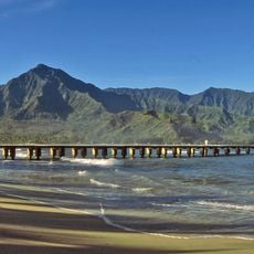
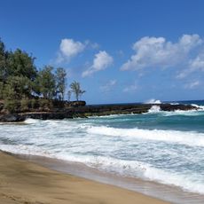
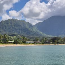
Hawaii Route 560, also called the Kuhio Highway, is a roughly ten-mile road along the northern coast of Kauaʻi connecting Princeville to Haʻena State Park. It runs through tight sections with historic one-lane bridges from 1912 and offers views of valleys, rivers, and the Nā Pali Coast cliffs.

The route follows a path that ancient Hawaiians once used and was later built up to connect Princeville and points east. The one-lane bridges date from 1912, and in 2004 the entire road was added to the National Register of Historic Places.

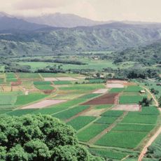
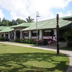
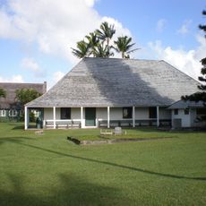
The road links small towns like Hanalei, where life moves at a relaxed pace and visitors browse shops or sit by the water. Traditional homes and older structures along the route give a sense of early island life.

The road is very narrow at several points with historic bridges passable only by one vehicle at a time, so drivers should be ready to wait at these spots. Early morning or late afternoon driving works best to avoid busy times with other cars.

The one-lane bridges were built in 1912 with unusual designs not meant for heavy modern vehicles, which is why certain vehicle types are still not allowed across all of them. One of the original bridges was replaced in 2003 with a historically accurate replica while the old structure was preserved.

The community of curious travelers

AroundUs brings together thousands of curated places, local tips, and hidden gems, enriched daily by 60,000 contributors worldwide.

Start exploring
Location
GPS coordinates
22.21194,-159.52778
Latest update
February 9, 2026 08:22
« Hawaii Route 560 - state highway in Kauai County, Hawaii, United States that is listed on the National Register of Historic Places » is provided by Around Us (aroundus.com). Images and texts are derived from Wikimedia project under a Creative Commons license. You are allowed to copy, distribute, and modify copies of this page, under the conditions set by the license, as long as this note is clearly visible.

Discover hidden gems everywhere you go!

From secret cafés to breathtaking viewpoints, skip the crowded tourist spots and find places that match your style. Our app makes it easy with voice search, smart filtering, route optimization, and insider tips from travelers worldwide. Download now for the complete mobile experience.

Around Us App Screenshot

A unique approach to discovering new places

Le Figaro

All the places worth exploring

France Info

A tailor-made excursion in just a few clicks

20 Minutes

Around Us
Travel Guide & Maps
Download

Send to your phone

QR Code
1

Open the camera app on your mobile.

2

Point at the QR code with your camera. A notification will appear.

3

Tap the notification to open the link.