Enable Location

We need your location to show you interesting places around you

Discover nearby places

Find interesting locations and hidden gems around you

Precise directions

Get accurate directions and distances to places

Your location is never shared with other users. It's only used when you tap the location button.

Lázaro Cárdenas

Log in to your account

Start exploring — it's free

Trusted by 62,858 travelers worldwide

Continue with Google
Continue with Apple
or

We will send you a code to connect

By continuing, you accept our Terms and Conditions and our Privacy Policy

Check your inbox

We've sent a pincode in your inbox. Please enter the code below.

Lázaro Cárdenas

Lázaro Cárdenas, Municipality in Michoacán, Mexico

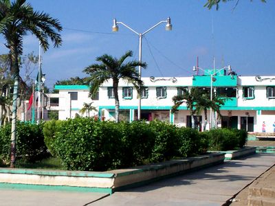
Lázaro Cárdenas is a municipality in Michoacán with mixed terrain including farm areas, villages, and port facilities along the Pacific coast. The territory stretches across coastal plains and agricultural zones that support both farming and trade activities.

The municipality was named in 1970 to honor President Lázaro Cárdenas del Río, who carried out major land reforms across Mexico between 1934 and 1940. This naming reflected recognition of his role in reshaping rural territories throughout the nation.

The local population balances farming traditions with work tied to port operations and trade. This mix shapes daily rhythms and shows how older and newer livelihoods exist side by side.

The area spans multiple districts with different administrative zones, accessible by road throughout the territory. It helps to ask local residents or guides to understand which sections focus on farming, which on port activity, and where facilities are located.

The municipality combines one of Mexico's major ports with spread-out farm areas and small villages, creating an unusual mixed economic landscape. This blend shows how a single area can support both international shipping and traditional family operations.

The community of curious travelers

AroundUs brings together thousands of curated places, local tips, and hidden gems, enriched daily by 60,000 contributors worldwide.

Start exploring
GPS coordinates
21.07788,-87.42705
Latest update
December 7, 2025 20:44
« Lázaro Cárdenas - Municipality in Michoacán, Mexico » is provided by Around Us (aroundus.com). Images and texts are derived from Wikimedia project under a Creative Commons license. You are allowed to copy, distribute, and modify copies of this page, under the conditions set by the license, as long as this note is clearly visible.

Discover hidden gems everywhere you go!

From secret cafés to breathtaking viewpoints, skip the crowded tourist spots and find places that match your style. Our app makes it easy with voice search, smart filtering, route optimization, and insider tips from travelers worldwide. Download now for the complete mobile experience.

Around Us App Screenshot

A unique approach to discovering new places

Le Figaro

All the places worth exploring

France Info

A tailor-made excursion in just a few clicks

20 Minutes

Around Us
Travel Guide & Maps
Download

Send to your phone

QR Code
1

Open the camera app on your mobile.

2

Point at the QR code with your camera. A notification will appear.

3

Tap the notification to open the link.