Enable Location

We need your location to show you interesting places around you

Discover nearby places

Find interesting locations and hidden gems around you

Precise directions

Get accurate directions and distances to places

Your location is never shared with other users. It's only used when you tap the location button.

Log in to your account

Start exploring — it's free

Trusted by 61,818 travelers worldwide

Continue with Google
Continue with Apple
or

We will send you a code to connect

By continuing, you accept our Terms and Conditions and our Privacy Policy

Check your inbox

We've sent a pincode in your inbox. Please enter the code below.

ACE Basin National Wildlife Refuge

ACE Basin National Wildlife Refuge, National Wildlife Refuge in Beaufort County, US

Description

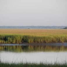
The Ernest F. Hollings ACE Basin National Wildlife Refuge covers around 11,800 acres and includes bottomland forests, freshwater marshes, and managed wetland areas. The refuge is split into two separate sections along the Edisto River and Combahee River with distinct ecosystems.

History

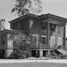
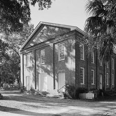
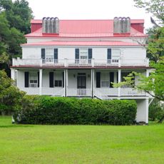
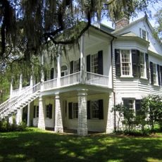
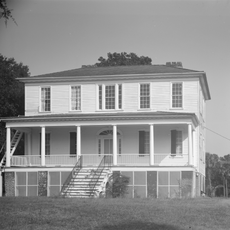
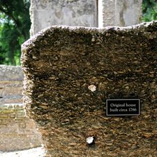
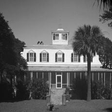
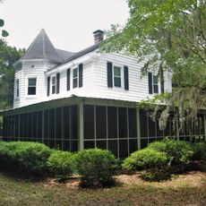
The refuge was established to protect wetland habitats and their wildlife, becoming an important conservation area over the decades. Within its boundaries stands Grove Plantation, a manor house built in 1828 that survived the Civil War era.

Culture

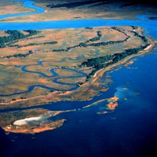
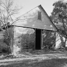
The former rice fields within the refuge show how people once managed this land, with preserved irrigation channels still visible throughout the area. These systems reflect an older way of organizing the landscape that shaped the region.

Practical

You can access the refuge at two separate entry points, allowing you to explore different areas for hiking, photography, hunting, and bird watching. The best time to visit depends on what activities or wildlife viewing you prefer.

Did you know?

The refuge protects one of the largest continuous wetland areas along the Atlantic Coast and provides critical habitat for wood storks. These birds use the waters and marsh areas as hunting grounds and for raising their young.

Location
Inception
1990
GPS coordinates
32.50833,-80.46667
Latest update
December 12, 2025 14:27

AroundUs brings together thousands of curated places, local tips, and hidden gems, enriched daily by 60,000 contributors worldwide. Discover all places nearby (Beaufort County).

Around this place
Brookland Plantation
United States of America

Brookland Plantation

12.4 km
Hunting Island State Park
United States of America

Hunting Island State Park

15.9 km
ACE Basin
United States of America

ACE Basin

17.8 km
Penn School Historic District
United States of America

Penn School Historic District

16.8 km
Edisto Beach State Park
United States of America

Edisto Beach State Park

15.7 km
Brick House Ruins
United States of America

Brick House Ruins

16.8 km
St. Helena Parish Chapel of Ease Ruins
United States of America

St. Helena Parish Chapel of Ease Ruins

18 km
Coffin Point Plantation
United States of America

Coffin Point Plantation

8.5 km
Grove Plantation
United States of America

Grove Plantation

18.7 km
Frogmore Plantation Complex
United States of America

Frogmore Plantation Complex

18.9 km
Prospect Hill
United States of America

Prospect Hill

11.2 km
Seaside Plantation House
United States of America

Seaside Plantation House

16.7 km
Edisto Island Presbyterian Church
United States of America

Edisto Island Presbyterian Church

17.8 km
Knights of Wise Men Lodge
United States of America

Knights of Wise Men Lodge

15.7 km
Sams Plantation Complex Tabby Ruins
United States of America

Sams Plantation Complex Tabby Ruins

14.8 km
Sunnyside
United States of America

Sunnyside

17.1 km
Hunting Island Light
United States of America

Hunting Island Light

15.1 km
Edisto Island Baptist Church
United States of America

Edisto Island Baptist Church

18.6 km
Mary Jenkins Community Praise House
United States of America

Mary Jenkins Community Praise House

12.4 km
Alexander Bache U.S. Coast Survey Line
United States of America

Alexander Bache U.S. Coast Survey Line

14.7 km
Edgar Fripp Mausoleum, St. Helena Island Parish Church
United States of America

Edgar Fripp Mausoleum, St. Helena Island Parish Church

18.1 km
Spanish Mount Point
United States of America

Spanish Mount Point

13.8 km
Coffin Point Plantation Caretaker's House
United States of America

Coffin Point Plantation Caretaker's House

8.1 km
Trinity Episcopal Church
United States of America

Trinity Episcopal Church

18.5 km
Dr. York Bailey House
United States of America

Dr. York Bailey House

15.9 km
Eddings Point Community Praise House
United States of America

Eddings Point Community Praise House

10.2 km
The Green
United States of America

The Green

16.2 km
Emanuel Alston House
United States of America

Emanuel Alston House

14.6 km
Show the full map
« ACE Basin National Wildlife Refuge - National Wildlife Refuge in Beaufort County, US » is provided by Around Us (aroundus.com). Images and texts are derived from Wikimedia project under a Creative Commons license. You are allowed to copy, distribute, and modify copies of this page, under the conditions set by the license, as long as this note is clearly visible.

Discover hidden gems everywhere you go!

From secret cafés to breathtaking viewpoints, skip the crowded tourist spots and find places that match your style. Our app makes it easy with voice search, smart filtering, route optimization, and insider tips from travelers worldwide. Download now for the complete mobile experience.

Around Us App Screenshot

A unique approach to discovering new places

Le Figaro

All the places worth exploring

France Info

A tailor-made excursion in just a few clicks

20 Minutes

Around Us
Travel Guide & Maps
Download

Send to your phone

QR Code
1

Open the camera app on your mobile.

2

Point at the QR code with your camera. A notification will appear.

3

Tap the notification to open the link.