Chest opened
+${chestReward.xp} XP
Explorer
NOUVEAU ×${chestReward.collectible.quantity}
tapez pour fermer
Chest locked

Open chests in the app

Around Us is built for your phone — chests unlock when you walk, explore and capture nearby places.

Enable Location

We need your location to show you interesting places around you

Discover nearby places

Find interesting locations and hidden gems around you

Precise directions

Get accurate directions and distances to places

Your location is never shared with other users. It's only used when you tap the location button.

Edisto River

Log in to your account

Start exploring — it's free

Trusted by 72,891 travelers worldwide

Continue with Google
Continue with Apple
or

We will send you a code to connect

By continuing, you accept our Terms and Conditions and our Privacy Policy

Check your inbox

We've sent a pincode in your inbox. Please enter the code below.

Edisto River
Discussion Reviews 1 Photos
11.8k Popularity

Edisto River, Blackwater river in South Carolina, United States.

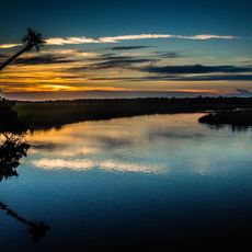
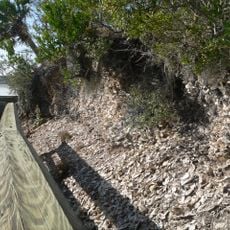
The Edisto River is a blackwater river in South Carolina that flows over 250 miles through the state. Its dark waters come from natural tannins released by decaying plant materials as it travels from the central Sandhills toward the Atlantic Ocean.

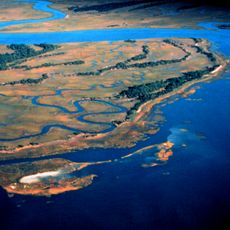
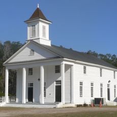
The river took shape thousands of years ago through natural geological processes and became the main waterway for the region. Over time it shaped the landscape and settlement patterns of South Carolina.

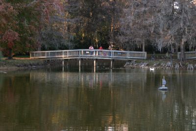
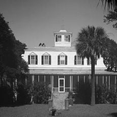
The river sustains a rich variety of wildlife that residents have depended on for fishing and food for generations. People value it as a natural anchor for their communities and outdoor way of life.

The river has several access points for paddling and boating, with specific routes available between state park areas. Visitors should come prepared for river conditions and bring gear suited to darker waters and swampy surroundings.

This is one of the few remaining major river systems in North America that flows freely without dams. The extensive network of tributary streams spanning thousands of miles makes it one of the largest unfragmented waterways in the region.

The community of curious travelers

AroundUs brings together thousands of curated places, local tips, and hidden gems, enriched daily by 60,000 contributors worldwide.

Start exploring
Location
GPS coordinates
32.65444,-80.38806
Latest update
December 7, 2025 20:48
Around this place
United States of America

Charleston Tea Plantation

19.4 km
ACE Basin
United States of America

ACE Basin

14.7 km
Botany Bay Plantation Wildlife Management Area
United States of America

Botany Bay Plantation Wildlife Management Area

18.4 km
Edisto Beach State Park
United States of America

Edisto Beach State Park

17.8 km
William Seabrook House
United States of America

William Seabrook House

11.6 km
Hutchinson House
United States of America

Hutchinson House

15.5 km
Brick House Ruins
United States of America

Brick House Ruins

8.3 km
Coffin Point Plantation
United States of America

Coffin Point Plantation

26 km
Oak Island
United States of America

Oak Island

14.5 km
Cassina Point
United States of America

Cassina Point

14.7 km
Grove Plantation
United States of America

Grove Plantation

1.3 km
Charleston Tea Garden
United States of America

Charleston Tea Garden

19.4 km
Pon Pon Chapel
United States of America

Pon Pon Chapel

19.7 km
Prospect Hill
United States of America

Prospect Hill

8.1 km
Seaside Plantation House
United States of America

Seaside Plantation House

17.5 km
John's Island Presbyterian Church
United States of America

John's Island Presbyterian Church

28.9 km
Edisto Island Presbyterian Church
United States of America

Edisto Island Presbyterian Church

12 km
Summit Plantation House
United States of America

Summit Plantation House

10.5 km
Sunnyside
United States of America

Sunnyside

13 km
Edisto Island Baptist Church
United States of America

Edisto Island Baptist Church

13.3 km
Alexander Bache U.S. Coast Survey Line
United States of America

Alexander Bache U.S. Coast Survey Line

18.1 km
Spanish Mount Point
United States of America

Spanish Mount Point

18.4 km
Stono River Slave Rebellion Site
United States of America

Stono River Slave Rebellion Site

27.1 km
Coffin Point Plantation Caretaker's House
United States of America

Coffin Point Plantation Caretaker's House

25.6 km
Trinity Episcopal Church
United States of America

Trinity Episcopal Church

13.6 km
Eddings Point Community Praise House
United States of America

Eddings Point Community Praise House

27.7 km
Wilkinson-Boineau House
United States of America

Wilkinson-Boineau House

8.1 km
Seabrook Beach
United States of America

Seabrook Beach

23.5 km
Show the full map
Reviews
Share your experience

No review yet

Discussions
Start a discussion...

No discussion yet

« Edisto River - Blackwater river in South Carolina, United States » is provided by Around Us (aroundus.com). Images and texts are derived from Wikimedia project under a Creative Commons license. You are allowed to copy, distribute, and modify copies of this page, under the conditions set by the license, as long as this note is clearly visible.

Discover hidden gems everywhere you go!

From secret cafés to breathtaking viewpoints, skip the crowded tourist spots and find places that match your style. Our app makes it easy with voice search, smart filtering, route optimization, and insider tips from travelers worldwide. Download now for the complete mobile experience.

Around Us App Screenshot

A unique approach to discovering new places

Le Figaro

All the places worth exploring

France Info

A tailor-made excursion in just a few clicks

20 Minutes

Around Us
Travel Guide & Maps
Download

Send to your phone

QR Code
1

Open the camera app on your mobile.

2

Point at the QR code with your camera. A notification will appear.

3

Tap the notification to open the link.