Chest opened
+${chestReward.xp} XP
Explorer
NOUVEAU ×${chestReward.collectible.quantity}
tapez pour fermer
Chest locked

Open chests in the app

Around Us is built for your phone — chests unlock when you walk, explore and capture nearby places.

Enable Location

We need your location to show you interesting places around you

Discover nearby places

Find interesting locations and hidden gems around you

Precise directions

Get accurate directions and distances to places

Your location is never shared with other users. It's only used when you tap the location button.

Folly Island

Log in to your account

Start exploring — it's free

Trusted by 72,983 travelers worldwide

Continue with Google
Continue with Apple
or

We will send you a code to connect

By continuing, you accept our Terms and Conditions and our Privacy Policy

Check your inbox

We've sent a pincode in your inbox. Please enter the code below.

Folly Island
Discussion Reviews 1 Photos
9.2k Popularity

Folly Island, Barrier island in Charleston County, United States.

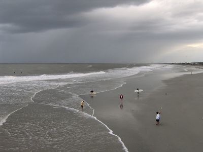
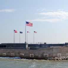
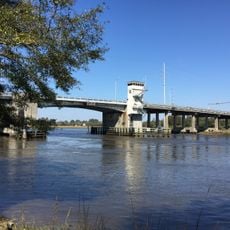
Folly Island is a barrier island off South Carolina's coast south of Charleston, stretching along the Atlantic with wide sandy beaches and marine habitats. A historic pier dominates the landscape, providing a focal point for fishing, walking, and observing the ocean environment.

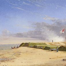
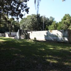
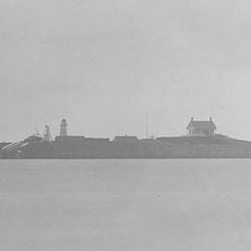
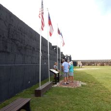
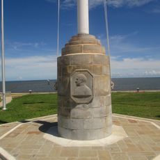
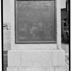
The island became strategically important during the Civil War when Union troops occupied it in 1863 and established a military base there. This position allowed Northern forces to coordinate campaigns against Confederate strongholds in the Charleston area.

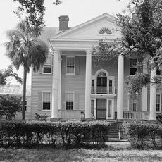
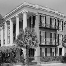
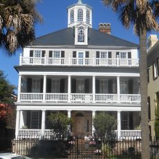
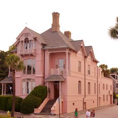
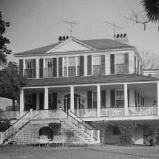
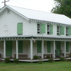
The island's name comes from an English estate that once stood here as a bold architectural experiment. Today visitors encounter a laid-back community spirit, local musicians, and artists who are drawn to the relaxed beach culture.

The island is easily reached from the mainland with parking areas and multiple beach access points distributed along its length. Visitors should plan around tides and water conditions, especially for water sports like surfing, paddling, and boating.

After major storms and coastal erosion, waves regularly wash Civil War artifacts like cannonballs onto the beach, surprising walkers. These remnants from the past serve as tangible reminders of the conflict that shaped this region.

The community of curious travelers

AroundUs brings together thousands of curated places, local tips, and hidden gems, enriched daily by 60,000 contributors worldwide.

Start exploring
Elevation above the sea
5 m
GPS coordinates
32.66046,-79.93120
Latest update
December 10, 2025 15:58
Around this place
Fort Sumter
United States of America

Fort Sumter

11.5 km
McLeod Plantation
United States of America

McLeod Plantation

12 km
Morris Island Light
United States of America

Morris Island Light

5.9 km
White Point Gardens
United States of America

White Point Gardens

12.2 km
Calhoun Mansion
United States of America

Calhoun Mansion

12.4 km
Fort Johnson
United States of America

Fort Johnson

10.7 km
Miles Brewton House
United States of America

Miles Brewton House

12.5 km
Robert William Roper House
United States of America

Robert William Roper House

12.3 km
Secessionville Historic District
United States of America

Secessionville Historic District

5.1 km
Col. John Ashe House
United States of America

Col. John Ashe House

12.3 km
William Gibbes House
United States of America

William Gibbes House

12.3 km
McLeod Plantation Historic Site
United States of America

McLeod Plantation Historic Site

12 km
The Defenders of Fort Moultrie
United States of America

The Defenders of Fort Moultrie

12.2 km
Charles Drayton House
United States of America

Charles Drayton House

12.4 km
The Progressive Club
United States of America

The Progressive Club

10.6 km
Marshlands Plantation House
United States of America

Marshlands Plantation House

10.4 km
Fort Sumter Range Lights
United States of America

Fort Sumter Range Lights

11.5 km
Wappoo Creek Bridge
United States of America

Wappoo Creek Bridge

12.5 km
Faber-Ward House
United States of America

Faber-Ward House

12.4 km
Cleland Kinloch and Burnet R. Maybank Huger House
United States of America

Cleland Kinloch and Burnet R. Maybank Huger House

12.4 km
Seashore Farmers' Lodge No. 767
United States of America

Seashore Farmers' Lodge No. 767

4.1 km
Tristram Hyde House
United States of America

Tristram Hyde House

12.4 km
George Mathews House
United States of America

George Mathews House

12.5 km
Splash Zone
United States of America

Splash Zone

10 km
Battery Huger
United States of America

Battery Huger

11.5 km
Flagpole Monument
United States of America

Flagpole Monument

11.5 km
Garrison Monument
United States of America

Garrison Monument

11.5 km
United States of America

The Battery

12.1 km
Show the full map
Reviews
Share your experience

No review yet

Discussions
Start a discussion...

No discussion yet

« Folly Island - Barrier island in Charleston County, United States » is provided by Around Us (aroundus.com). Images and texts are derived from Wikimedia project under a Creative Commons license. You are allowed to copy, distribute, and modify copies of this page, under the conditions set by the license, as long as this note is clearly visible.

Discover hidden gems everywhere you go!

From secret cafés to breathtaking viewpoints, skip the crowded tourist spots and find places that match your style. Our app makes it easy with voice search, smart filtering, route optimization, and insider tips from travelers worldwide. Download now for the complete mobile experience.

Around Us App Screenshot

A unique approach to discovering new places

Le Figaro

All the places worth exploring

France Info

A tailor-made excursion in just a few clicks

20 Minutes

Around Us
Travel Guide & Maps
Download

Send to your phone

QR Code
1

Open the camera app on your mobile.

2

Point at the QR code with your camera. A notification will appear.

3

Tap the notification to open the link.