Enable Location

We need your location to show you interesting places around you

Discover nearby places

Find interesting locations and hidden gems around you

Precise directions

Get accurate directions and distances to places

Your location is never shared with other users. It's only used when you tap the location button.

Log in to your account

Start exploring — it's free

Trusted by 64,844 travelers worldwide

Continue with Google
Continue with Apple
or

We will send you a code to connect

By continuing, you accept our Terms and Conditions and our Privacy Policy

Check your inbox

We've sent a pincode in your inbox. Please enter the code below.

Spring Lake Regional Park
Discussion Reviews Photo
3.1k Popularity

Spring Lake Regional Park, Regional park in Santa Rosa, United States

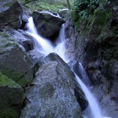
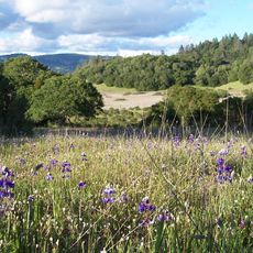
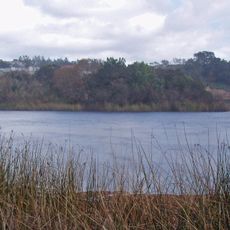
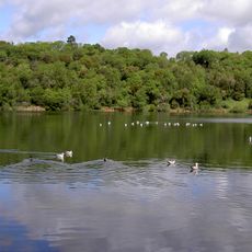
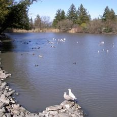
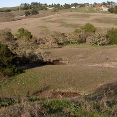
Spring Lake Regional Park is a natural area of woodlands, wetlands, and meadows built around a large lake in Sonoma County, Northern California. The grounds offer several hiking trails, designated picnic areas with barbecue facilities, and a seasonal swimming area on the lakeshore.

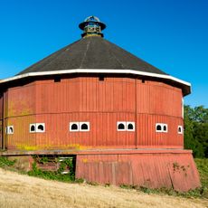
The land was originally used for farming before Sonoma County Regional Parks converted it into a recreational area in the mid-twentieth century. The transformation opened the natural landscape to the public without destroying what was already there.

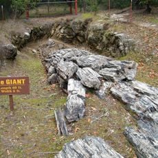
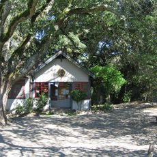
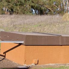
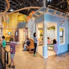
The Environmental Discovery Center inside the park runs programs about native animals and local rock formations throughout the year. Visitors can follow the exhibits at their own pace while walking the grounds.

Dry weather makes for the best visit, and the trails suit different fitness levels so most people can find a comfortable route. The swimming area is only open during warmer months, so the time of year shapes what you can do.

A fitness circuit with 18 stations runs along the trails, letting visitors do outdoor exercises as they walk. A sign at each station shows exactly how to perform each movement.

The community of curious travelers

AroundUs brings together thousands of curated places, local tips, and hidden gems, enriched daily by 60,000 contributors worldwide.

Start exploring
Location
GPS coordinates
38.45000,-122.65000
Latest update
March 3, 2026 13:55
Around this place
Petrified Forest
United States of America

Petrified Forest

11.9 km
Charles M. Schulz Museum and Research Center
United States of America

Charles M. Schulz Museum and Research Center

7.5 km
Safari West
United States of America

Safari West

12.6 km
Sugarloaf Ridge State Park
United States of America

Sugarloaf Ridge State Park

13.1 km
McDonald Mansion
United States of America

McDonald Mansion

4.7 km
Taylor Mountain
United States of America

Taylor Mountain

5.9 km
Luther Burbank Home and Gardens
United States of America

Luther Burbank Home and Gardens

5.6 km
Trione-Annadel State Park
United States of America

Trione-Annadel State Park

3.2 km
Mount Hood
United States of America

Mount Hood

8.4 km
Luther Burbank Center for the Arts
United States of America

Luther Burbank Center for the Arts

9.9 km
Church of One Tree
United States of America

Church of One Tree

5.8 km
Naval Auxiliary Landing Field Santa Rosa
United States of America

Naval Auxiliary Landing Field Santa Rosa

10.8 km
Fountaingrove Lake
United States of America

Fountaingrove Lake

7 km
Sonoma Mountain Zen Center
United States of America

Sonoma Mountain Zen Center

11.2 km
William Hood House
United States of America

William Hood House

6.4 km
Rosenberg's Department Store
United States of America

Rosenberg's Department Store

5.4 km
Lake Ralphine
United States of America

Lake Ralphine

1.6 km
Scandia Family Fun Center
United States of America

Scandia Family Fun Center

11.6 km
Sonoma County Museum
United States of America

Sonoma County Museum

6 km
Bennett Mountain
United States of America

Bennett Mountain

4.7 km
De Turk Round Barn
United States of America

De Turk Round Barn

6.5 km
Roberts Lake
United States of America

Roberts Lake

10.8 km
Crane Creek Regional Park
United States of America

Crane Creek Regional Park

11.6 km
Sonoma State Observatory
United States of America

Sonoma State Observatory

12.7 km
Children's Museum of Sonoma County
United States of America

Children's Museum of Sonoma County

7.7 km
Fountaingrove Round Barn
United States of America

Fountaingrove Round Barn

7.3 km
Cambria Hotel
United States of America

Cambria Hotel

12.6 km
Stoke Ranch
United States of America

Stoke Ranch

13.1 km
Show the full map
Reviews
Share your experience

No review yet

Discussions
Start a discussion...

No discussion yet

« Spring Lake Regional Park - Regional park in Santa Rosa, United States » is provided by Around Us (aroundus.com). Images and texts are derived from Wikimedia project under a Creative Commons license. You are allowed to copy, distribute, and modify copies of this page, under the conditions set by the license, as long as this note is clearly visible.

Discover hidden gems everywhere you go!

From secret cafés to breathtaking viewpoints, skip the crowded tourist spots and find places that match your style. Our app makes it easy with voice search, smart filtering, route optimization, and insider tips from travelers worldwide. Download now for the complete mobile experience.

Around Us App Screenshot

A unique approach to discovering new places

Le Figaro

All the places worth exploring

France Info

A tailor-made excursion in just a few clicks

20 Minutes

Around Us
Travel Guide & Maps
Download

Send to your phone

QR Code
1

Open the camera app on your mobile.

2

Point at the QR code with your camera. A notification will appear.

3

Tap the notification to open the link.