Enable Location

We need your location to show you interesting places around you

Discover nearby places

Find interesting locations and hidden gems around you

Precise directions

Get accurate directions and distances to places

Your location is never shared with other users. It's only used when you tap the location button.

Copeland Creek

Log in to your account

Start exploring — it's free

Trusted by 62,842 travelers worldwide

Continue with Google
Continue with Apple
or

We will send you a code to connect

By continuing, you accept our Terms and Conditions and our Privacy Policy

Check your inbox

We've sent a pincode in your inbox. Please enter the code below.

Copeland Creek

Copeland Creek, Perennial stream in Sonoma County, California.

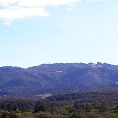
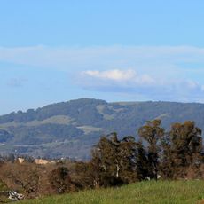
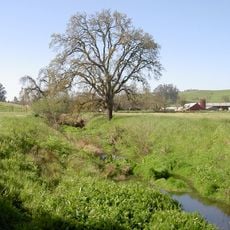
Copeland Creek is a perennial stream in Sonoma County that flows from Sonoma Mountain through diverse landscapes until it reaches the Laguna de Santa Rosa. The waterway passes through agricultural areas, woodlands, and valleys while collecting water from smaller tributaries along its path.

The Copeland Creek watershed was home to Coast Miwok, Wappo, and Pomo peoples who inhabited the region for centuries before European arrival. Settlement from the 1800s onward brought major changes to the land and the traditional ways water was used.

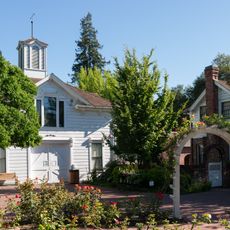
The creek system passes through Sonoma State University campus, providing educational opportunities for environmental studies and research programs.

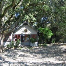
The area is accessible through hiking trails maintained by local water management agencies with observation points along the route. Wear sturdy footwear and pay attention to seasonal changes, as water levels and trail conditions vary with rainfall.

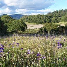
The upper reaches feature California oak woodlands with coast live oak trees that provide habitat for endangered red-legged frogs. These amphibians depend on clean water and serve as indicators of the ecosystem's overall health.

The community of curious travelers

AroundUs brings together thousands of curated places, local tips, and hidden gems, enriched daily by 60,000 contributors worldwide.

Start exploring
Location
GPS coordinates
38.34360,-122.72400
Latest update
December 14, 2025 18:08
Around this place
Charles M. Schulz Museum and Research Center
United States of America

Charles M. Schulz Museum and Research Center

13 km
McDonald Mansion
United States of America

McDonald Mansion

12 km
Sonoma Mountain
United States of America

Sonoma Mountain

13.2 km
Taylor Mountain
United States of America

Taylor Mountain

7.7 km
Luther Burbank Home and Gardens
United States of America

Luther Burbank Home and Gardens

10.4 km
Trione-Annadel State Park
United States of America

Trione-Annadel State Park

12.9 km
Church of One Tree
United States of America

Church of One Tree

10.3 km
Naval Auxiliary Landing Field Santa Rosa
United States of America

Naval Auxiliary Landing Field Santa Rosa

8.7 km
Sonoma Mountain Zen Center
United States of America

Sonoma Mountain Zen Center

13 km
Luther Burbank's Gold Ridge Experiment Farm
United States of America

Luther Burbank's Gold Ridge Experiment Farm

11.3 km
Lake Ralphine
United States of America

Lake Ralphine

13.4 km
Sonoma County Museum
United States of America

Sonoma County Museum

11 km
Sonoma Mountain Village Rohnert Park
United States of America

Sonoma Mountain Village Rohnert Park

4.8 km
Bennett Mountain
United States of America

Bennett Mountain

11.7 km
De Turk Round Barn
United States of America

De Turk Round Barn

10.9 km
Roberts Lake
United States of America

Roberts Lake

2.7 km
Ragle Ranch Regional Park
United States of America

Ragle Ranch Regional Park

13 km
Crane Creek Regional Park
United States of America

Crane Creek Regional Park

6.9 km
Washoe Creek
United States of America

Washoe Creek

1.1 km
George A. Strout House
United States of America

George A. Strout House

11.3 km
Petaluma and Santa Rosa Railway Powerhouse
United States of America

Petaluma and Santa Rosa Railway Powerhouse

10.8 km
Sonoma State Observatory
United States of America

Sonoma State Observatory

4.9 km
Children's Museum of Sonoma County
United States of America

Children's Museum of Sonoma County

13.1 km
Ellis–Martin House
United States of America

Ellis–Martin House

13.7 km
Cambria Hotel
United States of America

Cambria Hotel

905 m
Belden Barns
United States of America

Belden Barns

10.8 km
Wasserman House
United States of America

Wasserman House

11.8 km
Cnopius House
United States of America

Cnopius House

11.4 km
Show the full map
« Copeland Creek - Perennial stream in Sonoma County, California » is provided by Around Us (aroundus.com). Images and texts are derived from Wikimedia project under a Creative Commons license. You are allowed to copy, distribute, and modify copies of this page, under the conditions set by the license, as long as this note is clearly visible.

Discover hidden gems everywhere you go!

From secret cafés to breathtaking viewpoints, skip the crowded tourist spots and find places that match your style. Our app makes it easy with voice search, smart filtering, route optimization, and insider tips from travelers worldwide. Download now for the complete mobile experience.

Around Us App Screenshot

A unique approach to discovering new places

Le Figaro

All the places worth exploring

France Info

A tailor-made excursion in just a few clicks

20 Minutes

Around Us
Travel Guide & Maps
Download

Send to your phone

QR Code
1

Open the camera app on your mobile.

2

Point at the QR code with your camera. A notification will appear.

3

Tap the notification to open the link.