Chest opened
+${chestReward.xp} XP
Explorer
NOUVEAU ×${chestReward.collectible.quantity}
tapez pour fermer
Chest locked

Open chests in the app

Around Us is built for your phone — chests unlock when you walk, explore and capture nearby places.

Enable Location

We need your location to show you interesting places around you

Discover nearby places

Find interesting locations and hidden gems around you

Precise directions

Get accurate directions and distances to places

Your location is never shared with other users. It's only used when you tap the location button.

Log in to your account

Start exploring — it's free

Trusted by 72,952 travelers worldwide

Continue with Google
Continue with Apple
or

We will send you a code to connect

By continuing, you accept our Terms and Conditions and our Privacy Policy

Check your inbox

We've sent a pincode in your inbox. Please enter the code below.

Discussion Reviews Photo
12.2k Popularity

Emerald Lake Hills, Census-designated place in San Mateo County, California.

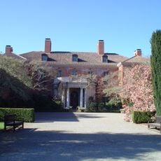
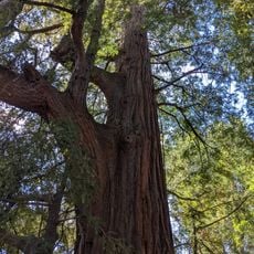
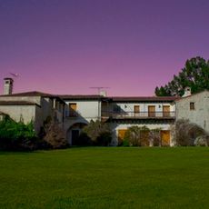
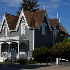
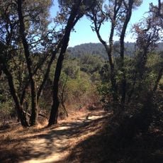
Emerald Lake Hills is a residential census-designated place in San Mateo County located between Woodside and Redwood City, California. The area spreads across oak-covered slopes where homes sit individually within the natural landscape rather than forming a compact settlement.

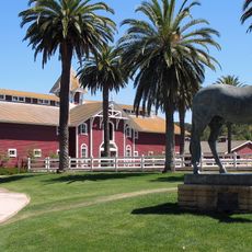
The area originated from a Rancho de las Pulgas land grant dating back to 1795. It developed as a residential community after World War I, with two subdivisions established around 1920.

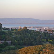
The two lakes define the area's character, with Lower Emerald Lake serving as a social hub and Upper Emerald Lake remaining secluded on private grounds. Residents gather around these water features that shape daily life and community identity in the hills.

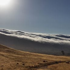
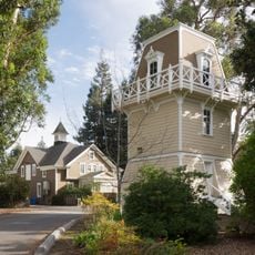
The area sits on hillside terrain, so walking or driving are the best ways to explore the neighborhoods. Visitors should expect winding roads and varying elevation throughout the region.

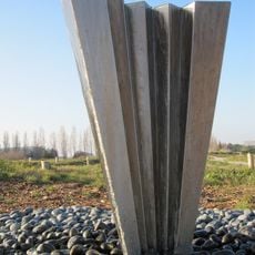
Handley Rock Park holds San Mateo County's largest sandstone monolith, protected and maintained by a local group dedicated to conservation. This natural landmark attracts visitors curious about the geology and outdoor features of the region.

The community of curious travelers

AroundUs brings together thousands of curated places, local tips, and hidden gems, enriched daily by 60,000 contributors worldwide.

Start exploring
Location
GPS coordinates
37.46417,-122.26639
Latest update
December 7, 2025 20:46
Around this place
Filoli
United States of America

Filoli

4 km
Marine World/Africa USA
United States of America

Marine World/Africa USA

7.5 km
El Palo Alto
United States of America

El Palo Alto

8.7 km
Jackling House
United States of America

Jackling House

5.4 km
Pulgas Water Temple
United States of America

Pulgas Water Temple

5 km
Stanford Mausoleum
United States of America

Stanford Mausoleum

9.1 km
Center for Advanced Study in the Behavioral Sciences
United States of America

Center for Advanced Study in the Behavioral Sciences

9.1 km
Hiller Aviation Museum
United States of America

Hiller Aviation Museum

5.5 km
Arizona Cactus Garden
United States of America

Arizona Cactus Garden

9 km
Ralston Hall
United States of America

Ralston Hall

6.2 km
Searsville Dam
United States of America

Searsville Dam

6.9 km
San Mateo County History Museum
United States of America

San Mateo County History Museum

4.1 km
Purisima Creek Redwoods Open Space Preserve
United States of America

Purisima Creek Redwoods Open Space Preserve

7.3 km
Stanford Rowing and Sailing Center
United States of America

Stanford Rowing and Sailing Center

6.2 km
Fox Theatre
United States of America

Fox Theatre

4.1 km
Edgewood County Park
United States of America

Edgewood County Park

1.5 km
Folger Estate Stable Historic District
United States of America

Folger Estate Stable Historic District

6.3 km
Brittan Party House
United States of America

Brittan Party House

4.1 km
James H. Clark Center
United States of America

James H. Clark Center

8.9 km
Palo Alto Stock Farm Horse Barn
United States of America

Palo Alto Stock Farm Horse Barn

8.6 km
Lathrop House
United States of America

Lathrop House

4.2 km
Pulgas Ridge Open Space Preserve
United States of America

Pulgas Ridge Open Space Preserve

2.6 km
Holbrook-Palmer Estate
United States of America

Holbrook-Palmer Estate

6.6 km
Thornewood Open Space Preserve
United States of America

Thornewood Open Space Preserve

8.2 km
McMurtry Building
United States of America

McMurtry Building

9.1 km
Ray of Light
United States of America

Ray of Light

7.4 km
Orthodox church of the Nativity of the Virgin Mary
United States of America

Orthodox church of the Nativity of the Virgin Mary

7.2 km
Marine World
United States of America

Marine World

7.5 km
Show the full map
Reviews
Share your experience

No review yet

Discussions
Start a discussion...

No discussion yet

« Emerald Lake Hills - Census-designated place in San Mateo County, California » is provided by Around Us (aroundus.com). Images and texts are derived from Wikimedia project under a Creative Commons license. You are allowed to copy, distribute, and modify copies of this page, under the conditions set by the license, as long as this note is clearly visible.

Discover hidden gems everywhere you go!

From secret cafés to breathtaking viewpoints, skip the crowded tourist spots and find places that match your style. Our app makes it easy with voice search, smart filtering, route optimization, and insider tips from travelers worldwide. Download now for the complete mobile experience.

Around Us App Screenshot

A unique approach to discovering new places

Le Figaro

All the places worth exploring

France Info

A tailor-made excursion in just a few clicks

20 Minutes

Around Us
Travel Guide & Maps
Download

Send to your phone

QR Code
1

Open the camera app on your mobile.

2

Point at the QR code with your camera. A notification will appear.

3

Tap the notification to open the link.