Chest opened
+${chestReward.xp} XP
Explorer
NOUVEAU ×${chestReward.collectible.quantity}
tapez pour fermer
Chest locked

Open chests in the app

Around Us is built for your phone — chests unlock when you walk, explore and capture nearby places.

Enable Location

We need your location to show you interesting places around you

Discover nearby places

Find interesting locations and hidden gems around you

Precise directions

Get accurate directions and distances to places

Your location is never shared with other users. It's only used when you tap the location button.

Log in to your account

Start exploring — it's free

Trusted by 72,883 travelers worldwide

Continue with Google
Continue with Apple
or

We will send you a code to connect

By continuing, you accept our Terms and Conditions and our Privacy Policy

Check your inbox

We've sent a pincode in your inbox. Please enter the code below.

Discussion Reviews Photo
31.6k Popularity

La Honda, Census-designated place in San Mateo County, United States.

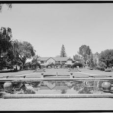
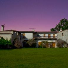
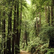
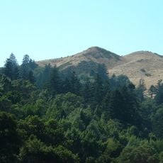
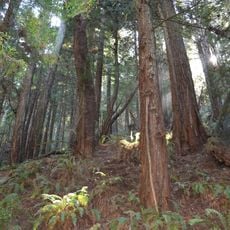
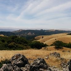
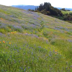
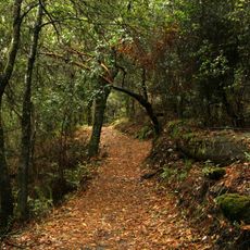
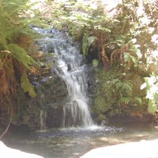
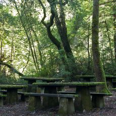
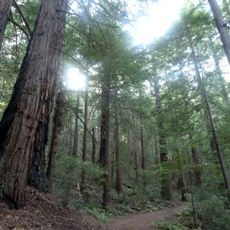
La Honda is a small community in the Santa Cruz Mountains between the Santa Clara Valley and the Pacific coast. The place spreads across several square miles of forested terrain with scattered homes and rural roads.

A post office was established in 1880 and made the place a known point in the region. The spelling changed to its current form in 1895.

The annual festival each June brings neighbors together for live music and local food. This event shapes village life and shows how residents celebrate their community.

A local elementary school serves children within the district's school system. The place is rural, so expect longer travel times to larger towns and services.

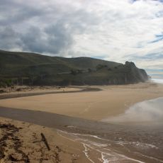
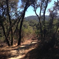
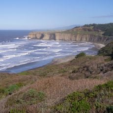
The place sits along a winding mountain road that offers sweeping views of the hills and sometimes the distant coast. This setting makes it an interesting stop for those exploring the hillside terrain.

The community of curious travelers

AroundUs brings together thousands of curated places, local tips, and hidden gems, enriched daily by 60,000 contributors worldwide.

Start exploring
Location
GPS coordinates
37.31917,-122.27417
Latest update
December 20, 2025 01:13
Around this place
Mortimer Fleishhacker House
United States of America

Mortimer Fleishhacker House

12.7 km
Jackling House
United States of America

Jackling House

10.9 km
Butano State Park
United States of America

Butano State Park

12.2 km
San Gregorio State Beach
United States of America

San Gregorio State Beach

11.3 km
Martin's Beach
United States of America

Martin's Beach

13.4 km
Black Mountain
United States of America

Black Mountain

11.2 km
Portola Redwoods State Park
United States of America

Portola Redwoods State Park

9.3 km
Arastradero Preserve
United States of America

Arastradero Preserve

11.6 km
Searsville Dam
United States of America

Searsville Dam

10.3 km
Pomponio State Beach
United States of America

Pomponio State Beach

12.2 km
Windy Hill Open Space Preserve
United States of America

Windy Hill Open Space Preserve

6.6 km
Purisima Creek Redwoods Open Space Preserve
United States of America

Purisima Creek Redwoods Open Space Preserve

13.5 km
Folger Estate Stable Historic District
United States of America

Folger Estate Stable Historic District

10 km
Our Lady of the Wayside Church
United States of America

Our Lady of the Wayside Church

8 km
Monte Bello Open Space Preserve
United States of America

Monte Bello Open Space Preserve

11 km
Russian Ridge Open Space Preserve
United States of America

Russian Ridge Open Space Preserve

5.1 km
Los Trancos Open Space Preserve
United States of America

Los Trancos Open Space Preserve

8.5 km
Tip Toe Falls
United States of America

Tip Toe Falls

9.1 km
Memorial Park
United States of America

Memorial Park

4.9 km
Foothill Observatory
United States of America

Foothill Observatory

13.5 km
Sam McDonald County Park
United States of America

Sam McDonald County Park

2.6 km
Thornewood Open Space Preserve
United States of America

Thornewood Open Space Preserve

8.1 km
Stanford Dish
United States of America

Stanford Dish

13 km
Methodist Episcopal Church of Pescadero
United States of America

Methodist Episcopal Church of Pescadero

12.1 km
San Gregorio House
United States of America

San Gregorio House

10 km
Portola Valley School
United States of America

Portola Valley School

8.1 km
Tunitas Beach
United States of America

Tunitas Beach

11.9 km
San Gregorio Beach
United States of America

San Gregorio Beach

11.4 km
Show the full map
Reviews
Share your experience

No review yet

Discussions
Start a discussion...

No discussion yet

« La Honda - Census-designated place in San Mateo County, United States » is provided by Around Us (aroundus.com). Images and texts are derived from Wikimedia project under a Creative Commons license. You are allowed to copy, distribute, and modify copies of this page, under the conditions set by the license, as long as this note is clearly visible.

Discover hidden gems everywhere you go!

From secret cafés to breathtaking viewpoints, skip the crowded tourist spots and find places that match your style. Our app makes it easy with voice search, smart filtering, route optimization, and insider tips from travelers worldwide. Download now for the complete mobile experience.

Around Us App Screenshot

A unique approach to discovering new places

Le Figaro

All the places worth exploring

France Info

A tailor-made excursion in just a few clicks

20 Minutes

Around Us
Travel Guide & Maps
Download

Send to your phone

QR Code
1

Open the camera app on your mobile.

2

Point at the QR code with your camera. A notification will appear.

3

Tap the notification to open the link.