Chest opened
+${chestReward.xp} XP
Explorer
NOUVEAU ×${chestReward.collectible.quantity}
tapez pour fermer
Chest locked

Open chests in the app

Around Us is built for your phone — chests unlock when you walk, explore and capture nearby places.

Enable Location

We need your location to show you interesting places around you

Discover nearby places

Find interesting locations and hidden gems around you

Precise directions

Get accurate directions and distances to places

Your location is never shared with other users. It's only used when you tap the location button.

Lake Elizabeth

Log in to your account

Start exploring — it's free

Trusted by 72,883 travelers worldwide

Continue with Google
Continue with Apple
or

We will send you a code to connect

By continuing, you accept our Terms and Conditions and our Privacy Policy

Check your inbox

We've sent a pincode in your inbox. Please enter the code below.

Lake Elizabeth
Discussion Reviews 1 Photos
9.8k Popularity

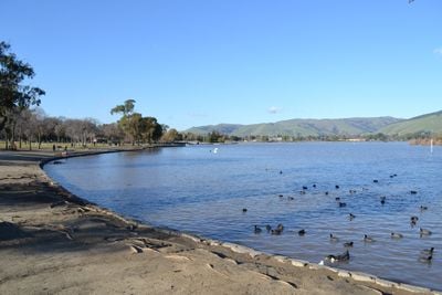
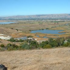
Lake Elizabeth, Natural lake in Angeles National Forest, California

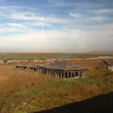
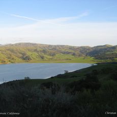
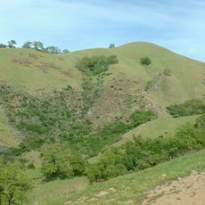
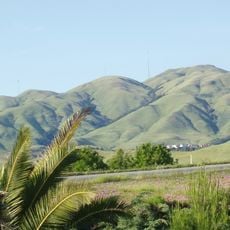
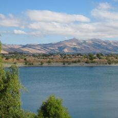
Lake Elizabeth is a natural lake in the Angeles National Forest situated within the Sierra Pelona Mountains. The body of water sits at an elevation of roughly 3,200 feet and is surrounded by extensive hiking trails and parking facilities.

Spanish explorer Junípero Serra named the lake La Laguna de Diablo in 1780, reflecting local stories about mysterious creatures in the waters. This early European designation shows how the place was initially understood by newcomers.

The lake served as a meeting point between different Native American groups who inhabited the surrounding mountains. Today, visitors can explore the natural landscape that shaped these early communities.

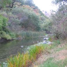
The area is best explored on foot with marked trails and parking available for visitors. The best time to visit is during wetter months when the lake reliably holds water.

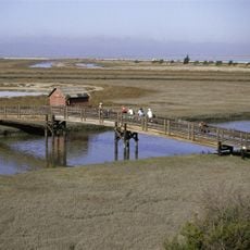
The lake can dry up completely during severe drought periods when rainfall is scarce. Yet winter rains in 2022 and 2023 demonstrated that the lake can refill entirely with adequate moisture.

The community of curious travelers

AroundUs brings together thousands of curated places, local tips, and hidden gems, enriched daily by 60,000 contributors worldwide.

Start exploring
Location
GPS coordinates
37.54860,-121.96200
Latest update
December 10, 2025 15:56
Around this place
Mission San José
United States of America

Mission San José

4.2 km
Mission Peak
United States of America

Mission Peak

8.2 km
Dumbarton Bridge
United States of America

Dumbarton Bridge

14.4 km
Drawbridge
United States of America

Drawbridge

9.3 km
Niles Canyon
United States of America

Niles Canyon

3.6 km
Don Edwards San Francisco Bay National Wildlife Refuge
United States of America

Don Edwards San Francisco Bay National Wildlife Refuge

10.4 km
Ardenwood Historic Farm
United States of America

Ardenwood Historic Farm

7.8 km
Calaveras Reservoir
United States of America

Calaveras Reservoir

14.6 km
Sunol Water Temple
United States of America

Sunol Water Temple

7.9 km
Coyote Hills Regional Park
United States of America

Coyote Hills Regional Park

10.4 km
Sunol Regional Wilderness
United States of America

Sunol Regional Wilderness

12.5 km
Hacienda del Pozo de Verona
United States of America

Hacienda del Pozo de Verona

11.5 km
Monument Peak
United States of America

Monument Peak

11.1 km
Quarry Lakes Regional Recreation Area
United States of America

Quarry Lakes Regional Recreation Area

5 km
Mount Allison
United States of America

Mount Allison

9.7 km
Golden Gate Railroad Museum
United States of America

Golden Gate Railroad Museum

6.7 km
Niles Essanay Silent Film Museum
United States of America

Niles Essanay Silent Film Museum

3.5 km
Warren Hall
United States of America

Warren Hall

14.6 km
Alviso Adobe Community Park
United States of America

Alviso Adobe Community Park

13.2 km
San Antonio Reservoir
United States of America

San Antonio Reservoir

12.3 km
Vallejo Flour Mill
United States of America

Vallejo Flour Mill

3.3 km
Golden Gate Biosphere Reserve
United States of America

Golden Gate Biosphere Reserve

6.4 km
Pleasanton Public Library
United States of America

Pleasanton Public Library

14.1 km
Ohlone Wilderness
United States of America

Ohlone Wilderness

9.5 km
Holy Cross Orthodox Monastery
United States of America

Holy Cross Orthodox Monastery

9.5 km
Milpitas Grammar School
United States of America

Milpitas Grammar School

13.8 km
Niles Depot Museum
United States of America

Niles Depot Museum

3.5 km
Sunol
United States of America

Sunol

8.2 km
Show the full map
Reviews
Share your experience

No review yet

Discussions
Start a discussion...

No discussion yet

« Lake Elizabeth - Natural lake in Angeles National Forest, California » is provided by Around Us (aroundus.com). Images and texts are derived from Wikimedia project under a Creative Commons license. You are allowed to copy, distribute, and modify copies of this page, under the conditions set by the license, as long as this note is clearly visible.

Discover hidden gems everywhere you go!

From secret cafés to breathtaking viewpoints, skip the crowded tourist spots and find places that match your style. Our app makes it easy with voice search, smart filtering, route optimization, and insider tips from travelers worldwide. Download now for the complete mobile experience.

Around Us App Screenshot

A unique approach to discovering new places

Le Figaro

All the places worth exploring

France Info

A tailor-made excursion in just a few clicks

20 Minutes

Around Us
Travel Guide & Maps
Download

Send to your phone

QR Code
1

Open the camera app on your mobile.

2

Point at the QR code with your camera. A notification will appear.

3

Tap the notification to open the link.