Log in to your account

AroundUs is a community-driven map of interesting places, built by curious explorers like you. It grows with every review, story, and photo you share.
Connect to save your favorite spots, contribute locations, and create personalized routes.
Continue with Google
Continue with Apple
Continue with X
Continue with Facebook
Continue with email
By continuing, you accept our Terms and Conditions and our Privacy Policy
Create an account
Add to collection
Map
Suggest a change
Share

Iron Horse Regional Trail, Multi-use trail system in San Francisco East Bay, United States.

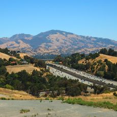
The Iron Horse Regional Trail is a multi-use path that stretches about 32 miles through Contra Costa and Alameda counties, connecting nine different cities along the way. The paved route includes designated sections designed for different users, from cyclists and joggers to horse riders.

The path follows the former Southern Pacific Railroad route from 1891, which operated until 1978. After the railway closed, the old rail corridor was transformed into a public recreational space for the community.

The trail serves as a daily route for residents commuting and enjoying outdoor time across multiple towns. You can see joggers, cyclists, and horse riders sharing the path, showing how important this route has become to the local community.

Multiple entry points and parking areas exist along the route, including Walden Park and Railroad Avenue, plus connections to BART stations for public transit. The paved surface makes the path easy to travel, though check conditions after rain as some sections can become slippery.

The path features specially built bridges that safely cross major roads and help separate different user groups. This infrastructure shows careful planning to ensure safety and comfort for all types of traffic using the route.

Location: California

Website: http://ebparks.org/parks/trails/iron_horse

GPS coordinates: 37.82400,-122.00600

Latest update: December 8, 2025 19:51

Photos
Around this place
Mount Diablo
United States of America

Mount Diablo

10.3 km
Federal Correctional Institution, Dublin
United States of America

Federal Correctional Institution, Dublin

15.2 km
Dunsmuir House
United States of America

Dunsmuir House

14.9 km
Oakland Zoo
United States of America

Oakland Zoo

14.9 km
Blackhawk Museum
United States of America

Blackhawk Museum

8.2 km
Lafayette Reservoir
United States of America

Lafayette Reservoir

13.5 km
Dr. Aurelia Reinhardt Redwood Regional Park
United States of America

Dr. Aurelia Reinhardt Redwood Regional Park

14.1 km
Eugene O'Neill National Historic Site
United States of America

Eugene O'Neill National Historic Site

1.9 km
Ruth Bancroft Garden
United States of America

Ruth Bancroft Garden

11.4 km
McKeon Pavilion
United States of America

McKeon Pavilion

9 km
Las Trampas Regional Wilderness
United States of America

Las Trampas Regional Wilderness

3.9 km
Anthony Chabot Regional Park
United States of America

Anthony Chabot Regional Park

11.8 km
Maynard Buehler House
United States of America

Maynard Buehler House

15 km
Forest Home Farms
United States of America

Forest Home Farms

11.1 km
Lindsay Wildlife Experience
United States of America

Lindsay Wildlife Experience

12.6 km
Upper San Leandro Reservoir
United States of America

Upper San Leandro Reservoir

11.2 km
Old Borges Ranch
United States of America

Old Borges Ranch

7.4 km
Sequoyah Country Club
United States of America

Sequoyah Country Club

13 km
Don Castro Regional Recreation Area
United States of America

Don Castro Regional Recreation Area

15.2 km
Shadelands Ranch
United States of America

Shadelands Ranch

11.4 km
Gardens at Heather Farm
United States of America

Gardens at Heather Farm

11.1 km
Moraga Adobe
United States of America

Moraga Adobe

13.1 km
Markham Regional Arboretum
United States of America

Markham Regional Arboretum

15.1 km
Episcopal Church of the Resurrection – Pleasant Hill, CA
United States of America

Episcopal Church of the Resurrection – Pleasant Hill, CA

15 km
Patrick Rodgers Farm
United States of America

Patrick Rodgers Farm

15 km
Rainforest Flora
United States of America

Rainforest Flora

15.1 km
Labadie Arboretum
United States of America

Labadie Arboretum

14.6 km
San Ramon Library
United States of America

San Ramon Library

8.1 km
Show the full map
Reviews

Visited this place? Tap the stars to rate it and share your experience / photos with the community! Try now! You can cancel it anytime.

« Iron Horse Regional Trail - Multi-use trail system in San Francisco East Bay, United States » is provided by Around Us (aroundus.com). Images and texts are derived from Wikimedia project under a Creative Commons license. You are allowed to copy, distribute, and modify copies of this page, under the conditions set by the license, as long as this note is clearly visible.

Discover hidden gems everywhere you go!

From secret cafés to breathtaking viewpoints, skip the crowded tourist spots and find places that match your style. Our app makes it easy with voice search, smart filtering, route optimization, and insider tips from travelers worldwide. Download now for the complete mobile experience.

Around Us App Screenshot

A unique approach to discovering new places

Le Figaro

All the places worth exploring

France Info

A tailor-made excursion in just a few clicks

20 Minutes